

- Coordinates
- 45.6486° N, 85.5466° WGoogle Maps: Township of PeaineDownload KML
- Eras
- Indigenous eraStrang era
- Concepts
- governanceIndigenous eraStrang erademography
- Within
- Beaver Island · Beaver Island archipelago
- Media
- Beaver Island History Map, 1978 revision · General highway map of Charlevoix County, 1965 · Plat of the north end of Beaver Island, 1930s · Plat of the south end of Beaver Island, 1930s
Summary
The Township of Peaine is one of two civil townships covering Beaver Island — together with Township of Saint James, the two cover the whole island and no mainland territory. Peaine is the older of the two administratively: Public Act No. 69 legally set off and organized the entire Beaver Island archipelago as Peaine Township in 1847. Contemporary and later narratives report that the first meetings failed, but that officers were elected by 1850–51. It has not always covered the same ground: from 1855 it was one of four townships in Manitou County, and it shared Beaver Island with the Township of Galilee until Galilee was vacated in 1897. The township was named for an Odawa (Ottawa) chief who was a documented contemporary of James Jesse Strang.
History
The primary legal record is explicit. Section 8 of Michigan Public Act No. 69 of 1847 set off and “organized into a separate township by the name of Peaine” all the Beaver Islands then in Mackinac County. It scheduled the first township meeting at A. Cable’s store in Beaver Island Harbor for May 1. The act was approved March 16 and took effect April 1.1 This establishes legal organization in 1847, but not that the scheduled meeting successfully elected and seated officers.
An 1854 account of the Mackinac–Mormon controversy supplies that crucial qualification. It records that “in 1847 the Beaver Islands were erected into the township of Peaine,” but says three meetings held that year failed to effect a regular organization. The same account nevertheless says non-Mormon officeholders neglected public business until Mormons elected a majority in 1850 and all officers in 1851.2 Its chronology does not support the 1978 Historical Map’s claim that the township was first “organized” in 1852.
The same source names “Peaine” among several influential Odawa/Ojibwe chiefs — “Kimmeoue, Peaine, Watanesa and Chenotin” — who, during the winter of 1850–51, confronted Strang directly over traders’ efforts to turn the Indigenous population against the Mormon settlement; Strang is recorded rebuffing Peaine sharply (“I am no child, and cannot understand you… March on”), after which “Peaine and his fellow chief[s]… sullenly followed.”3 A later township election dispute in the same account turns on “the vote of Peaine,” confirming the township (not merely the chief) as a going administrative unit through the 1850s.4
A separate, independent source — Elizabeth Whitney Williams’ 1905 memoir, written by a woman whose family lived among the island’s Odawa as government-appointed teachers from 1862 to 1864 — states that the harbor town (Saint James) “was named in honor of the Indian Chief at Garden Island, town of ‘Peain,’” describing him as ruling “his tribe with great kindness and firmness” and identifying “their tribe” as the Ottawas.5 The two sources agree that a chief named Peaine/Peain existed, was Odawa, and gave his name to the township. They are not reconciled on his specific base: the 1854 account situates him generally “at Beaver,” while Williams ties him to Garden Island. See Garden Island’s Open questions for the same tension.
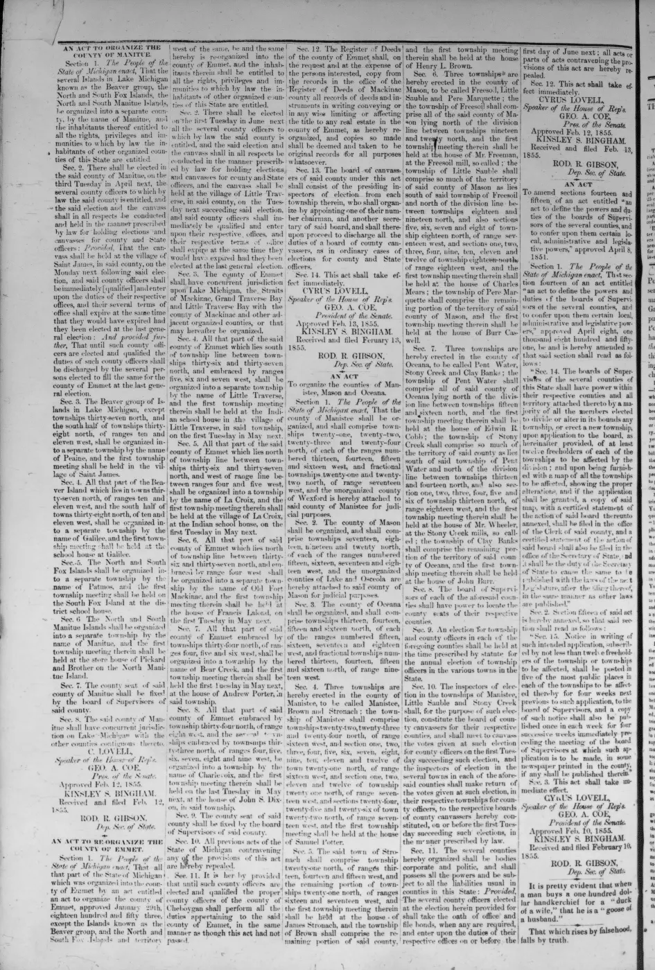
Peaine did not stay the archipelago’s only township. On 12 February 1855 the legislature organized the Beaver, Fox and Manitou islands as the County of Manitou and, in the same act, divided the new county into four townships. Section 3 kept Peaine, covering “the Beaver group of Islands in Lake Michigan, except townships thirty-seven north, and the south half of townships thirty-eight north, of ranges ten and eleven west,” with its first township meeting in the village of Saint James; the outer islands stayed with Peaine, and what it lost was the southern end of Beaver Island. Section 4 organized that excepted southern part as Galilee, meeting at the school house at Galilee. Section 5 organized the North and South Fox Islands as Patmos, meeting at the district school house on South Fox. Section 6 organized the North and South Manitou Islands as Manitou, meeting at Pickard and Brother’s store house on North Manitou.6
The 1874 Michigan Historical Collections reprint of the same act carries sections 1, 2, 7 and 8 and nothing between them, so the four township sections are recoverable only from the newspaper printing.7 Galilee was vacated in 1897 and its territory returned to Peaine.8
The later division that produced a separate Township of Saint James alongside Peaine is described in Township of Saint James.
Geography
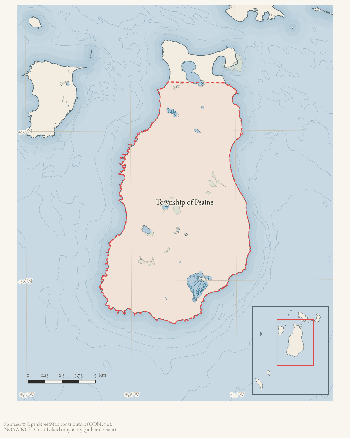
Peaine Township covers the southern and central part of Beaver Island, south of Township of Saint James, which covers the harbor area, the island’s north end and the outer islands. Measured from the State of Michigan’s minor-civil-divisions layer, Peaine takes in 53.59 square miles — 138.80 km², or 34,297 acres, in EPSG:3078 — against Saint James’s 20.99 square miles, so it is much the larger of the two on land.9
On the 2020 census count of 266 residents that is a density of 4.96 people per square mile (1.92 per km²). Peaine’s own counts were 244 in 2000 and 292 in 2010; see the demography survey for the full series.
The layer’s polygon centroid falls at 45.649°N, 85.553°W, about half a kilometre from the GNIS representative point recorded as this article’s coordinate. The two agree, which is not true of Saint James, whose GNIS point lies in open water outside its own polygon.
Names
No former or alternate name for the township is recorded in sources held; “Peaine” is the statutory form, while the chief’s personal name also appears as “Peain.” The statute supplies the chosen township name but no rationale. The Chief Peaine naming tradition rests on the 1854 account and Williams’s later memoir; see Chief Peaine.
Significance
Peaine Township is the direct administrative descendant of the 1847 organization of the entire archipelago, which makes it the senior civil unit on the island. Its name is also one of the few Indigenous personal names preserved in the island’s official toponymy, against the biblical (Strang-era) and Irish (post-1856) naming layers found elsewhere on the island.
Open questions
- Peaine Township’s 1847 election returns and minutes have not been located; these are needed to reconstruct the three failed meetings and determine when its first regularly functioning board took office.
- Chief Peaine’s specific base — Garden Island (Williams, 1905) versus a more general presence “at Beaver” (Ancient and Modern Michilimackinac, 1854) — is unresolved.
- No legislative journal, petition, or bill file has been found explaining why the 1847 act selected the name Peaine.
- The 1855 act describes Peaine and Galilee by survey township and range, but no plat or boundary description tying those lines to the ground has been located, and the 1859, 1861 and 1901 adjustments that followed are known here only from a modern summary of Joan C. Vyse’s research.
See also
Footnotes
-
Michigan Public Act No. 69 of 1847, §8, printed pp. 83–84; §22 and approval, p. 85. ↩
-
Ancient and Modern Michilimackinac (1854), pp. 20–21. ↩
-
Ancient and Modern Michilimackinac (1854), pp. 27-28. ↩
-
Ancient and Modern Michilimackinac (1854), p. 31 (in the same source’s pagination, immediately following the confrontation narrative). ↩
-
Williams, A Child of the Sea (1905), p. 82. ↩
-
“An Act to Organize the County of Manitue,” sections 3 to 6, printed in Strang’s Northern Islander (Saint James, Beaver Island), 31 May 1855, vol. V, no. 1, whole no. 68, on the issue’s fourth page. The act was approved 12 February 1855; the masthead and the printed sections were read from the page images. ↩
-
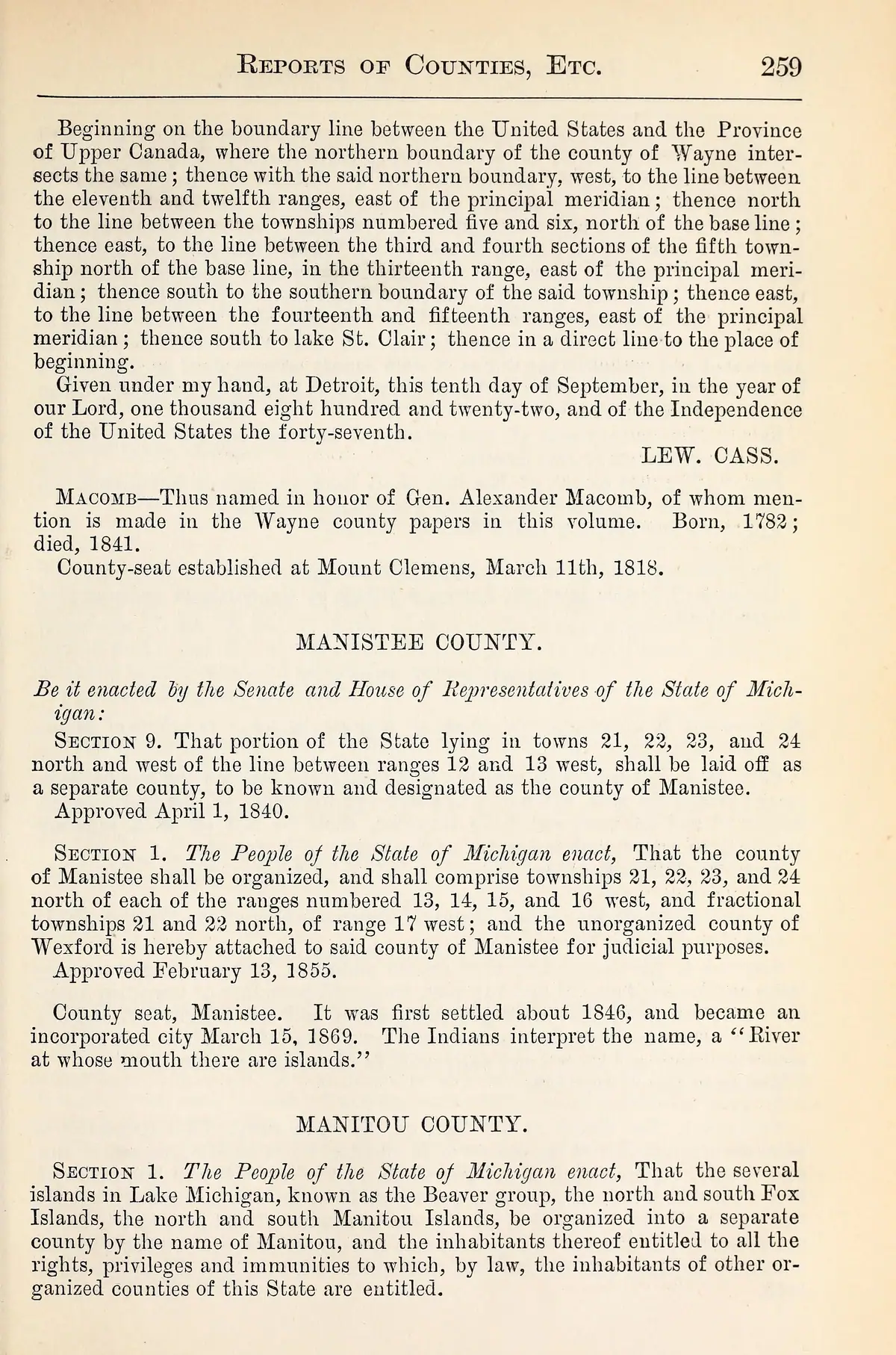
Michigan Historical Collections, vol. 1 (1874), “Manitou County,” pp. 259-260. Page images checked: the reprint runs sections 1, 2, 7 and 8 and omits sections 3 through 6. ↩
-
Bobbi Welke, “A Short History of Governance on the Beaver Island Archipelago,” Northern Islander (the modern island newspaper), February 2026, summarising Joan C. Vyse’s 2002 research. ↩
-
State of Michigan, Michigan Geographic Framework, minor civil divisions layer. Areas measured from the layer’s own geometry reprojected to EPSG:3078; the layer’s published area attributes agree to five significant figures. ↩
The dated record
Sources
- Tim Keeney and Rich Gillespie, “Island Place Names,” Beaver Island Forum, March 9, 2009, topic 1516.The thread records an informal pronunciation of “Peaine” as “Pee-Aine” and attributes the name to an Odawa chief, while the same speaker separately discusses the related Paid Een Og road name. This is community testimony; the historical identity and township naming remain grounded here in the 1854, 1905, 1847 statute, and 1978 map sources.forum · www.beaverislandforum.com · 01 · t001516
- GNIS feature 1626888; feature class 'Civil'.federal · gnis · gnis_names
- 'In 1847 the Beaver Islands were erected into the township of Peaine.' Also describes 'Peaine' as one of several Odawa/Ojibwe chiefs ('Kimmeoue, Peaine, Watanesa and Chenotin, influential chiefs') who confronted Strang during the winter of 1850-51 over traders inciting hostility toward the Mormons; records Peaine's rebuff by Strang ('I am no child... March on.') and a subsequent 1854 election dispute over 'the vote of Peaine' [township].
- 'The town at the harbor was named in honor of the Indian Chief at Garden Island, town of "Peain."' States Chief Peain 'ruled his tribe with great kindness and firmness... Their tribe was the Ottawas,' and that the author's family lived among them as teachers 1862-1864.
- Primary statute. Section 8 legally sets off and organizes all the Beaver Islands in Mackinac County as a separate township named Peaine and schedules the first meeting at A. Cable's Beaver Island Harbor store on May 1. Section 22 makes the act effective April 1; it was approved March 16, 1847. The act does not explain the name or prove that the scheduled meeting succeeded.
- Described in this archive: Beaver Island History Map, 1978 revision.Says Peaine Township was named for Chief Peaine of Garden Island, formed in 1847, and organized in 1852. The statute legally organized it in 1847, while the 1854 account says 1847 meetings failed and officers were elected in 1850–51; no source read supports 1852.
- Peaine Township population 244 (2000), 292 (2010), 266 (2020).demographics · township_population_series
- Peaine Township total population 378, 530 total housing units (315 vacant), median household income $75,625, median age 66.1, median home value $348,500.demographics · acs2023_townships
- Described in this archive: Northern Islander, 1850–1856.The full text of the 12 February 1855 organization act, sections 1 to 8. Sections 3 to 6 divide Manitou County into the townships of Peaine, Galilee, Patmos and Manitou and name each one's first meeting place. Read from the page image of the issue's fourth page as well as the transcription; sections 1, 2, 7 and 8 agree word for word with the independent 1874 reprint, and sections 3 to 6 appear in no other source held here.
- Described in this archive: Michigan Historical Collections, volume 1, 1874.Page images checked. The reprint carries sections 1, 2, 7 and 8 of the act and omits sections 3 through 6, so it corroborates the county's creation and island membership but is silent on the four townships.
- Modern secondary summary of local historian Joan C. Vyse's 2002 research, in the modern island newspaper of that name and not Strang's. Its timeline records Galilee Township vacated in 1897 with the property returned to Peaine, and further adjustments to Peaine's boundary in 1859, 1861 and 1901. The underlying legislative and county records have not been read here.
- Source of the area figures in Geography. Peaine measures 53.59 square miles (138.80 km2, 34,297 acres) and St. James 20.99 square miles, each measured from the layer's own geometry reprojected to EPSG:3078; the layer's published SQMILES and ACRES attributes agree to five significant figures. The measured polygon centroid for Peaine is 45.649 N, 85.553 W.state · michigan · minor_civil_divisions
Added 28 July 2026 · revised 20 August 2026. Recent changes
Cite this article
Beaver Island Archive, “Township of Peaine”, https://beaverislandarchive.org/places/township-of-peaine/, accessed [date], citing Tim Keeney and Rich Gillespie, “Island Place Names,” Beaver Island Forum, March 9, 2009, topic 1516. (and 11 further sources listed on the page).
Last revised 2026-08-20. Fill in [date] with the date you read it — this page is static and cannot know that.