

- Date
- 1956
- Eras
- Modern era
- Concepts
- toponymyland-surveyenvironmentheritageModern era
- Within
- Beaver Island
Summary
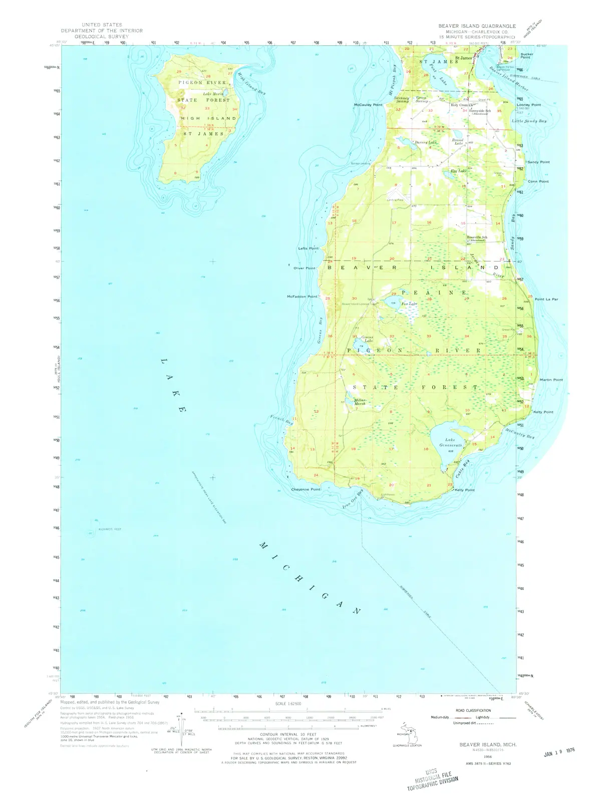
The held 1956 USGS Beaver Island 15-minute quadrangle is a 1:62,500 topographic-map snapshot of most of Beaver Island and High Island. The sheet represents topography from 1954 aerial photographs, field checked in 1956, and hydrography compiled from 1955 Lake Survey charts.
It visibly labels St. James, Peaine, High Island, Lake Geneserath, Font Lake, and many roads, waters, contours, and state-forest areas. These are cartographic attestations on this edition; they supply a useful mid-century comparison layer for earlier maps and later geographic records.
Three dates on one sheet
The edition is dated 1956, and nothing on it is uniformly 1956. The sheet’s own statements put topography from 1954 aerial photography, a field check in 1956, and hydrography compiled from 1955 Lake Survey charts — three different observation regimes, printed together, distinguishable only by knowing which layer a feature belongs to.
That matters whenever this sheet is used to date something. A road drawn here was photographed in 1954 and confirmed on the ground in 1956, so its absence from an earlier map and presence here brackets it loosely at best. A depth or a shoreline belongs to the hydrographic layer and inherits the Lake Survey’s own dates and datum, which are not the topographic ones — and, as the Lake Survey sheets in this archive state explicitly, a charted shoreline is the water surface at the time of that survey rather than a fixed coast.
This is the same caution the 1907 and 1911 charts require, in a different form. A published map is a compilation with an issue date, and the issue date is the one thing on it that certainly does not describe any feature.
What it is good for
Read with those limits, the sheet is one of the more useful mid-century layers the archive holds. It is the last full topographic treatment of the island before the 1986 provisional 1:24,000 series, it carries interior detail — contours, inland lakes, forest land and the road network — that no chart does, and being georeferenced from its own embedded transform it can be laid directly under modern data without a registration step of this project’s own devising. Where it disagrees with the 1986 sheet, the disagreement is evidence about thirty years of change rather than about either sheet’s accuracy.
Georeferencing, and what it says about the sheet
The held PDF is a TerraGo GeoPDF: it carries its own transform in an embedded
LGIDict, so the sheet can be registered to ground coordinates without
picking a single control point. This archive did that
(scripts/georeference_topo.py), and the resulting record states the sheet’s
own terms:
| projection | polyconic (+proj=poly), lat_0 45.5°N, lon_0 85.625°W |
| datum | NAD27 |
| scale | 1:62,500 |
| ground sample distance | 5.29 m per pixel |
| coverage check | overlaps 78% of the island area |
Three consequences follow, and each one is a way of getting a comparison wrong.
The datum is NAD27, not NAD83 or WGS84. A position read off this sheet and plotted on modern data lands tens of metres from where it belongs unless it is shifted. That is the same order as the difference this archive has had to allow for when testing 1986 ink coverage against walked GPS.
The projection is polyconic, which no modern layer here uses — the working CRS is EPSG:3078. Polyconic is one of only three projections among the 22 georeferenced quads in this collection (six polyconic, fifteen transverse Mercator, one Lambert conformal conic), and it is the signature of the 1955–56 1:62,500 series specifically.
It does not cover the whole island. The coverage check puts the sheet over 78% of the island area, which is why the summary above says most of Beaver Island. A feature’s absence from this sheet may mean it was off the sheet.
Evidence and limits
This map establishes what the USGS printed and depicted on this dated edition. It does not establish legal township or parcel boundaries, ownership, public access, a road’s maintenance or condition, a building’s construction or use, a population, or the exact date a mapped feature began or ended. A label or symbol must be independently checked before it supports a detailed historical claim.
The aerial-photography and field-check dates describe the map’s compilation, not a uniform observation date for every feature. Hydrographic detail also has its own stated 1955 chart source.
See also
- John Farmer map of Michigan, 1853
- USGS Beaver Island North and South US Topo quadrangles source set
- North End of Lake Michigan Including the Beaver Island Group, 1855 Lake Survey chart
- Beaver Island
- High Island
- Saint James
- Lake Geneserath
- Font Lake
- Historical toponymy and map change
- Land survey and settlement geography
The page
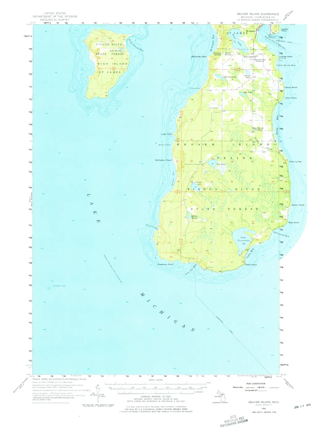
Rendered from the held scan.
Sources
- Held USGS map PDF. Its marginal information states that topography was compiled by photogrammetric methods from aerial photographs taken in 1954, field checked in 1956, with hydrography compiled from U.S. Lake Survey charts 704 and 706 (1955). Direct visual review identifies its 1:62,500 scale and coverage of most of Beaver Island and High Island. It is a dated cartographic representation, not a title, boundary, access, building-use, road-condition, census, or current-condition record.federal · usgs_topo · historical · Beaver-Island_1956_62500_277992
- Project provenance sidecar for the USGS Beaver Island 1956 quadrangle.Records the USGS Historical Topographic Maps source URL, 2026-07-29 retrieval timestamp, SHA-256 checksum, 7,822,866-byte file size, ScienceBase catalog item, and public-domain status. No public copy of this file is known; the archive holds one and can provide it on request.federal · usgs_topo · historical · Beaver-Island_1956_62500_277992.provenance
- Project georeferencing record for the 1956 Beaver Island quadrangle.Written by scripts/georeference_topo.py from the sheet's own embedded GeoPDF LGIDict, with no control points picked. Records the projection, the ground sample distance and the coverage check. No public copy of this file is known; the archive holds one and can provide it on request.federal · usgs_topo · georeferenced · Beaver-Island_1956_62500_277992.provenance
Added 2 August 2026 · revised 4 August 2026. Recent changes
Cite this article
Beaver Island Archive, “USGS Beaver Island topographic map, 1956”, https://beaverislandarchive.org/documents/usgs-beaver-island-topographic-map-1956/, accessed [date], citing U.S. Geological Survey, *Beaver Island, Michigan—Charlevoix Co.*, 15-minute series, 1:62,500, 1956. (and 2 further sources listed on the page).
Last revised 2026-08-04. Fill in [date] with the date you read it — this page is static and cannot know that.
BibTeX for “USGS Beaver Island topographic map, 1956”RIS for “USGS Beaver Island topographic map, 1956”