

- Coordinates
- 45.8069° N, 85.2979° WGoogle Maps: Shoe IslandDownload KML
- Eras
- Modern era
- Concepts
- environmentgeologysoilsvegetationtreeswildlifebirdsconservationmaritime
- Within
- Beaver Island archipelago
- Media
- Caspian tern colony at Shoe Island (film, Gault, ca. 1920s)
Summary
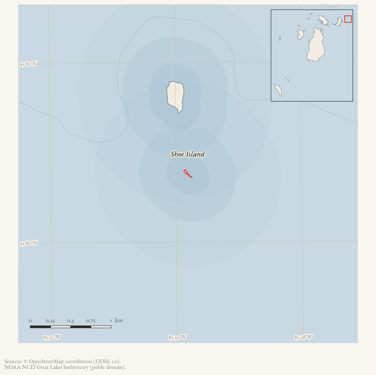
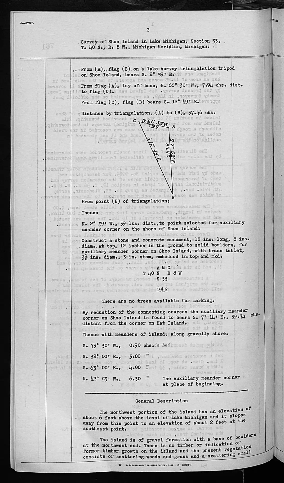
Shoe Island is a small island in the Beaver Island archipelago. OpenStreetMap provides the mapped island polygon, and the 2023 Beaver Island Master Plan states that Shoe Island is federally owned and part of the Michigan Islands National Wildlife Refuge, administered through Seney National Wildlife Refuge of the U.S. Fish and Wildlife Service. The plan gives the island a clear conservation context. A federal survey completed on September 11, 1942 describes a gravel-and-boulder island sloping from about six feet above Lake Michigan at the northwest portion to about two feet at the southeast point. It recorded no timber or evidence of former timber, sparse weeds, grass and small willows, no improvements, and gull nesting/resting use. These are dated survey observations, not a statement of current conditions or title.1
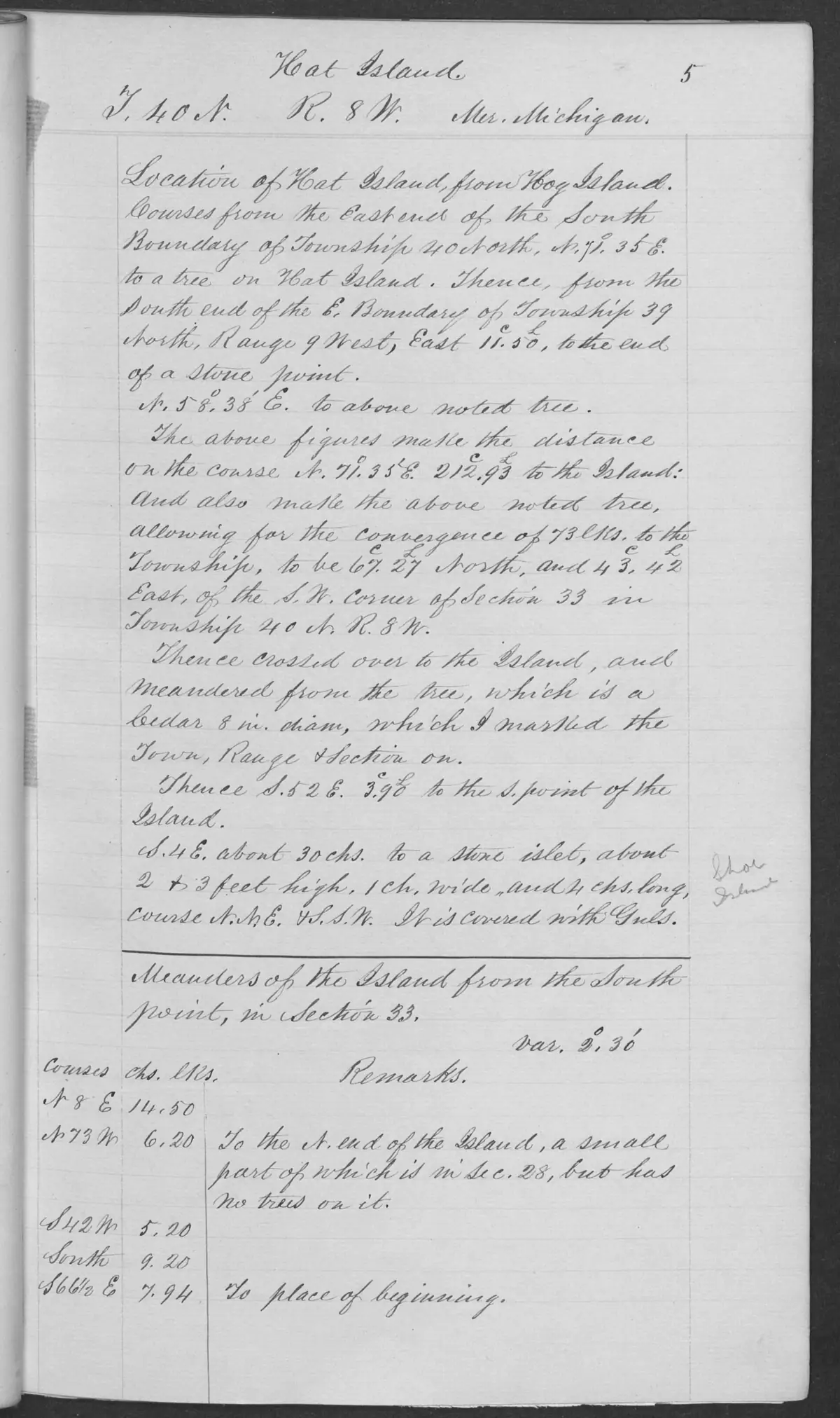
The 1942 survey explicitly refers to the 1849 Hat Island field notes, which label a nearby stone islet “Shoe.” This creates a source-bounded documentary connection to Hat Island, not a title or boundary conclusion.
GLO field-note pages: Shoe Island survey, 1942 preserves the two checked pages as a separate source record, including the survey’s own title reasoning and its explicit limits.
Ecological profile
The 1942 Shoe Island pages describe a low gravel-and-boulder formation with sparse weeds, grass, and small willows. The survey records no timber or evidence of former timber available for the operation, but that is a dated survey observation rather than proof that the island has never carried trees or shrubs. Its continuation describes the island as upland and not subject to overflow, and explicitly records gull nesting and resting use, including a connected stone islet covered with gulls. The record supports a gravel-shore, low-vegetation, and bird-use profile, but not a colony count, species inventory, or current habitat assessment.1
A silent film shot on the island by the ornithologist Benjamin T. Gault, for the Chicago Academy of Sciences, shows the same profile in motion: a rocky shoreline under short vegetation, hundreds of birds in flight, and men picking up and banding juveniles. It carries what the survey could not — the Academy catalogues it as a Caspian tern colony, where the 1942 field note recorded only “gull” nesting and resting use. The film is dated no more precisely than ca. 1900–1942, so it corroborates the survey’s picture of the island without dating it or counting anything.
Open questions
- What are the island’s area, habitat, and nesting or migration records in federal refuge inventories?
- When did the island enter refuge ownership, and are there earlier local names or uses?
Footnotes
Maps for this place
These Atlas plates provide regional context. They do not establish a precise boundary, current ownership, access right, operating status, or field condition.
- EnvironmentSoils, wetlands, hydrography, and terrain
- GeologyGeneralized geology and landforms
- HydrologyMapped water and wetland context
- AccessMapped routes, facilities, and protected areas
- Land surveyPLSS geometry and historic GLO patent-location context
Sources
- Area 0.00 km² computed in EPSG:3078.osm · islands
- The plan states that Shoe Island is federally owned and part of the Michigan Islands National Wildlife Refuge, administered through Seney National Wildlife Refuge of the U.S. Fish and Wildlife Service.
- Bureau of Land Management, General Land Office Records, Field Note Volume 276017, pp. 0762–0763, T40N R8W; survey completed 11 September 1942.Described in this archive: BLM GLO field-note volumes linked to Beaver Island-area surveys.Visual page-image verification. The typed original describes a 1942 survey: the northwest portion was about six feet above Lake Michigan, sloping to about two feet at the southeast point; the island had gravel and boulders, no timber or evidence of former timber, sparse weeds, grass, and small willows, and no improvements. It reports gull nesting/resting use. The document’s title-analysis conclusions are not treated as a modern title determination. No public copy of this file is known; the archive holds one and can provide it on request.federal · glo_field_notes · page_evidence · field-note-volume-276017-page-0762-shoe-island-general-description
- Described in this archive: GLO field-note pages: Hat Island survey, 1849.The checked 1849 Hat Island field note labels a nearby stone islet “Shoe.” The held 1942 Shoe Island field note explicitly identifies that page as a connection source; neither record is treated as a continuous title, current boundary, or current habitat record.federal · glo_field_notes · page_evidence · field-note-volume-168138-page-0005-hat-island-survey
- Described in this archive: GLO field-note pages: Shoe Island survey, 1942.The checked pages record the 1942 triangulation/meander operation and a source-specific title analysis. They do not establish a present island boundary, title, ownership, access, or current habitat.federal · glo_field_notes · page_evidence · field-note-volume-276017-page-0762-shoe-island-general-description
- Project-generated visually verified GLO modern ecology crosswalk, Shoe Island pages 0762–0763, 1942.Described in this archive: Visually verified GLO modern island ecology observations, 1942.Separates the page-bounded gravel/boulder, sparse-willow, and gull nesting/resting observations from the survey’s title-analysis language. The holder's public portal is searchable but does not link this record directly; the archive holds a copy of the file and can provide it on request.research · land_cover · crosswalks · glo_modern_ecology_1942
Added 28 July 2026 · revised 3 August 2026. Recent changes
Cite this article
Beaver Island Archive, “Shoe Island”, https://beaverislandarchive.org/places/shoe-island/, accessed [date], citing OpenStreetMap contributors, island polygons via Overpass API, retrieved 2026-07-28 (ODbL 1.0). (and 5 further sources listed on the page).
Last revised 2026-08-03. Fill in [date] with the date you read it — this page is static and cannot know that.