

- Eras
- Modern era
- Concepts
- soilswetlandshydrologygeologycartographyenvironment
- Within
- Beaver Island
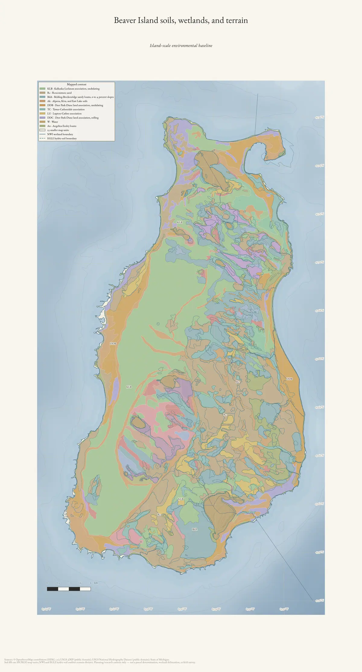
This sheet is the island-scale entry before the four non-administrative detail frames. It is a contextual map, not an approval, delineation, or parcel map. The Island-scale SSURGO soil crosswalk for the Beaver archipelago records the source and intersection limits.
Sources
- Project environmental-atlas renderer.Shared EPSG:3078 cartographic renderer. No public copy of this file is known; the archive holds one and can provide it on request.scripts · make_environmental_atlas
- Planning/research map-unit context only.soils · ssurgo_mapunit_polygons
- Retained as distinct overlays.federal · layers · nwi_wetlands
Added 3 August 2026 · revised 4 August 2026. Recent changes
Cite this article
Beaver Island Archive, “Beaver Island soils, wetlands, and terrain”, https://beaverislandarchive.org/map/atlas-beaver-island-environment/, accessed [date], citing Project environmental-atlas renderer. (and 2 further sources listed on the page).
Last revised 2026-08-04. Fill in [date] with the date you read it — this page is static and cannot know that.
BibTeX for “Beaver Island soils, wetlands, and terrain”RIS for “Beaver Island soils, wetlands, and terrain”