

- Date
- 1942-09-11
- Eras
- Modern era
- Concepts
- land-surveyheritageenvironment
- Within
- Shoe Island
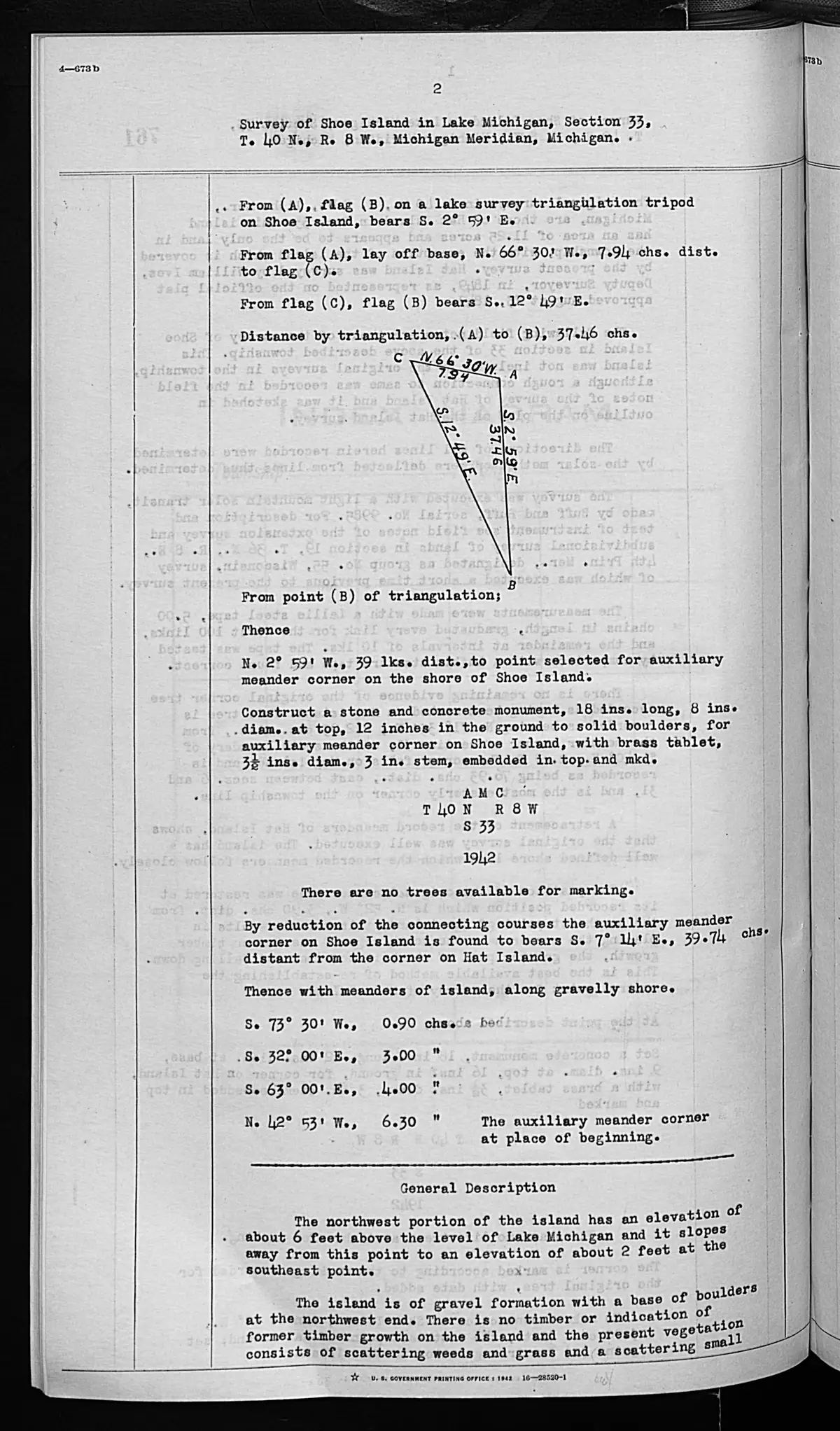
Summary
These checked pages record a federal survey of Shoe Island in Section 33, T40N R8W, completed 11 September 1942. The pages document a triangulation and meander operation, including an auxiliary meander corner and its reported relationship to a corner on Hat Island.
Hat connection and title language
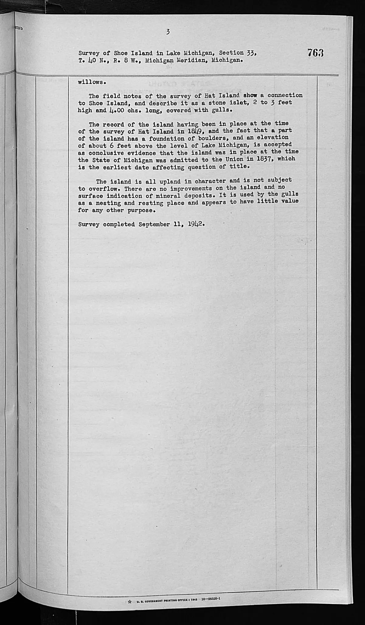
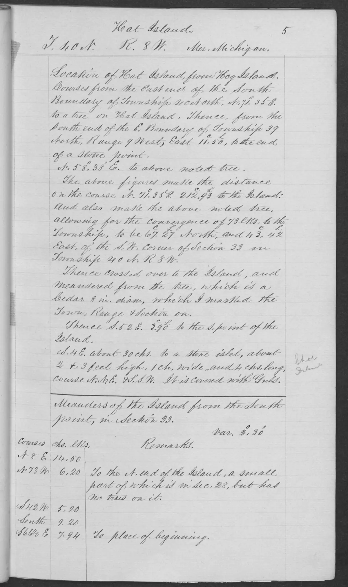
The pages explicitly identify the 1849 Hat Island field notes as the earlier record of a connection to Shoe Island. The 1942 survey then supplies its own reasoning about the island’s physical presence and an earliest date relevant to a question of title. That is a source-specific survey conclusion, not an independent determination of title, current owner, jurisdiction, or any legal right. A complete chain of title and the governing legal record remain outside these pages.
Evidence and limits
The source reports 1942 shore/meander measurements, a gravel-and-boulder description, no timber or indication of earlier timber growth, sparse vegetation, no improvements, and gull nesting/resting use. These are dated survey observations; they do not establish current conditions, a modern island polygon, access, mineral status, or wildlife status.
See also
Sources
- Described in this archive: BLM GLO field-note volumes linked to Beaver Island-area surveys.Visual page-image verification of both retained pages. The typed field notes record a triangulation/meander operation and auxiliary meander corner, a 39.74-chain relation to a Hat Island corner, a gravel/boulder and vegetation description, and a completion date of 11 September 1942. The page’s conclusion concerning the earliest date affecting a question of title is reported surveyor reasoning, not a KB determination of title, ownership, jurisdiction, or current boundary.federal · glo_field_notes · page_evidence · field-note-volume-276017-page-0762-shoe-island-general-description
- Bureau of Land Management, General Land Office Records, Field Note Volume 276017, p. 0763, T40N R8W, Shoe Island general description, 1942.Visual page-image verification. Page 0763 continues the Shoe Island general description and completion/title-analysis language; it is source-specific survey reasoning, not a KB determination of title, ownership, jurisdiction, or current boundary. No public copy of this file is known; the archive holds one and can provide it on request.federal · glo_field_notes · page_evidence · field-note-volume-276017-page-0763-shoe-island-general-description
- Bureau of Land Management, General Land Office Records, Field Note Volume 168138, p. 0005, T40N R8W, Hat Island survey, 1849.Described in this archive: GLO field-note pages: Hat Island survey, 1849.The checked 1849 page supplies the earlier source the 1942 pages identify for the Hat-Shoe connection. It does not establish a later title chain or current location of any survey monument. No public copy of this file is known; the archive holds one and can provide it on request.federal · glo_field_notes · page_evidence · field-note-volume-168138-page-0005-hat-island-survey
Added 2 August 2026 · revised 3 August 2026. Recent changes
Cite this article
Beaver Island Archive, “GLO field-note pages: Shoe Island survey, 1942”, https://beaverislandarchive.org/documents/glo-field-note-shoe-island-survey-1942/, accessed [date], citing Bureau of Land Management, General Land Office Records, Field Note Volume 276017, pp. 0762–0763, “Survey of Shoe Island in Lake Michigan,” Section 33, T40N R8W, Michigan Meridian; survey completed 11 September 1942. (and 2 further sources listed on the page).
Last revised 2026-08-03. Fill in [date] with the date you read it — this page is static and cannot know that.
BibTeX for “GLO field-note pages: Shoe Island survey, 1942”RIS for “GLO field-note pages: Shoe Island survey, 1942”