

- Date
- 1849-07-09
- Eras
- Early American era
- Concepts
- land-surveyheritageenvironmenttoponymy
- Within
- Hat Island
Summary
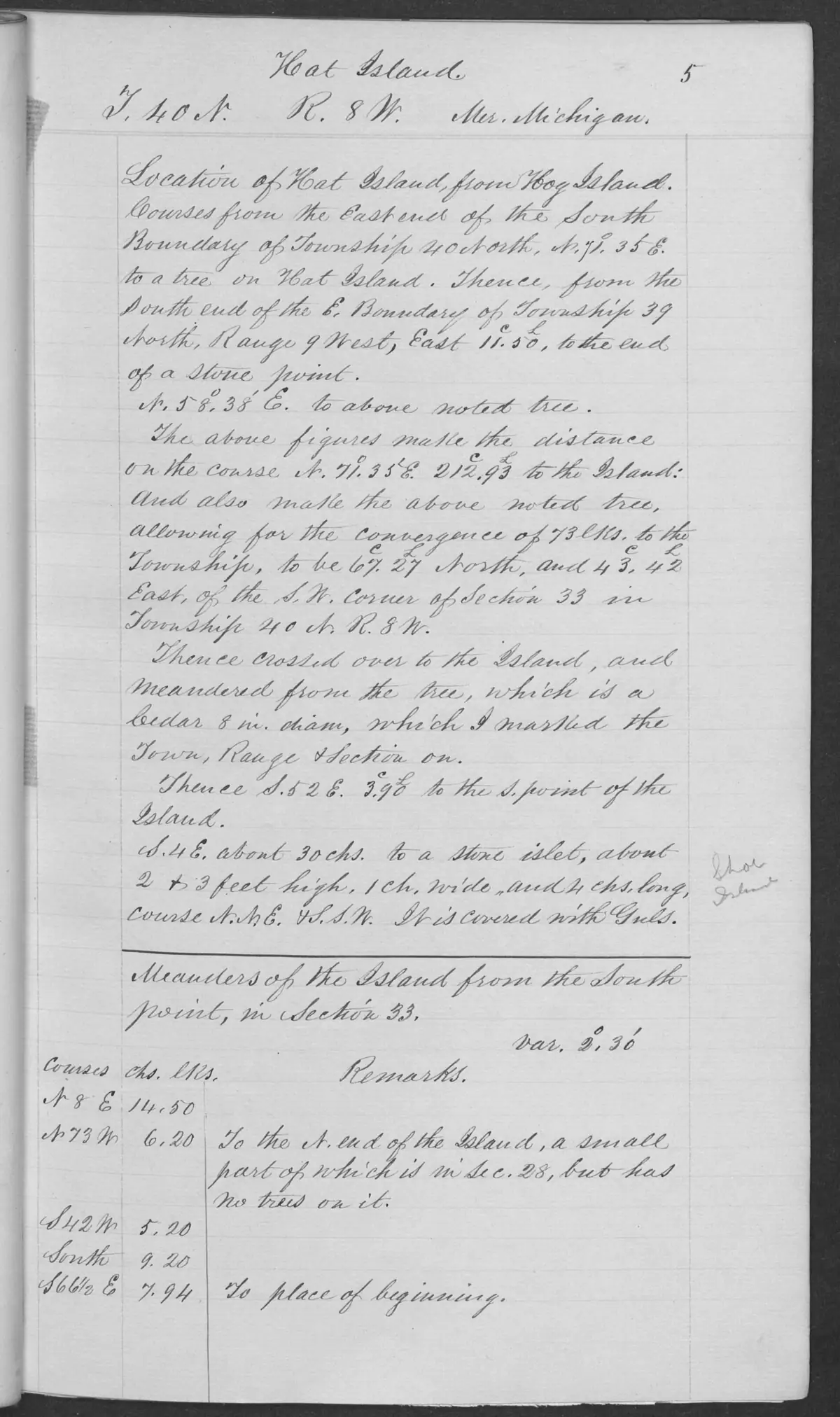
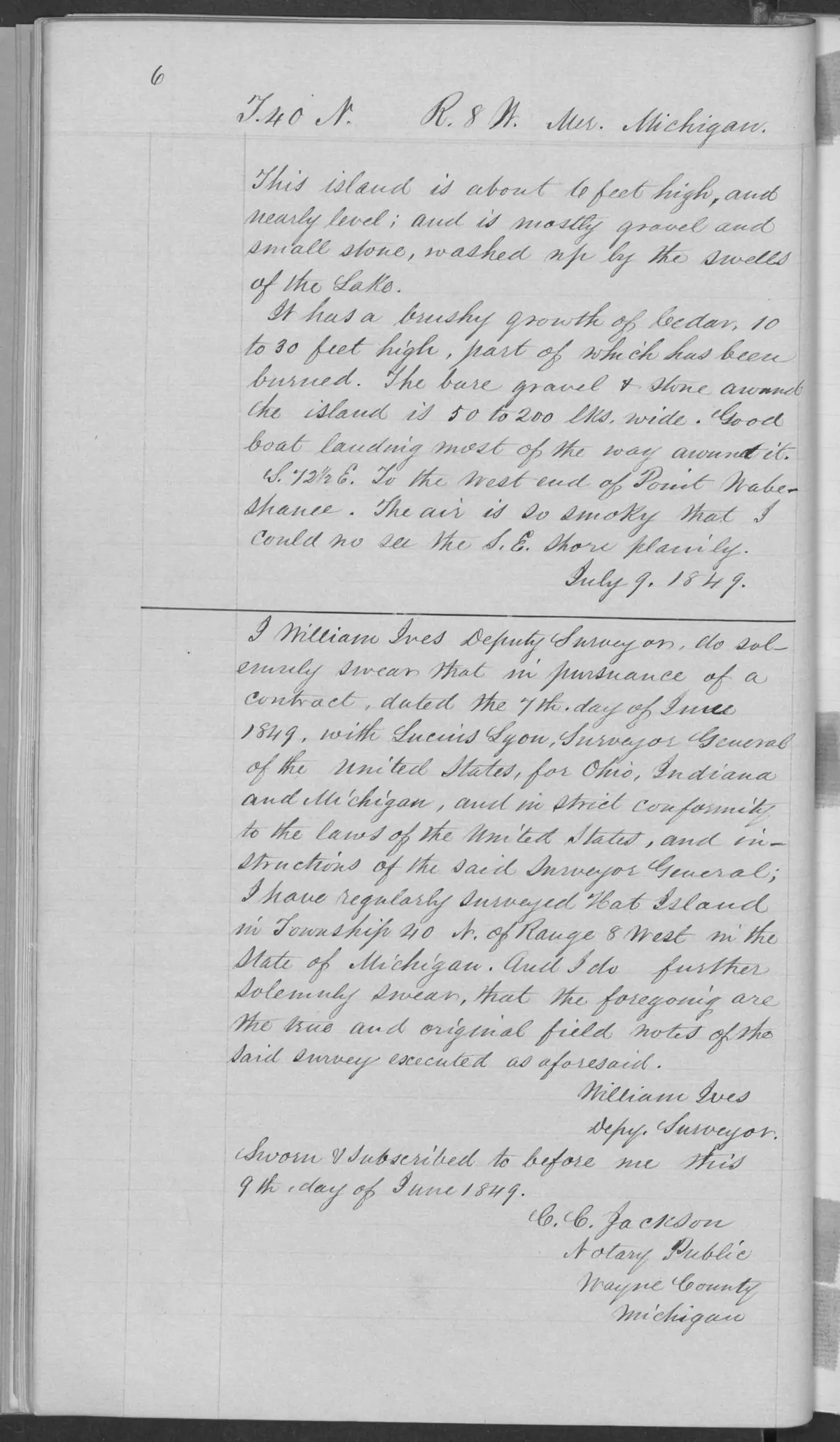
These checked pages from BLM Field Note Volume 168138 record the 1849 federal survey and general description of Hat Island in T40N R8W. The general-description page is dated 9 July 1849 and signed by deputy surveyor William Ives.
Hat-Shoe connection
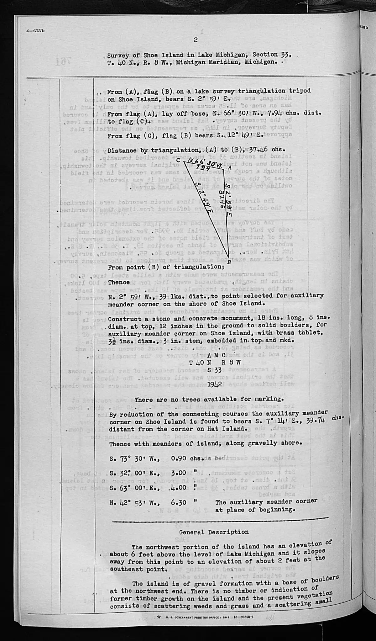
The survey page records a nearby stone islet labeled “Shoe”, described as two to three feet high, one chain wide, four chains long, and covered with gulls. The held 1942 field-note pages for Shoe Island explicitly refer back to the Hat Island field notes as recording the connection. Together, the records support a source-bounded 1849-1942 documentary connection between the named features. They do not establish a continuous title chain, present ownership, a current nesting condition, or exact modern boundaries.
Evidence and limits
The pages record the surveyor’s 1849 observations of Hat Island’s shore material, cedar growth, fire effects, and boat landing. Those observations are not treated as current conditions or a complete environmental inventory. The page’s survey lines and its “Shoe” label are not converted into coordinates or parcel boundaries.
See also
Sources
- Described in this archive: BLM GLO field-note volumes linked to Beaver Island-area surveys.Visual page-image verification of both retained pages. Page 0005 is headed Hat Island, T40N R8W, and records the meander survey. It calls a nearby stone islet “Shoe,” describing it as 2–3 feet high, one chain wide, four chains long, and covered with gulls. Page 0006 gives the dated general description and William Ives’s surveyor certificate. These are page-bounded 1849 observations, not current habitat, a title determination, ownership, access, or a modern island boundary.federal · glo_field_notes · page_evidence · field-note-volume-168138-page-0005-hat-island-survey
- Bureau of Land Management, General Land Office Records, Field Note Volume 168138, p. 0006, T40N R8W, Hat Island general description, 1849.Visual page-image verification. Page 0006 continues the Hat Island general description and carries William Ives’s surveyor certificate; it is a page-bounded 1849 observation, not a current condition, title, ownership, access, or modern boundary record. No public copy of this file is known; the archive holds one and can provide it on request.federal · glo_field_notes · page_evidence · field-note-volume-168138-page-0006-hat-island-general-description
- Bureau of Land Management, General Land Office Records, Field Note Volume 276017, pp. 0762–0763, T40N R8W; survey completed 11 September 1942.Visual page-image verification. The 1942 Shoe Island survey expressly says the Hat Island field notes record a connection to Shoe Island and describe a stone islet covered with gulls. Its internal title-analysis language is retained as a source statement, not a KB title conclusion. No public copy of this file is known; the archive holds one and can provide it on request.federal · glo_field_notes · page_evidence · field-note-volume-276017-page-0762-shoe-island-general-description
Added 2 August 2026. Recent changes
Cite this article
Beaver Island Archive, “GLO field-note pages: Hat Island survey, 1849”, https://beaverislandarchive.org/documents/glo-field-note-hat-island-survey-1849/, accessed [date], citing Bureau of Land Management, General Land Office Records, Field Note Volume 168138, pp. 0005–0006, T40N R8W, Hat Island survey and general description, 9 July 1849. (and 2 further sources listed on the page).
Last revised 2026-08-02. Fill in [date] with the date you read it — this page is static and cannot know that.
BibTeX for “GLO field-note pages: Hat Island survey, 1849”RIS for “GLO field-note pages: Hat Island survey, 1849”