

- Coordinates
- 45.7683° N, 85.4454° WGoogle Maps: Pismire IslandDownload KML
- Eras
- Modern era
- Concepts
- environmentgeologysoilsvegetationtreeswildlifebirdsconservationmaritime
- Within
- Beaver Island archipelago
Summary
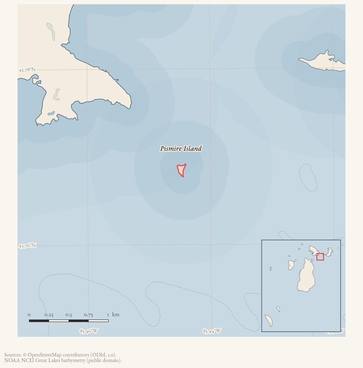
Pismire Island is a very small island between Garden and Hog Islands in the Beaver Island Archipelago. A June 1965 Beaver Beacon excursion describes approaching it from St. James through reefs and shoal water and entering a small cove in its rock-rimmed beach. The account records hundreds of nesting gulls, eggs and chicks, sparse weather-beaten trees, daisies, dune grass, wind-driven driftwood, and a largely sand-and-rock surface. Its phrase that the island was “strictly for the birds” is a dated local observation, not a claim that the island has never had another use.
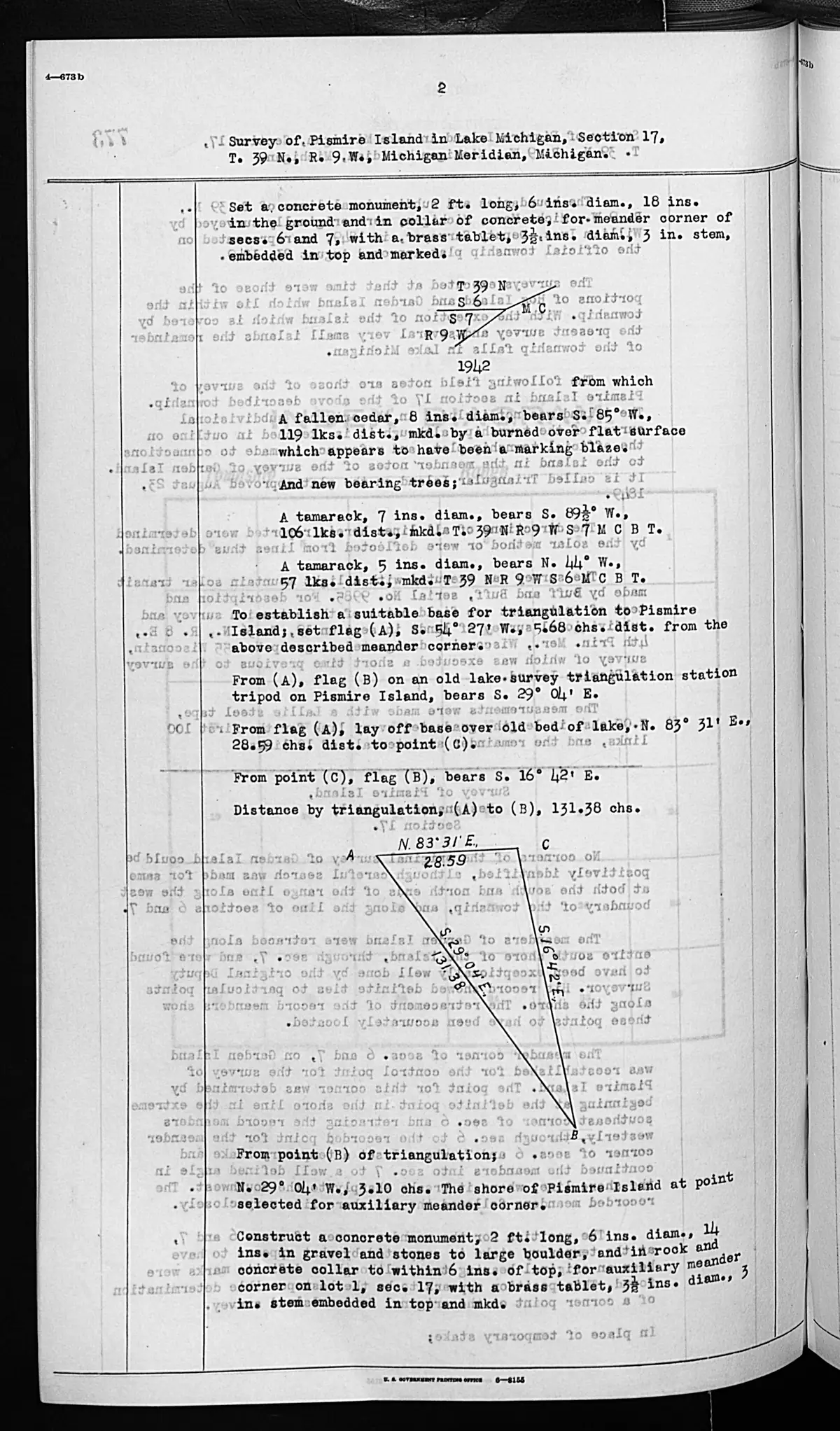
A federal survey completed on September 15, 1942 described Pismire as about three-quarters of a mile from Garden Island’s southeast point, rising gradually to 10–12 feet above Lake Michigan. It recorded gravel and brush shorelines, a dead cedar grove near the center, a few small ash trees, willow brush, grass and weeds, gravel with humus in places, no improvements, and use by ducks and gulls for nesting and resting. These are dated survey observations, not statements of current habitat, title, ownership, or access.1
The 2023 Beaver Island Master Plan identifies Pismire as federally owned and part of the Michigan Islands National Wildlife Refuge. Together, the local description and the plan support an ecological and navigation profile while leaving the refuge acquisition history and any earlier Indigenous or fishing uses open.
Ecological profile
Pismire’s 1942 record combines a gravel island surface with a small but varied vegetation description. The island rose gradually to roughly 10–12 feet above Lake Michigan, had gravel with considerable humus over parts of the surface, and included gravelly and brushy shore segments. The surveyor described a dead cedar grove near the center, a few small ash trees, willow brush, grass, and weeds; a separate bearing-tree page records a fallen cedar and tamaracks on a burned-over flat. The general description also says ducks and gulls used the island considerably for nesting and resting. This is a dated qualitative observation, not a bird count, colony census, complete plant inventory, or current habitat assessment.1
Open questions
- When was Pismire Island incorporated into the national wildlife refuge?
- Are the 1965 nesting observations represented in wildlife surveys or refuge management records?
- Can historical charts identify the reefs and shoals described in the approach account, and do they carry an earlier name?
Footnotes
Maps for this place
These Atlas plates provide regional context. They do not establish a precise boundary, current ownership, access right, operating status, or field condition.
- EnvironmentSoils, wetlands, hydrography, and terrain
- GeologyGeneralized geology and landforms
- HydrologyMapped water and wetland context
- AccessMapped routes, facilities, and protected areas
- Land surveyPLSS geometry and historic GLO patent-location context
The dated record
Sources
- Area 0.01 km² computed in EPSG:3078.osm · islands
- GNIS feature 635045; feature class 'Island'.federal · gnis · gnis_names
- Local excursion describes Pismire as a small island between Garden and Hog Islands, approached through reefs and shoal water; records nesting gulls, eggs and chicks, sparse vegetation, dune grass, and driftwood.data1 · beaver-island-archive · beaver_beacon · 1965-06_Beaver-Beacon
- The held seven-page issue scan is paired with the OCR source and confirms the published notice or report; it does not expand the source-specific identity, event, or outcome claims.data1 · beaver-island-archive · scans · beaver_beacon · issues · 1965-06_Beaver-Beacon
- Identifies Pismire Island as federally owned and part of the Michigan Islands National Wildlife Refuge administered through Seney National Wildlife Refuge.
- Bureau of Land Management, General Land Office Records, Field Note Volume 276017, pp. 0774–0775, T39N R9W; survey completed 15 September 1942.Described in this archive: GLO field-note pages: Pismire Island survey, 1942.Visual page-image verification. The typed original describes a 1942 survey: Pismire lay about three-quarters of a mile from Garden Island’s southeast point, rose gradually to 10–12 feet above Lake Michigan, and had gravel and brush shorelines. It records dead cedar remains near the center, a few small ash trees, willow brush, grass and weeds, a gravel formation with humus in places, no improvements, and duck/gull nesting/resting use. These are time-bounded observations; its title-analysis conclusion is not treated as a title determination. No public copy of this file is known; the archive holds one and can provide it on request.federal · glo_field_notes · page_evidence · field-note-volume-276017-page-0774-pismire-island-survey
- Described in this archive: Visually verified GLO modern island ecology observations, 1942.Preserves the dated vegetation, gravel/humus, disturbance, and duck/gull nesting/resting observations as machine-readable page-bounded records. The holder's public portal is searchable but does not link this record directly; the archive holds a copy of the file and can provide it on request.research · land_cover · crosswalks · glo_modern_ecology_1942
Added 28 July 2026 · revised 3 August 2026. Recent changes
Cite this article
Beaver Island Archive, “Pismire Island”, https://beaverislandarchive.org/places/pismire-island/, accessed [date], citing OpenStreetMap contributors, island polygons via Overpass API, retrieved 2026-07-28 (ODbL 1.0). (and 6 further sources listed on the page).
Last revised 2026-08-03. Fill in [date] with the date you read it — this page is static and cannot know that.