

- Date
- 1942-09-15
- Eras
- Modern era
- Concepts
- land-surveyheritageenvironment
- Within
- Pismire Island
Summary
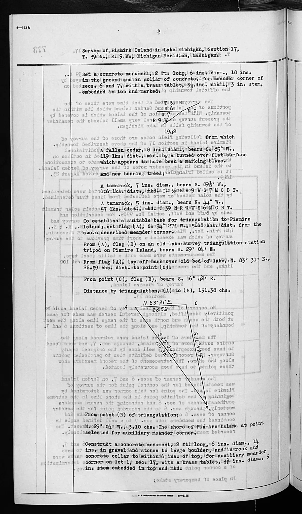
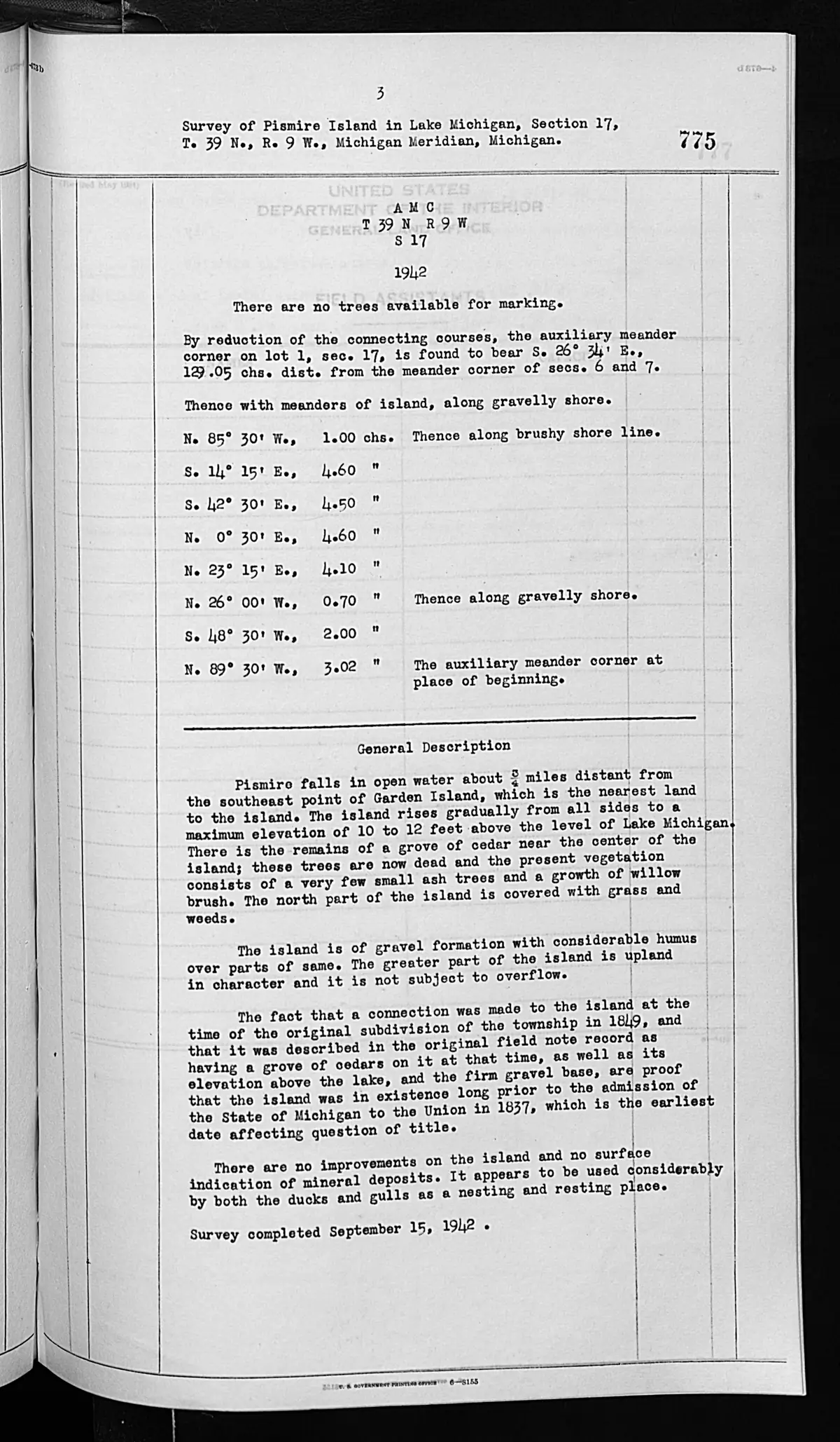
These checked pages record a federal survey of Pismire Island in Section 17, T39N R9W, completed 15 September 1942. The survey records triangulation and meander work, including concrete monuments and an auxiliary meander corner. It describes Pismire as about three-quarters of a mile from the southeast point of Garden Island.
Dated description
The general description says Pismire rose gradually to 10–12 feet above Lake Michigan, had gravel and brush shorelines, remains of dead cedar near its center, a few small ash trees, willow brush, grass and weeds, and gravel with humus in places. It reports no improvements and use by ducks and gulls for nesting and resting. Those are 1942 survey observations, not present ecological, access, or ownership claims.
Evidence and limits
The typed pages include the surveyor’s reasoning that certain physical features and an asserted 1849 connection bore on the earliest date relevant to a title question. This article preserves that reasoning only as a source statement. It does not establish title, ownership, jurisdiction, the survival or location of the 1942 monuments, a contemporary boundary, mineral status, or a continuous history of Pismire Island.
See also
Sources
- Described in this archive: BLM GLO field-note volumes linked to Beaver Island-area surveys.Visual page-image verification of both retained pages. The typed field notes record a triangulation/meander operation, temporary flags, concrete meander monuments, and the 1942 survey description. They report a three-quarter-mile relation to Garden Island’s southeast point, gravel and brush shore, 10–12 foot elevation, dead cedar remains, sparse ash and willow vegetation, no improvements, and duck/gull nesting and resting use. The page’s conclusion about the earliest date relevant to title is surveyor reasoning, not a KB determination of title, ownership, jurisdiction, or current boundary.federal · glo_field_notes · page_evidence · field-note-volume-276017-page-0774-pismire-island-survey
- Bureau of Land Management, General Land Office Records, Field Note Volume 276017, p. 0775, Pismire Island general description, 1942.Continuation page visually checked with page 0774. It contains the general description and completion date; neither page establishes present habitat, modern monument survival, access, current ownership, mineral status, or a complete land-title history. No public copy of this file is known; the archive holds one and can provide it on request.federal · glo_field_notes · page_evidence · field-note-volume-276017-page-0775-pismire-island-general-description
Added 2 August 2026 · revised 3 August 2026. Recent changes
Cite this article
Beaver Island Archive, “GLO field-note pages: Pismire Island survey, 1942”, https://beaverislandarchive.org/documents/glo-field-note-pismire-island-survey-1942/, accessed [date], citing Bureau of Land Management, General Land Office Records, Field Note Volume 276017, pp. 0774–0775, “Survey of Pismire Island in Lake Michigan,” Section 17, T39N R9W, Michigan Meridian; survey completed 15 September 1942. (and 1 further source listed on the page).
Last revised 2026-08-03. Fill in [date] with the date you read it — this page is static and cannot know that.
BibTeX for “GLO field-note pages: Pismire Island survey, 1942”RIS for “GLO field-note pages: Pismire Island survey, 1942”