

- Date
- 2017
- Eras
- Modern era
- Concepts
- governanceenvironmentconservationheritageagriculture
- Within
- Beaver Island archipelago
Summary
The Michigan Department of Natural Resources’ 2017 Management Plan for State-owned Lands on Northern Lake Michigan Islands sets a shared state-land management frame for North and South Fox, Beaver, Garden, High, Hog, and Whiskey islands. It calls this group the Beaver Island State Wildlife Research Area for the plan’s purposes.
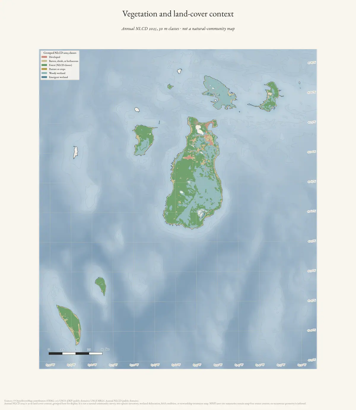
The plan is useful as a dated administrative and environmental snapshot. It identifies state-land management issues including old homesteads and “Mormon fields” on Beaver Island; an old apple orchard at Garden Island’s former Indian Village; old fields and a historical apple orchard on High Island; and land and wildlife conditions across the group. It also summarizes state-acquisition history at an island level.
Purpose and background
The plan states that it grew out of two 2013 efforts: the Department’s own draft Managed Public Land Strategy, and Recommendations for Natural Resource Management in the Beaver Archipelago, produced by the Beaver Island Natural Resources and Ecotourism Steering Committee. It describes its purpose as providing “a vision and intended actions for the future management of state owned lands on northern Lake Michigan islands, in partnership with local units of government, tribal governments, and other interested stakeholders,” and assigns administration of the covered lands to the DNR’s Wildlife Division.
State-land acquisition history
The plan reports that state administration in the archipelago began in 1856 with the transfer of federal “Swamp Grants,” followed by tax-reverted parcels as early as 1903 on Beaver Island and 1907 on Garden Island, with most purchasing occurring in the 1950s using the State Game Fund and the federal Pittman-Robertson Act’s Wildlife Restoration excise-tax fund. By the plan’s figures, Beaver Island is 33% state land (12,237 acres, over half of it tax-reverted rather than purchased); Garden Island is 98% state land (4,254 acres); High and Hog islands are entirely state owned; Whiskey Island became entirely state owned through a 2012 exchange with St. James Township and Charlevoix County; and South Fox Island is 33% state land, most of it purchased in 1958 with Pittman-Robertson funds.
Island-specific management issues
Beyond the homesteads, “Mormon fields,” and orchards already noted, the plan records other site-specific concerns. On Garden Island it identifies a “DNR Cabin” and other standing structures including “Golden’s cabin,” a land-use permit held by the Miniss Kitigan Drum organization, historical garbage dumps, and a Native American cemetery of unknown areal extent. On High Island it identifies two research cabins the plan recommends for removal, House of David structures, and a proposed Natural Area designation developed with The Nature Conservancy. These are recorded as 2017 management issues, not as a complete inventory or history of any site.
Evidence and limits
The plan’s shared scope is strong evidence that the Fox Islands belong in a regional state-land management frame with the Beaver Islands. It does not erase the Fox Islands’ distinct Leelanau County jurisdiction, establish that all land on any listed island is state-owned, or determine cultural affiliation, ownership, public access, or the exact location and extent of historical or archaeological sites.
Its references to former fields, homesteads, and orchards identify 2017 management concerns, not dates of cultivation, continuous use, farm boundaries, or a complete agricultural inventory. Proposed or described management work is not treated as implementation or an enduring present condition.
See also
Sources
- Beaver Island Association, “DNR Plans for the outer Islands,” Beaver Island Forum, July 13–19, 2015.Contemporaneous relay of the DNR draft-plan open house at Beaver Island Community School, including the seven-island scope and earlier public meetings. The held DNR plan remains the controlling source for final plan content and status.forum · www.beaverislandforum.com · 09 · t009066
- Held official plan PDF for state-owned lands on North and South Fox, Beaver, Garden, High, Hog, and Whiskey islands. Its stated scope is state-land management. It records 2017 descriptions, acquisition summaries, and management issues; it is not a title abstract, access authorization, archaeological inventory, current management decision, or a complete history of every island.research · island_farming · sources · mdnr_northern_lake_michigan_islands_plan_2017
- Searchable extraction used to locate the plan’s stated scope and island-specific sections; the PDF remains the authoritative held rendering.research · island_farming · mdnr_northern_lake_michigan_islands_plan_2017
Added 2 August 2026. Recent changes
Cite this article
Beaver Island Archive, “MDNR management plan for state-owned Northern Lake Michigan islands, 2017”, https://beaverislandarchive.org/documents/mdnr-northern-lake-michigan-islands-management-plan-2017/, accessed [date], citing Beaver Island Association, “DNR Plans for the outer Islands,” Beaver Island Forum, July 13–19, 2015. (and 2 further sources listed on the page).
Last revised 2026-08-02. Fill in [date] with the date you read it — this page is static and cannot know that.
BibTeX for “MDNR management plan for state-owned Northern Lake Michigan islands, 2017”RIS for “MDNR management plan for state-owned Northern Lake Michigan islands, 2017”