

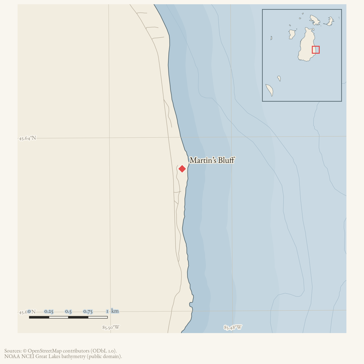
- Along road
- East Side Drive
- Coordinates
- 45.6364° N, 85.4881° WGoogle Maps: Martin’s BluffDownload KML
- Eras
- Irish eraModern era
- Concepts
- fishinglumberingenvironmentgeologysoilsforeststreesvegetationplantswetlandswildlifeanimalsconservationstewardshipheritagecommunity
- Within
- Beaver Island
- Media
- Beaver Island History Map, 1978 revision
Summary
Martins Bluff is a named Beaver Island place recorded by GNIS as a populated place. Its historical association with the Martin family is preserved in a March 2025 Northern Islander retrospective, which cites Helen Collar’s research in the Journal of Beaver Island History and a statement by descendant Francis (Ernie) Martin.
That account says that five Martin brothers came from County Mayo, first settled on Mackinac Island, and returned with their families to Beaver Island in 1857 after investigating land newly abandoned after the Strangite period. It reports that James Martin bought 57 acres in the area still known as Martin’s Bluff and that the brothers took land at Martin’s Point. It further describes their livelihoods as fishing pound nets off the beach and cutting cedar ties in winter. This is a retrospective account of earlier research, not a newly located 1857 deed or census record, so the exact property boundaries and relationship between the Bluff and Point remain open.
This chronology conflicts with the 1978 Historical Map, which says Ed, John, and Jim lived close together there “from the 1840’s.” The later account supports the associated fishing and winter cedar-tie work, but its 1857 return date does not support the map’s decade. The cited Journal of Beaver Island History, Volume IV passage, deeds, and census records are still needed to determine whether an earlier individual Martin presence preceded the families’ return.
The 2023 Beaver Island Master Plan independently treats Martin’s Bluff as a historic and cultural site: it mentions infrastructure there among DNR management considerations and lists a Martin’s Bluff recreation site with a trail and access toward the beach. Those references document the modern heritage and public-access context, but do not identify the historical infrastructure or establish that it survives from the Martin family period.
Ecological profile
MNFI Report 2017-11 records a Martin’s Bluff mesic northern forest occurrence (EO 626, 42 acres, report pp. 86–87). The occurrence consists of three small islands of uneven-aged old-growth forest on rolling ground moraine. It is surrounded by beaver-influenced wetlands, conifer swamp, and paper-birch and aspen forest that the survey considers likely to have established after turn-of-the-century logging. The occurrence record supplies ecological context for the named place; it does not make the GNIS populated-place point, historical Martin property, or recreation site equivalent to the MNFI polygons.
The MNFI occurrence is not a current legal boundary, ownership determination, or complete survey of Martin’s Bluff.
Soils vary with canopy dominance. Sugar-maple areas have mull humus over acidic (pH 5.0–6.0) sandy clay loams and sandy loams. Hemlock-dominated areas have acidic mor humus over leached sands (pH about 4.5) and loamy sands (pH 4.5–5.0). The survey observed one non-native earthworm in a soil pit and notes its potential to alter decomposition rates and nutrient dynamics; this is a field observation and ecological concern, not a population estimate.
Large-diameter trees dominate the old-growth canopy: sugar maple, hemlock, American beech, and yellow birch commonly exceed 60 cm DBH, with trees estimated at 250 years or more. Hemlock dominates the northern polygon, while sugar maple dominates the southern two. The uneven-aged structure includes balsam fir and red maple in the subcanopy, with green ash, paper birch, and quaking aspen along edges and larger gaps. The shrub and ground layers include striped maple, beaked hazelnut, Canadian fly honeysuckle, sugar-maple seedlings, starflower, wild sarsaparilla, Indian cucumber root, Canada mayflower, goldthread, gay-wings, bunchberry, partridge berry, blue-bead lily, and stiff clubmoss. Hemlock, yellow birch, red maple, and occasional northern white-cedar mark the wetland ecotone.
The survey records mature beech beginning to die from beech bark disease and finds deer herbivory likely affecting composition and structure, including the loss of hemlock regeneration. Browsed sugar-maple saplings and jewelweed were noted. Hunters were cutting coarse woody debris for firewood and clearing trails with a chainsaw, while the private portion was considered vulnerable to logging. MNFI recommends unmanaged forest and swamp as a buffer, longer rotations and late-successional retention where surrounding forest is managed, deer exclosures around coarse woody debris and nurse logs, and allowing fire and windthrow to operate without salvage logging. These are 2017 recommendations, not evidence that current management or ownership has been verified.
Open questions
- Can the Martin family claims be checked against the cited Journal of Beaver Island History volumes, original land recordings, and the 1850–1880 census records?
- What are the precise historical boundaries of Martin’s Bluff and Martin’s Point, and how do the GNIS coordinates relate to them?
- Which infrastructure and trail features did the 2023 Master Plan mean at the Martin’s Bluff site?
- What are the mapped MNFI polygon boundaries, and how do they relate to the historical Martin property, GNIS point, and current public-recreation lease?
Maps for this place
These Atlas plates provide regional context. They do not establish a precise boundary, current ownership, access right, operating status, or field condition.
- EnvironmentSoils, wetlands, hydrography, and terrain
- GeologyGeneralized geology and landforms
- HydrologyMapped water and wetland context
- AccessMapped routes, facilities, and protected areas
- Land surveyPLSS geometry and historic GLO patent-location context
Sources
- Names Martin’s Bluff Scenic Outlook as one of five DNR-leased Peaine public-recreation sites. It does not establish a current legal boundary, specific improvement consent, current access, or current condition.research · island_governance · peaine-lake-geneserath-dnr-lease
- GNIS feature 1618671; feature class 'Populated Place'.federal · gnis · gnis_names
- The Northern Islander, March 2025, “The Stories Behind the Names of Islanders Lost at Sea.”Retrospective article cites Helen Collar’s Journal of Beaver Island History research and descendant Francis Martin on the Martin brothers’ 1857 settlement, land at Martin’s Bluff and Martin’s Point, pound-net fishing, and winter cedar cutting. No public copy of this file is known; the archive holds one and can provide it on request.
- Identifies infrastructure at Martin’s Bluff as a historic and cultural management consideration and lists a Martin’s Bluff site with a trail and beach access in its recreation inventory; the inventory table gives East Side Drive as the approximate location. It does not establish a current legal boundary or access condition.
- Project-generated MNFI 2017 soil, vegetation, and wildlife crosswalk, preserving MNFI Report 2017-11, Martin’s Bluff mesic northern forest occurrence (EO 626), report pp. 86–87.Described in this archive: MNFI soil, vegetation, tree, and wildlife crosswalk, 2017.The 42-acre MNFI occurrence covers three small old-growth forest polygons associated with Martin’s Bluff; it is not a current legal boundary, ownership determination, or complete survey of the named place. No public copy of this file is known; the archive holds one and can provide it on request.research · island_farming · crosswalks · mnfi_soil_vegetation_wildlife_crosswalk
- Visual page evidence held with provenance sidecar; the image anchors the occurrence description and does not establish a modern boundary or current condition.research · island_farming · evidence · mnfi-report-2017-11-page-0086-martins-bluff-forest
- Described in this archive: Beaver Island History Map, 1978 revision.Says Ed, John, and Jim Martin lived close together from the 1840s and fished and cut cedar ties. The later Martin-family account supports the work but dates the brothers' return with families to 1857, creating a decade conflict.
Added 28 July 2026 · revised 7 August 2026. Recent changes
Cite this article
Beaver Island Archive, “Martin’s Bluff”, https://beaverislandarchive.org/places/martins-bluff/, accessed [date], citing Michigan Department of Natural Resources and Peaine Township, public-recreation lease, effective 2019–2048. (and 6 further sources listed on the page).
Last revised 2026-08-07. Fill in [date] with the date you read it — this page is static and cannot know that.