

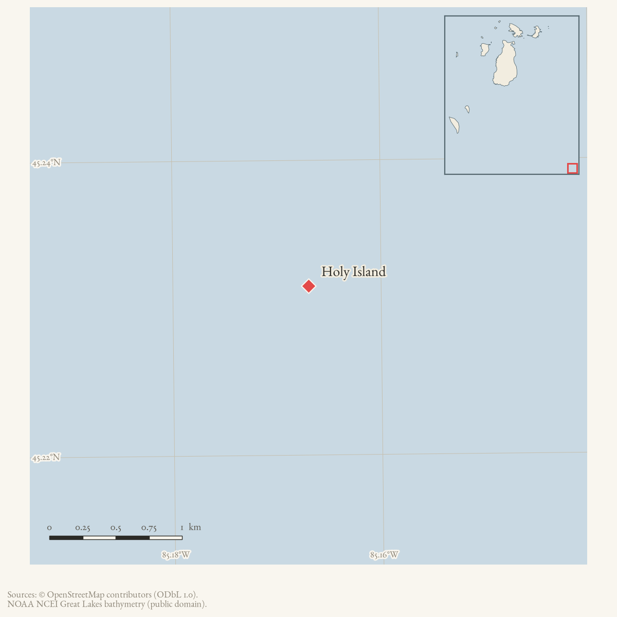
- Coordinates
- 45.2315° N, 85.1670° WGoogle Maps: Holy IslandDownload KML
- Eras
- Strang eraModern era
- Concepts
- toponymymormonismreligionenvironmentheritagehistoriography
- Within
- Pine Lake
Summary
Holy Island is a small island in the South Arm/Pine Lake system, the mainland waterway that Strang’s followers called Lake Mormon. A contemporary 1856 announcement places a special church conference there; later local histories connect the island’s name to a Strang-era celebration by people who traveled from Beaver Island. The 1936 local alias is Isle of Pines.
History and identity
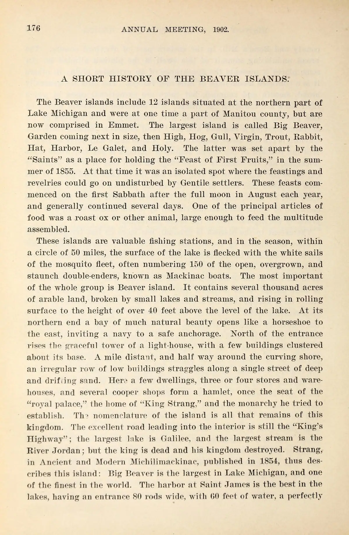
The held evidence supports the island’s identity and continued local use, but not every story attached to it. The May 1856 Daily Northern Islander announces a special conference for July 12 at Holy Island, Lake Mormon. A 1968 local-history serialization remembers an earlier celebration or “feast of first fruits” by about fifty Beaver Island Mormons, with Strang among them, and says the name was given during that visit. A separate 1902 retrospective dates such a Feast of First Fruits to summer 1855 and describes recurring August observances. Neither later account confirms its own date through a contemporary program, and neither establishes whether the announced 1856 conference actually met.
The 1912 Charlevoix County Herald reports old arches, a stone fort, excavations, and buried treasure, but presents these through first-settler tradition and a resort-development story. Its hostile account of Strang’s followers as pirates and its treasure narrative are evidence of later local memory, not verified archaeology or a settled history of the Strang settlement. The article’s geographic statement that Holy Island is an island in Pine Lake is treated separately from those claims.
A 1955 retrospective makes the source chain clearer. It attributes the legend to an earlier promotional booklet by real-estate broker I. B. McLean, reports searches by Bert Wilhelm with unnamed Indigenous guides in 1900 and again in spring 1912, and says the latter search exposed a stone vault about thirty inches square. It reports no treasure in the vault. The writer ends by praising McLean as a real-estate salesman. Read the story as resort promotion and folklore, not as archaeological confirmation. See Strang treasure traditions.
Evidence and limits
No GNIS feature identifier, coordinates, historical plat, or archaeological survey has been located for the island. The alias Isle of Pines is directly attested by the 1936 notice. The article is kept distinct from Beaver Island, Garden Island, and the several islands in the Beaver archipelago; it belongs to Pine Lake on the mainland side of the Strang-era network.
Open questions
- What modern parcel, survey, or GNIS feature corresponds to Holy Island?
- Did the announced July 12, 1856 conference actually occur, and are its attendees recorded?
- Can the claimed fort, arches, or excavations be matched to a documented archaeological or plat record?
- When and why did the name Isle of Pines enter local use?
- Does a copy survive of McLean’s illustrated Holy Island promotional booklet?
See also
Maps for this place
These Atlas plates provide regional context. They do not establish a precise boundary, current ownership, access right, operating status, or field condition.
- EnvironmentSoils, wetlands, hydrography, and terrain
- GeologyGeneralized geology and landforms
- HydrologyMapped water and wetland context
- AccessMapped routes, facilities, and protected areas
- Land surveyPLSS geometry and historic GLO patent-location context
Sources
- *Daily Northern Islander*, Saint James, May 27, 1856, announcement of a special conference at Holy Island, Lake Mormon.Contemporary Strangite newspaper announcement: a special conference was to be held at Holy Island, Lake Mormon, on July 12. The compilation preserves the announcement but not a later attendance report. No public copy of this file is known; the archive holds one and can provide it on request.
- "Treasure on Holy Island," *Charlevoix County Herald*, August 10, 1912.Local report identifies Holy Island as the only island in Pine Lake, describes its resort development, and attributes the name and buried-treasure story to first-settler tradition. The treasure, pirate, fort, and excavation claims are retained as reported tradition rather than verified facts. No public copy of this file is known; the archive holds one and can provide it on request.
- "Cottage Furniture Sale," *Charlevoix County Herald*, July 17, 1936, advertisement for Isle of Pines (Holy Island).Contemporary local notice gives the alias Isle of Pines, identifies it as Holy Island, and places it just off trunk line 68 south of Ferry and north of the Ironton ferry; it also documents a bridge connection. No public copy of this file is known; the archive holds one and can provide it on request.
- Charlevoix Courier, 1968, local-history serial "First town election...1857," section "Holy Island."Later local-history account says roughly fifty Beaver Island Mormons, with Strang, traveled by boat to a small island about two miles beyond the Pine River entrance for a first celebration and gave it the name Holy Island. It is retrospective and preserves local memory, not a contemporary attendance record. No public copy of this file is known; the archive holds one and can provide it on request.
- Described in this archive: Michigan Historical Collections, volume 32, 1902.Printed page image checked. The 1902 retrospective says Holy Island was set apart by “Saints” for a Feast of First Fruits in summer 1855, with recurring August observances. It is a later historical account, not a contemporary conference notice, attendance record, church calendar, archaeological record, or independent confirmation of the date or practice.
- Retrospective account of I. B. McLean’s promotional booklet and reported searches in 1900 and spring 1912. It describes a 30-inch-square stone vault but no recovered contents, and closes by identifying McLean as a talented real-estate salesman.research · strang_treasure · east_jordan_news-herald_1955-09-22
- The OSM island feature provides a 45.2314738°N, 85.1669727°W label point. It agrees with the held sources that identify Holy Island as the named island in Pine Lake/Lake Charlevoix; it is a map anchor rather than evidence for the reported Strang-era structures.
Added 1 August 2026 · revised 2 August 2026. Recent changes
Cite this article
Beaver Island Archive, “Holy Island”, https://beaverislandarchive.org/places/holy-island/, accessed [date], citing *Daily Northern Islander*, Saint James, May 27, 1856, announcement of a special conference at Holy Island, Lake Mormon. (and 6 further sources listed on the page).
Last revised 2026-08-02. Fill in [date] with the date you read it — this page is static and cannot know that.