

- Date
- 1900
- Eras
- Modern era
- Concepts
- maritimeshippinglighthousesheritage
- Within
- Beaver Island archipelago
Summary
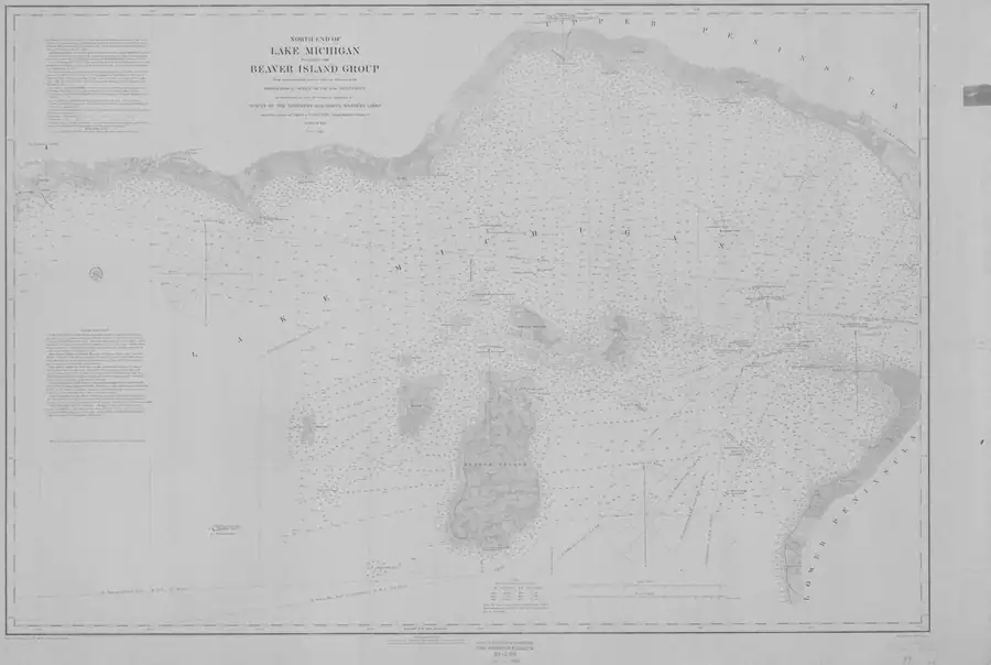
This held NOAA chart is the 1900 North End of Lake Michigan Including the Beaver Island Group (LS0), at catalog scale 1:120,000. It supplies a dated navigation-map snapshot of the archipelago and its approaches.
Evidence and limits
The NOAA catalog and the held image establish the chart’s title, year, type, scale, public-domain status, and coverage. The image’s correction notice says that aids to navigation were corrected from information received through 1 February 1900. That makes the sheet useful for chronological comparison with the 1855 Lake Survey chart and later NOAA charts.
This is not evidence of current navigation conditions, ownership, settlement, traffic, light operation, or exact modern boundaries. Individual chart symbols, soundings, and correction details need a feature-level reading of the full resolution sheet before they support separate claims.
See also
Sources
- Held full-resolution NOAA chart image. Direct visual review confirms the title block, Beaver Island Group coverage, and a bottom-margin correction notice stating that aids to navigation were corrected from information received to 1 February 1900. The record does not transcribe individual soundings, aids, corrections, or instructions.federal · noaa_charts · images · 1900_NORTH-END-OF-LAKE-MICHIGAN-INCLUDING-THE-BEAVER-ISLAND-GROUP-NORTH-END_00-7-1900
- Records the source URL, retrieval timestamp, SHA-256, 13,352,373-byte file size, NOAA public-domain status, chart number, and scale.federal · noaa_charts · images · 1900_NORTH-END-OF-LAKE-MICHIGAN-INCLUDING-THE-BEAVER-ISLAND-GROUP-NORTH-END_00-7-1900.provenance
- Catalog metadata gives year 1900, nautical-chart type, scale 1:120,000, chart number LS0, and a geographic bounding box that includes the Beaver Island archipelago.federal · noaa_charts · noaa_charts_aoi

Added 2 August 2026 · revised 4 August 2026. Recent changes
Cite this article
Beaver Island Archive, “North End of Lake Michigan including the Beaver Island Group nautical chart, 1900”, https://beaverislandarchive.org/documents/noaa-north-end-lake-michigan-chart-1900/, accessed [date], citing NOAA Office of Coast Survey, Historical Map & Chart Collection, “North End of Lake Michigan Including the Beaver Island Group,” chart LS0, 1900, scale 1:120,000. (and 2 further sources listed on the page).
Last revised 2026-08-04. Fill in [date] with the date you read it — this page is static and cannot know that.
BibTeX for “North End of Lake Michigan including the Beaver Island Group nautical chart, 1900”RIS for “North End of Lake Michigan including the Beaver Island Group nautical chart, 1900”