

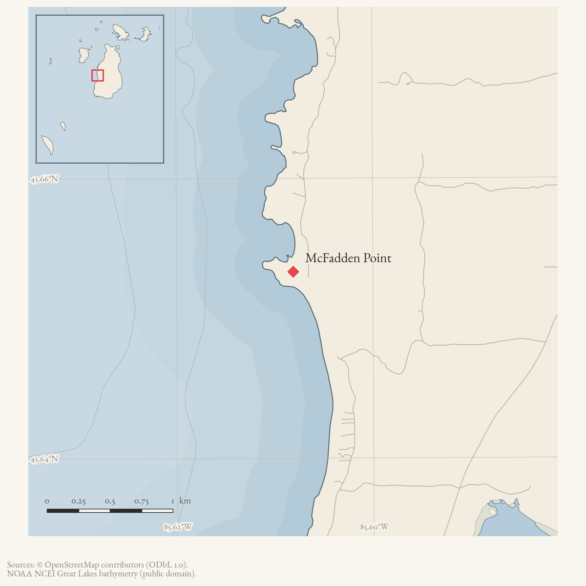
- Coordinates
- 45.6533° N, 85.6081° WGoogle Maps: McFadden PointDownload KML
- Eras
- Modern era
- Concepts
- toponymyenvironmentgeologysoilsdunesvegetationplantstreeswildlifeanimalsconservationstewardshipinvasive-species
- Within
- Beaver Island
- Media
- Beaver Island History Map, 1978 revision · Plat of Big Beaver Island, 1901 · Plat of the north end of Beaver Island, 1930s
Summary
USGS GNIS identifies McFadden Point as a cape. The 2023 Beaver Island Master Plan also labels “McFadden’s Point” on its map of island places. The 1978 History Map calls it a fishing camp at the north edge of the Greenes Bay settlement. Collar’s notes provide partial independent support: Johnny Green remembered an O’Brien/DeBriae household there, and another informant remembered pond-net fishing in Greenes Bay. Because the household list is incomplete and internally disputed, this establishes a plausible fishing-settlement association, not a formally bounded camp.
Ecological profile
MNFI Report 2017-11 records a 102-acre open-dune occurrence at McFadden Point (EO 10808, rank C, G3/S3; p. 117) along Beaver Island’s western shore. Fine- textured wind-blown and wave-worked sands are alkaline around pH 8.0. High parabolic dunes occupy the north, with a steep foredune beside sand and gravel beach; low foredunes form a long southern tail beside limestone cobble shore.
Marram grass, sand reed grass, and little bluestem are prevalent. Shrubs include sand cherry, shrubby cinquefoil, creeping juniper, and soapberry. Scattered trees and tall shrubs include balsam poplar, paper birch, balsam fir, white spruce, cedar, white pine, sandbar willow, sand-dune willow, choke cherry, and silky dogwood. An 18-centimeter red pine was estimated at 25 years old. Houses are scattered through the forested dunes behind the foredunes.
The report records beach pea, state- and federally threatened Pitcher’s thistle, wormwood, white camas, plains puccoon, harebell, horsetail, Gillman’s goldenrod, and milkweed. Residential development, foot traffic, and off-road vehicles threaten dune stability through erosion and devegetation. MNFI recommends eliminating off-road vehicle traffic along the beach, limiting traffic in the parabolic dunes, and posting fragile-ecosystem signs. This occurrence is not a current legal boundary, property determination, complete plant or wildlife inventory, or present-condition assessment.
Open questions
- Who or what gave McFadden Point its name?
- Can deeds, census schedules, or fishing records define the settlement and distinguish a household fishing station from a formal camp?
Sources
- GNIS feature 631888; feature class 'Cape'.federal · gnis · gnis_names
- Map label “McFadden's Point.”
- Records Johnny Green's recollection of an O'Brien/DeBriae household at McFadden's Point within his remembered Greenes Bay families. The list is incomplete and Collar records informant disagreements, so it supports settlement association rather than a surveyed boundary or formal camp.web · collar_subject_cards_e-i
- Described in this archive: Beaver Island History Map, 1978 revision.Calls the point a fishing camp at the north edge of the Greenes Bay settlement; an uncited retrospective annotation treated as a research claim.
- Project-generated MNFI 2017 soil, vegetation, and wildlife crosswalk, preserving MNFI Report 2017-11, McFadden Point open dunes occurrence (EO 10808), report p. 117.Described in this archive: MNFI soil, vegetation, tree, and wildlife crosswalk, 2017.The 102-acre record is a source-defined open-dune occurrence along McFadden Point; it is not a current legal boundary, ownership determination, or complete survey. No public copy of this file is known; the archive holds one and can provide it on request.research · island_farming · crosswalks · mnfi_soil_vegetation_wildlife_crosswalk
- Visual page evidence held with provenance sidecar; the image anchors the occurrence description and does not establish modern geometry or current condition.research · island_farming · evidence · mnfi-report-2017-11-page-0117-mcfadden-point-open-dunes
Added 28 July 2026 · revised 7 August 2026. Recent changes
Cite this article
Beaver Island Archive, “McFadden Point”, https://beaverislandarchive.org/places/mcfadden-point/, accessed [date], citing U.S. Geological Survey, Geographic Names Information System, Domestic Names (Michigan), retrieved 2026-07-28. (and 5 further sources listed on the page).
Last revised 2026-08-07. Fill in [date] with the date you read it — this page is static and cannot know that.