

- Coordinates
- 45.6719° N, 85.6076° WGoogle Maps: Left’s PointDownload KML
- Eras
- Modern era
- Concepts
- toponymy
- Within
- Beaver Island
- Media
- Beaver Island History Map, 1978 revision · Plat of Big Beaver Island, 1901 · Plat of the north end of Beaver Island, 1930s
Summary
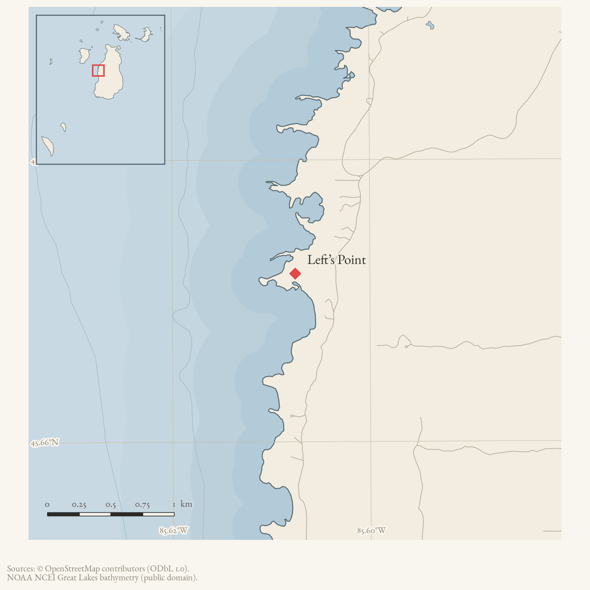
Lefts Point is a GNIS-named cape on Beaver Island. The 2023 Beaver Island Master Plan labels the feature “Left’s Point” on its coastal-wetlands map. The source confirms a contemporary cartographic form of the name. The 1978 Historical Map identifies Joe Left as the namesake. Held parish, census, civil, cemetery, and newspaper transcriptions document a German-born fisherman variously recorded as Joseph Left, Link, or Links, making the family association plausible but not independently proving the name’s origin.
The map also says Joe Left crossed from Oconto, Wisconsin. No inspected newspaper, federal land record, Collar file, or web source corroborates that route. A 1909 contemporary notice instead says Joseph Link came to Beaver Island in 1856, while the census compilation warns of two similar Joseph Left entries in 1860. The Oconto statement remains a map-attributed research lead.
Open questions
- What is the earliest map, deed, or newspaper using Left’s Point by name?
- Can Wisconsin, immigration, military, or maritime records document Joseph Left’s alleged Oconto crossing?
Sources
- GNIS feature 630276; feature class 'Cape'.federal · gnis · gnis_names
- Map label “Left's Point.” This is a cartographic attestation, not a narrative account of the point's history.
- Compiles parish, census, cemetery, and civil records for Joseph Left/Link, a German-born fisherman and early island resident. It does not connect him to the point or to Oconto.web · collar_biographical_biographical-papers-h-m
- Described in this archive: Beaver Island History Map, 1978 revision.Says the point was named for Joe Left, who crossed from Oconto, Wisconsin. No independent source for the Oconto route was located.
Added 28 July 2026 · revised 1 August 2026. Recent changes
Cite this article
Beaver Island Archive, “Left’s Point”, https://beaverislandarchive.org/places/lefts-point/, accessed [date], citing U.S. Geological Survey, Geographic Names Information System, Domestic Names (Michigan), retrieved 2026-07-28. (and 3 further sources listed on the page).
Last revised 2026-08-01. Fill in [date] with the date you read it — this page is static and cannot know that.