

- Along road
- Greene's Bay Drive
- Coordinates
- 45.6417° N, 85.6084° WGoogle Maps: Greene’s BayDownload KML
- Concepts
- toponymyenvironmenttourismsociety
- Within
- Beaver Island
- Media
- Beaver Island History Map, 1978 revision · Plat of Big Beaver Island, 1901 · Plat of the north end of Beaver Island, 1930s
Summary
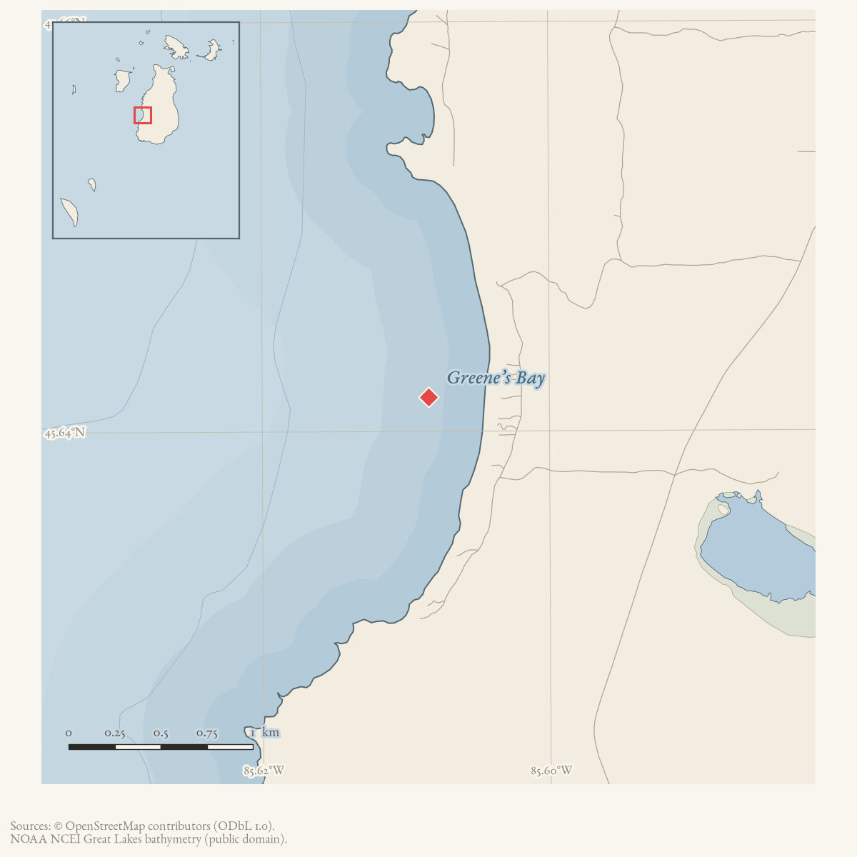
Greenes Bay is an official GNIS-named bay on the west shore of Beaver Island. GNIS records the variants “Green Bay” and “Greens Bay” and attributes the name to cousins “White Dan” and “Red Dan” Greene, who settled near the bay in the 1860s. The name should not be confused with the separate nearby Greene’s Lake. Since the 1950s the bay has been a recreational landmark and, from the 1980s on, a growing residential shoreline.
The map’s fuller settlement narrative needs qualification. Johnny Green told Helen Collar that twelve families had lived at the bay, but the surviving note lists only six before adding four households that Collar inferred; it also records disagreements over whether Dan Boyle and Bonner belonged at French Bay. The same note remembers Greenes Bay as a pond-net harbor. This is valuable oral evidence for a dispersed fishing settlement, but it is not a census of twelve simultaneous households. No contemporary record has yet been found for the map’s claim that the group moved collectively to Greenetown in 1876.
Names
GNIS’s raw variant-name table lists both “Green Bay” and “Greens Bay” as
Variant against the Official “Greenes Bay,” each sourced from a
topographic or state-DOT map rather than from a documented renaming. Both
variants are simple spelling drift — dropping the medial “e” of “Greenes” —
rather than a different name replacing an earlier one, so they are kept here
as alt_names, not former_names. This is consistent with how the name
circulates in the Beaver Beacon: the forms “Green’s Bay” and “Greens Bay”
dominate from 1958 through 2010, while “Greene’s Bay” appears occasionally
(1992, 2007, 2009) closer to the official spelling. No source found treats any
of these as a distinct, superseded toponym for a different feature.
History
The Beaver Island Game Club’s road and trail work opened “Greens Bay Bluff” to hunters and other visitors by 1958, alongside routes to Angeline’s Bluff and the Fire Tower; the same year’s Beacon lists Greens Bay among the island’s interesting hiking spots, with French Bay, Mount Pisgah, and Indian Point. A November 1971 hunting diary records travel from French Bay to Green’s Bay, deer sightings, and discussion of hunting pressure and winter browse.
Residential development on the bay’s shoreline grew through the 1980s: an August 1983 report notes “numerous homes built or in the process of being built” on the west shore at Green’s Bay and south of McCauley Point, including a “rumored” $500,000 house. In May 1988 a new home on Green’s Bay was one of the stops on a state-official tour of the island that included Attorney General Frank Kelley. By 1989 a formal “Green’s Bay subdivision” is named in Beacon coverage of pending state sand-dune legislation, which listed Greens Bay among the island’s critical dune areas alongside Donegal Bay and Iron Ore Bay; the Michigan Department of Natural Resources cited a Ron Wojan–built home on Green’s Bay as a model of construction compatible with dune preservation during the resulting zoning-ordinance debate. A separate November 1989 notice records a zoning dispute over a satellite dish placed on the Green’s Bay beach, which Bill Cashman, writing for Island Homes, argued should not be permitted.
The bay also continued as a recreational and community landmark: a Girl Scout troop backpacking around the island in August 1989 stopped at Green’s Bay for water, and a message in a bottle washed ashore there in July 1994. In December 2007 islander LaFreniere reported finding 27 dead birds, including 15 loons, along a half-mile stretch of Greene’s Bay beach. By 2009, real-estate reporting valued lake frontage on the bay’s north half at roughly $1,900 per front foot, and the September 2024 Northern Islander places a year-round resident’s home at Greenes Bay in an account of a medical emergency during a 911 service outage.
Geography
An August 2004 Beacon summary of a 32-page shoreline-tract survey, “Beaver Island Recreation: A Study of the State Lake Michigan Shoreline Tracts,” mapped eleven state Lake Michigan shoreline tracts on a “Wojan-Cashman Map.” Tract 4, South McFadden’s Point, is described as “the largest dune system on the Island,” a rare, unstable parabolic dune system with blowouts, migrating eastward and damaged by vehicle traffic; the tract summary is illustrated with a ground-level photograph captioned “Green’s Bay – intertidal region and backdunes,” placing Greenes Bay within or immediately adjacent to that tract, though the survey excerpt held here does not itself draw a boundary between the two by name. The full report, prepared with GIS overlays from the Central Michigan University Biological Station and the Charlevoix County GIS office, is held at the island’s public library and township offices but not by this archive. An October 2006 report on invasive Phragmites coordination between the Beaver Island Property Owners Association and the Michigan DNR locates small patches of the reed running “from Greene’s Bay up the west side to Donegal Bay,” among other shoreline locations, without describing treatment specific to the bay itself.
Evidence and limits
These sources establish local use of the name and setting, a recreational and residential history running from the 1950s to the present, and a formally named subdivision, without defining the bay’s private-property boundaries or implying that all of its shoreline is developed. The current real-estate listing supplies a direct road setting by placing Lake Michigan frontage at a Greene’s Bay Drive address; that does not make the road a legal boundary or establish the access pattern for the whole bay. The 2004 shoreline-tract survey is read here only in the excerpted magazine summary, not the full 32-page report, so its precise tract boundary against Greenes Bay is not independently confirmed.
Open questions
- Which historic maps, deeds, or shoreline surveys define Greenes Bay’s extent?
- Can the Greene family settlement described by GNIS be connected to identified parcels or other primary records?
- Was the December 2007 bird die-off part of the documented Lake Michigan avian botulism outbreaks of the mid-2000s, or a separate event? No source read here makes that connection explicit.
- Does Greenes Bay fall within the 2004-surveyed South McFadden’s Point tract, or is it a distinct, unsurveyed shoreline segment? The excerpted report does not say.
See also
Maps for this place
These Atlas plates provide regional context. They do not establish a precise boundary, current ownership, access right, operating status, or field condition.
- EnvironmentSoils, wetlands, hydrography, and terrain
- GeologyGeneralized geology and landforms
- HydrologyMapped water and wetland context
- AccessMapped routes, facilities, and protected areas
- Land surveyPLSS geometry and historic GLO patent-location context
Sources
- GNIS feature 627359; feature class 'Bay'.federal · gnis · gnis_names
- Feature 627359 description names “White Dan” and “Red Dan” Greene, cousins who settled near the bay in the 1860s.federal · gnis · gnis_feature_descriptions
- Records Johnny Green's statement that twelve families lived at the bay, but the written list names six before four inferred additions; Collar and another informant dispute whether Dan Boyle and Bonner belonged at French Bay. Also records pond-net fishing in the bay.web · collar_subject_cards_e-i
- Described in this archive: Beaver Island History Map, 1978 revision.Adds that the families lived there until an 1876 move to Greenetown. No contemporary removal source has been located.
- Variant names: Green Bay; Greens Bay.federal · gnis · gnis_variant_names
- Records a hunting party traveling from French Bay to Green's Bay, hearing shooting, seeing a doe, and discussing deer winter browse and hunting pressure.data1 · beaver-island-archive · beaver_beacon · 1971-11_Beaver-Beacon
- The held ten-page issue scan is paired with the OCR source and confirms the published notice or report; it does not expand the source-specific identity, event, or outcome claims.data1 · beaver-island-archive · scans · beaver_beacon · issues · 1971-11_Beaver-Beacon
- Northern Islander, September 2024, "Island Visitor Barely Avoids Disaster During 911 Failure."Places a resident's home at Greenes Bay and describes a medical emergency and communications failure there; it documents present residential use, not the bay's entire settled shoreline. No public copy of this file is known; the archive holds one and can provide it on request.
- The current listing identifies a Greene's Bay Drive address and describes Lake Michigan frontage. It confirms a present road-to-bay setting, not the bay's boundary, every road approach, or any private ownership claim in this article.
- A resident said they had five kayaks and planned to move a standing rack to a Greenes Bay property after the snow melted. This is a firsthand account of one private recreational use and seasonal access condition, not evidence of public access, a kayak facility, or the extent of settlement around the bay.forum · www.beaverislandforum.com · 17 · t017058
- Reports Game Club road and trail work opening "Greens Bay Bluff" to hunters by 1958, and separately lists "Greens Bay" among interesting island hiking spots with French Bay, Mount Pisgah, and Indian Point. The holding institution's portal restricts automated access; the archive holds a copy of this issue and can provide it on request.
- The held issue scan is paired with the OCR source and confirms the trail-work and hiking-spot notices.
- Reports numerous homes built or under construction on the west shore at Green's Bay and south of McCauley Point, including a "rumored" $500,000 house. The holding institution's portal restricts automated access; the archive holds a copy of this issue and can provide it on request.
- The held issue scan is paired with the OCR source and confirms the development report.
- Describes the May 26, 1988 state-official tour of the island, which included a visit to a newly completed home on Green's Bay. The holding institution's portal restricts automated access; the archive holds a copy of this issue and can provide it on request.
- The held issue scan is paired with the OCR source and confirms the tour account.
- Names Greens Bay, Donegal Bay, and Iron Ore Bay as critical dune areas under pending state legislation, and reports the DNR cited a Ron Wojan-built home on Green's Bay as a model of dune-compatible construction. The holding institution's portal restricts automated access; the archive holds a copy of this issue and can provide it on request.
- The held issue scan is paired with the OCR source and confirms the dune-legislation coverage.
- Names a "Green's Bay subdivision" among the critical dune areas under the pending zoning amendment. The holding institution's portal restricts automated access; the archive holds a copy of this issue and can provide it on request.
- The held issue scan is paired with the OCR source and confirms the subdivision reference.
- Reports a Girl Scout troop backpacking around the island in August 1989 stopping at Green's Bay for water. The holding institution's portal restricts automated access; the archive holds a copy of this issue and can provide it on request.
- The held issue scan is paired with the OCR source and confirms the trip report.
- Records a letter from Bill Cashman, Island Homes, to Zoning Administrator Gus Schmidt objecting to a satellite dish on the beach at Green's Bay. The holding institution's portal restricts automated access; the archive holds a copy of this issue and can provide it on request.
- The held issue scan is paired with the OCR source and confirms the zoning dispute.
- A visitor letter reports finding a message in a bottle on the beach at Green's Bay on July 2, 1994, and describes sharing a house there every summer. The holding institution's portal restricts automated access; the archive holds a copy of this issue and can provide it on request.
- The held issue scan is paired with the OCR source and confirms the letter.
- Beaver Beacon, December 2007, wildlife note.Reports LaFreniere finding 27 dead birds, including 15 loons, along a half-mile stretch of Greene's Bay beach on a recent visit. No public copy of this file is known; the archive holds one and can provide it on request.
- The held issue scan is paired with the OCR source and confirms the wildlife note.
- Beaver Beacon, May 2009, real estate listing.Advertises a house on Greene's Bay and states that lake frontage on the bay's north half had been selling for $1,900 per front foot or more over the preceding two years. No public copy of this file is known; the archive holds one and can provide it on request.
- The held issue scan is paired with the OCR source and confirms the listing.
- Beaver Beacon, August 2004, "Beaver Island Recreation: A Study of the State Lake Michigan Shoreline Tracts."A summary of a 32-page shoreline-tract survey (full report held at the library and township offices) mapping eleven state Lake Michigan shoreline tracts on a "Wojan-Cashman Map." Tract 4, South McFadden's Point -- described as "the largest dune system on the Island," a migrating parabolic dune damaged by vehicle traffic -- is illustrated with a ground-level photograph captioned "Green's Bay -- intertidal region and backdunes," placing Greenes Bay within or immediately adjacent to that tract; the excerpt held here does not itself draw a boundary between the two by name. No public copy of this file is known; the archive holds one and can provide it on request.data1 · beaver-island-archive · beaver_beacon · 2004-08_Beaver-Beacon
- Beaver Beacon, October 2006, Phragmites coordination report.Reports the Beaver Island Property Owners Association and the Michigan DNR coordinating against invasive Phragmites, and locates small patches of the reed "from Greene's Bay up the west side to Donegal Bay," among other shoreline locations. It does not describe treatment or outcome specific to Greenes Bay itself. No public copy of this file is known; the archive holds one and can provide it on request.data1 · beaver-island-archive · beaver_beacon · 2006-10_Beaver-Beacon
Added 28 July 2026 · revised 7 August 2026. Recent changes
Cite this article
Beaver Island Archive, “Greene’s Bay”, https://beaverislandarchive.org/places/greenes-bay/, accessed [date], citing U.S. Geological Survey, Geographic Names Information System, Domestic Names (Michigan), retrieved 2026-07-28. (and 31 further sources listed on the page).
Last revised 2026-08-07. Fill in [date] with the date you read it — this page is static and cannot know that.