

- Coordinates
- 45.6893° N, 85.5818° WGoogle Maps: Angeline BluffDownload KML
- Eras
- Modern era
- Concepts
- environmentconservationtoponymy
- Within
- Beaver Island
- Media
- Beaver Island History Map, 1978 revision
Summary
Angeline Bluff is a named Beaver Island area in the held local newspaper corpus. The September 1961 Beaver Beacon says six young wild turkeys were released there, and the November follow-up uses the variant “Angeline’s Bluff” while reporting that the birds had survived and grown.
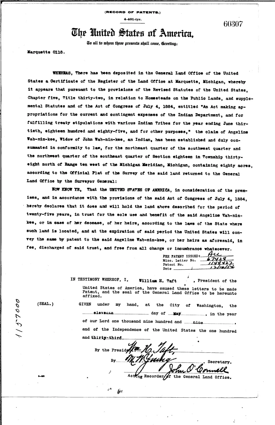
The 1978 Historical Map says the bluff was named for Angeline Wabaninkee of Peshawbe’s Town. A 1909 federal patent independently places Angeline Wab-nin-kee on an 80-acre trust holding in west-side Section 18. That makes the attribution geographically plausible, but the patent does not name the bluff or establish when the place-name began.
Evidence and limits
The sources establish the name and its association with the release area, but
do not provide a surveyed boundary or formal feature class. The current
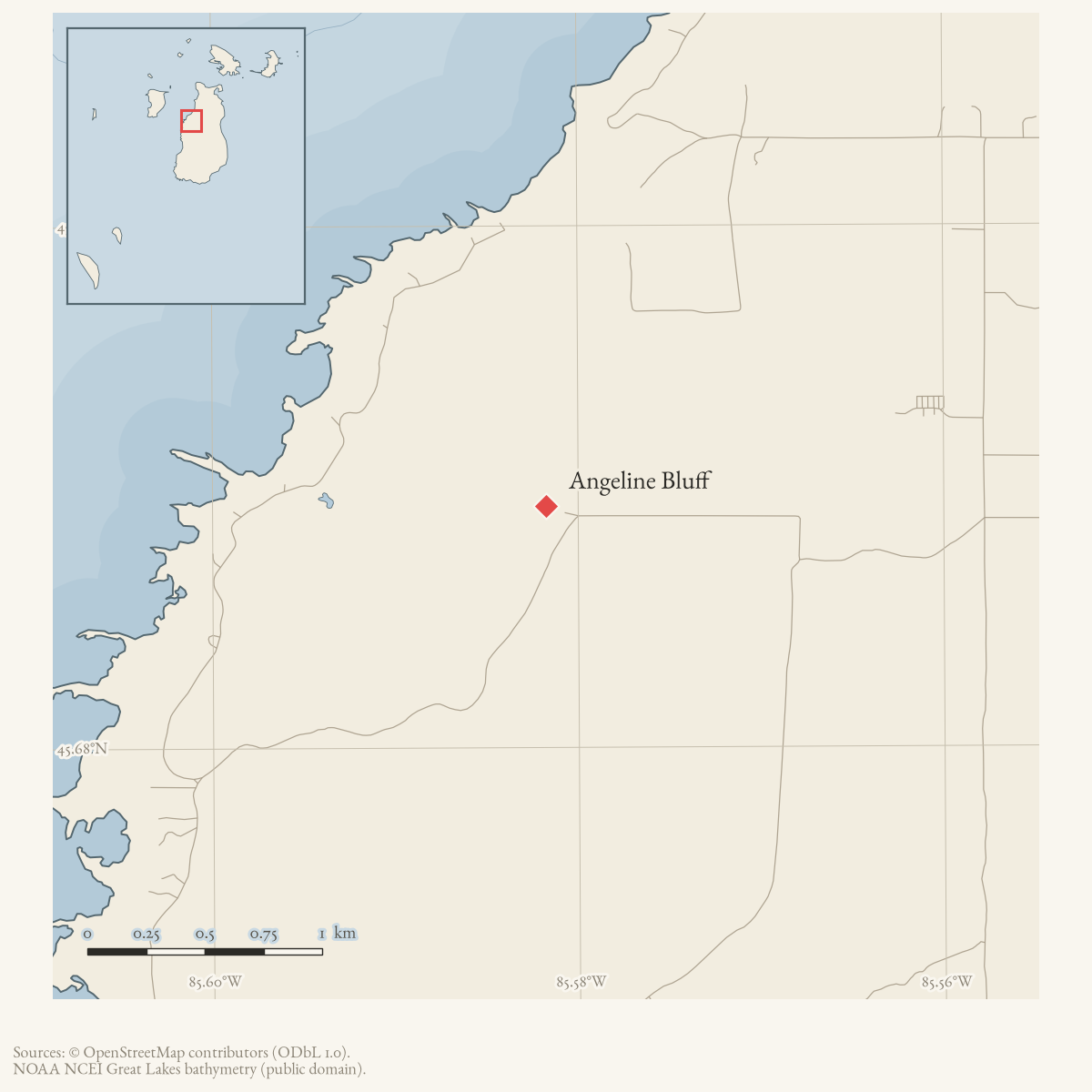
township plan and mapped public lookout provide an approximate research anchor
at the Vincent Rice Memorial Observation Deck on Mrs. Redding’s Trail; that
point is not the boundary or centroid of the bluff. The article therefore
remains a broad, source-qualified Place rather than a precisely bounded
landform subtype.
The township plan repeats that Angeline was a community leader and lumber- company worker. Those biographical details remain later local tradition until supported by tribal, census, payroll, family, or oral-history records. Reports of archaeological features below the bluff are not used here to publish a precise location or authenticate a site.
Open questions
- Where exactly was Angeline Bluff, and can a map, survey, parcel record, or GNIS entry locate it?
- Is the feature the same place as the area below Angeline’s Bluff mentioned in later local history?
- What deed, survey, newspaper, or oral-history record first calls the feature Angeline’s Bluff and attributes the name to Angeline Wab-nin-kee?
See also
Maps for this place
These Atlas plates provide regional context. They do not establish a precise boundary, current ownership, access right, operating status, or field condition.
- EnvironmentSoils, wetlands, hydrography, and terrain
- GeologyGeneralized geology and landforms
- HydrologyMapped water and wetland context
- AccessMapped routes, facilities, and protected areas
- Land surveyPLSS geometry and historic GLO patent-location context
The page
Rendered from the held scan.
Sources
- Primary federal record identifies Angeline Wab-nin-kee, widow of John, and her 80-acre Section 18 trust holding in the bluff’s broad west-side area. It does not name the bluff or prove the later leadership and employment traditions. The holder's public portal is searchable but does not link this record directly; the archive holds a copy of the file and can provide it on request.federal · glo · patents · 17113869873279326119-patent-ser-60307
- Described in this archive: Beaver Island History Map, 1978 revision.Says Angeline’s Bluff was named for Angeline Wabaninkee of Peshawbe’s Town. This is a retrospective namesake attribution, not an early naming record.
- Says the six young wild turkeys were released at the Angeline Bluff area; it gives no map, coordinates, feature class, or boundary.data1 · beaver-island-archive · beaver_beacon · 1961-09_Beaver-Beacon
- The held seven-page issue scan is paired with the OCR source and confirms the published notice or report; it does not expand the source-specific identity, event, or outcome claims.data1 · beaver-island-archive · scans · beaver_beacon · issues · 1961-09_Beaver-Beacon
- Refers to the six wild turkeys released in August at Angeline's Bluff and reports their subsequent sightings near town.data1 · beaver-island-archive · beaver_beacon · 1961-11_Beaver-Beacon
- The held five-page issue scan is paired with the OCR source and confirms the published notice or report; it does not expand the source-specific identity, event, or outcome claims.data1 · beaver-island-archive · scans · beaver_beacon · issues · 1961-11_Beaver-Beacon
- Identifies the public lookout and Vincent Rice Memorial Observation Deck on Mrs. Redding's Trail, and describes Angeline's Bluff as part of a larger escarpment and approximately 112-acre park; it does not define the bluff boundary.planning · beaver_island_master_plan · 2024-2028-beaver-island-recreation-plan-fa1f69af
- The mapped lookout is listed at 34001 Mrs. Redding's Trail and supplies the coordinate used here as an approximate public-access locator. It is a lookout point, not the boundary or centroid of Angeline Bluff.
Added 1 August 2026 · revised 6 August 2026. Recent changes
Cite this article
Beaver Island Archive, “Angeline Bluff”, https://beaverislandarchive.org/places/angeline-bluff/, accessed [date], citing U.S. General Land Office, Indian Homestead Trust Patent 60307, Angeline Wab-nin-kee, 11 May 1909. (and 7 further sources listed on the page).
Last revised 2026-08-06. Fill in [date] with the date you read it — this page is static and cannot know that.