

- Date
- 1935
- Eras
- Modern era
- Concepts
- maritimeshippinglighthousesheritage
- Within
- Beaver Island archipelago
Summary
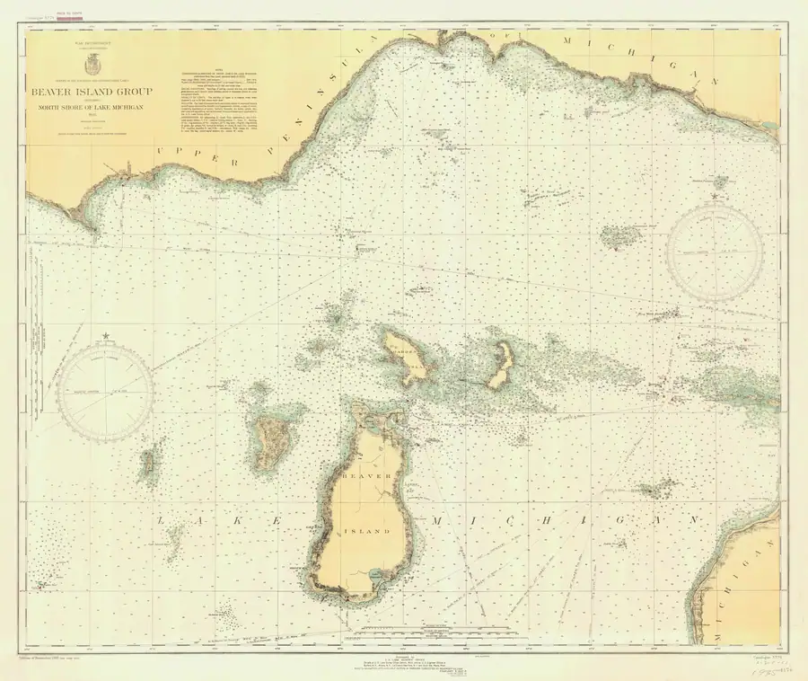
This held NOAA chart is the 1935 Beaver Island Group Including North Shore of Lake Michigan nautical chart (LS79), at catalog scale 1:80,000. It supplies a primary navigational-map snapshot in the same chart-number sequence as the held 1931 LS79 sheet.
Evidence and limits
The NOAA catalog and provenance establish the chart’s title, chart number, year, type, scale, stated coverage, public-domain status, and held image. The chart is a navigational source from 1935, not a present-day navigation aid or a complete record of ownership, settlement, traffic, light operation, or every feature shown on the sheet.
Individual soundings, symbols, notices, and aids to navigation require a direct reading of the full-resolution image and cross-checking against the chart’s own revision information before they support separate factual claims.
See also
Sources
- Held full-resolution NOAA chart image. The catalog identifies it as a 1935 nautical chart at scale 1:80,000; this record does not transcribe individual soundings, aids, corrections, or navigational instructions from the image.federal · noaa_charts · images · 1935_BEAVER-ISLAND-GROUP-INCLUDING-NORTH-SHORE-OF-LAKE-MICHIGAN-BEAVER-ISLA_79-11-1935
- Project provenance sidecar for NOAA chart LS79.Records source URL, retrieval timestamp, checksum, 27,333,113-byte file size, NOAA public-domain status, filename, chart number, and scale. No public copy of this file is known; the archive holds one and can provide it on request.federal · noaa_charts · images · 1935_BEAVER-ISLAND-GROUP-INCLUDING-NORTH-SHORE-OF-LAKE-MICHIGAN-BEAVER-ISLA_79-11-1935.provenance
- Catalog metadata gives year 1935, nautical-chart type, scale 1:80,000, chart number LS79, and stated Beaver Island Group north-shore coverage.federal · noaa_charts · noaa_charts_aoi

Added 2 August 2026 · revised 4 August 2026. Recent changes
Cite this article
Beaver Island Archive, “Beaver Island Group nautical chart, 1935”, https://beaverislandarchive.org/documents/noaa-beaver-island-group-chart-1935/, accessed [date], citing NOAA Office of Coast Survey, Historical Map & Chart Collection, “Beaver Island Group Including North Shore of Lake Michigan,” chart LS79, 1935. (and 2 further sources listed on the page).
Last revised 2026-08-04. Fill in [date] with the date you read it — this page is static and cannot know that.
BibTeX for “Beaver Island Group nautical chart, 1935”RIS for “Beaver Island Group nautical chart, 1935”