

- Along road
- White Birch Road
- Coordinates
- 45.7472° N, 85.5541° WGoogle Maps: Little Font Lake TrailDownload KML
- Eras
- Modern era
- Concepts
- trailstransportationrecreationtoponymy
- Within
- Beaver Island
- Media
- Beaver Island History Map, 1978 revision
Summary
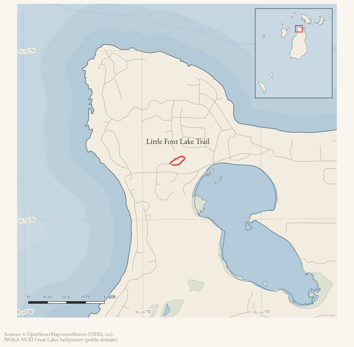
Little Font Lake Trail is a short walking trail off White Birch Road near the Old Stables Campground, leading to Little Font Lake. An August 1980 Beacon report describes it as newly completed, about half a mile, with plant-identification signs and benches; a December 2006 letter from the Port of St. James Association describes volunteers reopening it after roughly a decade of disuse. Its mapped line meets White Birch Road, linking the trail to the island road graph while keeping the route separate from the Font Lake place record.
The route
Published by contemporary report, and mapped. The August 1980 Beacon item puts the trail at “about one-half mile,” meandering off the end of White Birch Road adjacent to the Old Stables Campground down to Little Font Lake and back. OpenStreetMap carries one current named way (way/1082059868) meeting White Birch Road; the archive holds no walked GPS track here.
History
The trail was new in August 1980, when the Beacon reported it complete with signs identifying plant life and benches for “a quiet rest stop.” By December 2006 it had gone unused for at least a decade: a Port of St. James Association letter from board president Jack R. Spanhak, thanking three island-school students for a Community Service Project workday on 31 October 2006, describes clearing “new growth,” lopping branches, and cutting up dead trees along the trail, then reaching “the access point to the Lake, now little more than a beautiful bog” and clearing two benches that had become hidden. The same crew went on to clear the nearby Hidden Valley Trail the same day.
Access and ownership
No source held here establishes who owns the trail corridor or the lake frontage. The clearing work in both 1980 and 2006 was carried out under Port of St. James Association or school-community auspices, which suggests PSJA involvement in maintenance but is not a title or easement record. No source states whether the trail is open to the general public or restricted to PSJA membership, and no motorized-use designation is documented; there are no designated public ORV trails on Beaver Island in any case.
Evidence and limits
The lake name and the trail’s existence rest on two dated newspaper items thirty-six years apart, corroborated by the 1978 Historical Map’s label for Little Font Lake, and on current OpenStreetMap geometry. No separate held GNIS record or surveyed lake geometry was found, and the held sources do not establish trail ownership, ongoing maintenance after 2006, or present condition.
Open questions
- Who built the original trail in 1980, and under what authority? The Beacon report describes the finished trail, not who cut it.
- Has the trail been maintained since the 2006 clearing? No later source has been located.
- Is Little Font Lake’s status as “little more than a beautiful bog” in 2006 a permanent change or a seasonal or drought condition?
If you can answer any of these, or correct anything above, the archive wants to hear it — see Corrections.
See also
Documented associations
No source-confirmed non-road entity is linked yet. Exact-name research leads remain in scripts/audit_road_links.py; a name collision is not treated as a road association.
Research status
The local newspaper and website corpus contains exact-name mentions in 0 file(s). Those files are research leads; the relation layer is added only when the surrounding source text establishes that the record involves this road.
Maps for this place
These Atlas plates provide regional context. They do not establish a precise boundary, current ownership, access right, operating status, or field condition.
- EnvironmentSoils, wetlands, hydrography, and terrain
- GeologyGeneralized geology and landforms
- HydrologyMapped water and wetland context
- AccessMapped routes, facilities, and protected areas
- Land surveyPLSS geometry and historic GLO patent-location context
Sources
- Way 1082059868 is a current named trail line that meets White Birch Road. The volunteered map does not establish trail ownership or the lake’s historical relationship to the route.osm · trails
- Reports completion of a walking trail from White Birch Road to Little Font Lake and back, independently attesting the water-body name. The holding institution's portal restricts automated access; the archive holds a copy of this issue and can provide it on request.data1 · beaver-island-archive · beaver_beacon · 1980-08_Beaver-Beacon
- *Beaver Beacon*, December 2006, Little Font Lake trail-clearing letter.Describes clearing the trail to the lake and calls the lake little more than a bog by 2006. No public copy of this file is known; the archive holds one and can provide it on request.data1 · beaver-island-archive · beaver_beacon · 2006-12_Beaver-Beacon
- The map independently preserves the label but supplies illustrated placement rather than surveyed lake geometry.
Added 2 August 2026 · revised 16 August 2026. Recent changes
Cite this article
Beaver Island Archive, “Little Font Lake Trail”, https://beaverislandarchive.org/places/little-font-lake-trail/, accessed [date], citing OpenStreetMap contributors, Little Font Lake Trail way, retrieved 2026-08-02 (ODbL 1.0). (and 3 further sources listed on the page).
Last revised 2026-08-16. Fill in [date] with the date you read it — this page is static and cannot know that.
BibTeX for “Little Font Lake Trail”RIS for “Little Font Lake Trail”