

- Coordinates
- 45.7372° N, 85.5472° WGoogle Maps: Hidden Valley TrailDownload KML
- Eras
- Modern era
- Concepts
- trailsrecreationModern eratoponymytransportation
- Within
- Beaver Island
Summary
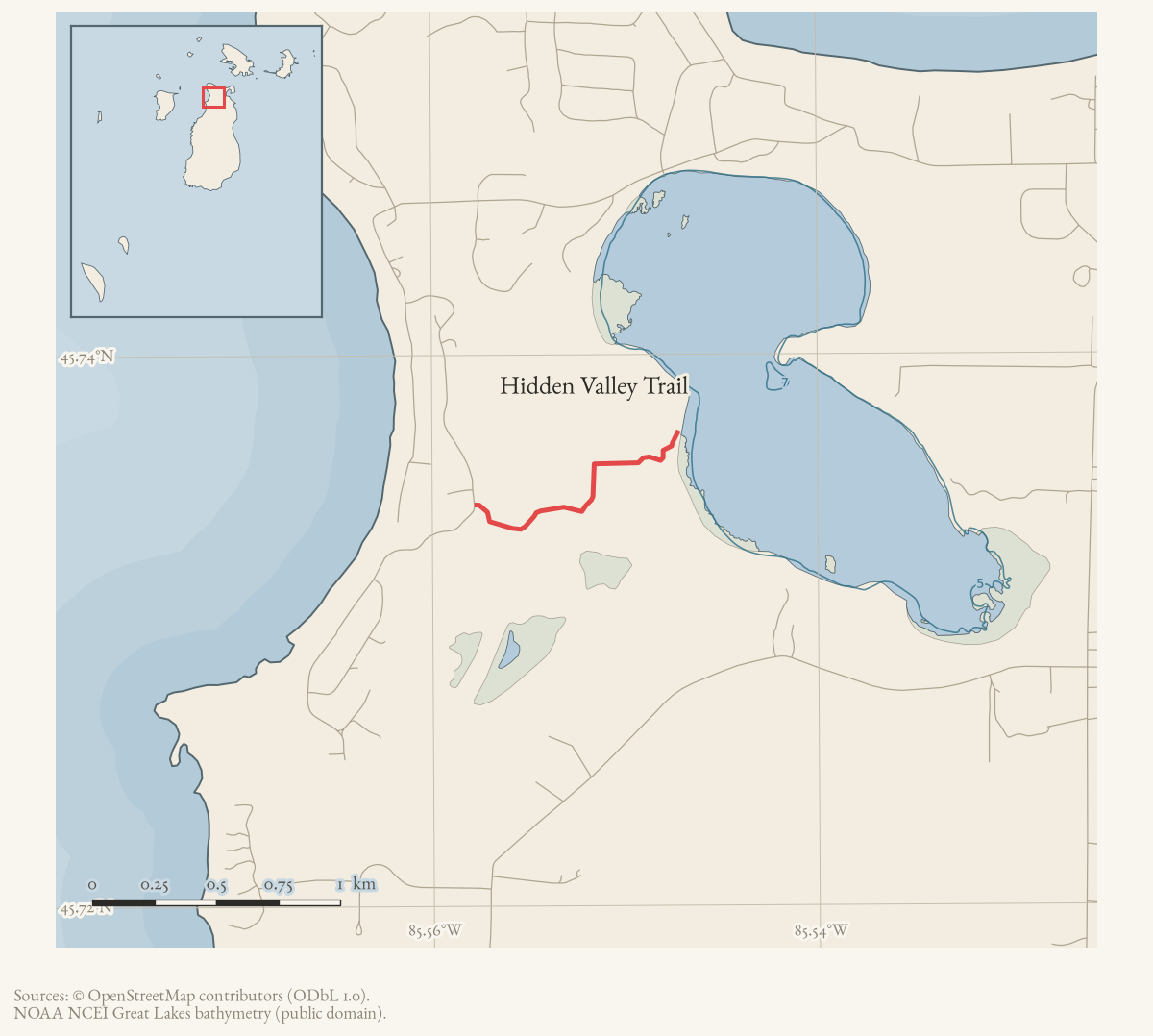
Hidden Valley Trail is a loop of about 2.87 miles through forested dunes above Font Lake at the north end of Beaver Island, maintained by the Port of St. James Association. The name records the trail growing over: the homestead at its end became known as Hidden Valley once the way in was lost.
The route
Published in the township trail guide, which describes it as “a trail through forested dunes, to an overlook of Font Lake, down along the Font Lake shore, and back on roads to the trailhead”. All three entrances are marked with Port of St. James Association signs.
From the Allen’s Lakeview Road trailhead the trail forks at 0.31 miles. The left fork climbs through high dunes to an overlook of Font Lake at 0.6 miles, then descends to the shore and runs to trailheads on Font Lake Court at 1.25 miles and White Birch Road at 1.42 miles; returning by road makes a loop of 2.87 miles. The right fork divides again, one branch running onto private property along the birch-lined shore, the other into a seasonal marsh clearing where, the guide notes, “Father Wren’s cabin was to the left around the marsh”, with a faint side trail continuing south around Sweeney’s Swamp.
What the route was
The land was homesteaded, and the trail is the way in to that homestead. A December 2006 account of a volunteer work party describes reaching “the remains of the fallen-down house at the end of the trail”, where the party “tossed a few apples from some very old apple trees”. Whether that ruin is the cabin the guide attributes to Father Wren is not established.
Access and ownership
The trail is maintained by the Port of St. James Association, a property owners’ association, and signed at its three entrances. Parts of both eastern forks run onto private property, which the guide states explicitly; walkers should not assume the whole network is open.
Access here has been contested. In September 2009 a letter circulated to the association’s board recorded that a sign had been fixed to the wooden trail marker and large rocks placed to block the trailhead, and questioned the effect on snowmobile access that had kept the trail open in winter. The archive holds no answer to who placed them or on what authority.
Trail conditions change and nothing here should be used for navigation.
Evidence and limits
The route rests on the township guide; the ruin and the volunteer work on one dated 2006 letter; the access dispute on a 2009 forum posting, which is archived for research and not cleared for publication. No walked track is held.
Open questions
- Is the “fallen-down house at the end of the trail” the same structure as the cabin the guide attributes to Father Wren, or a different building?
- Who placed the sign and the rocks at the trailhead in September 2009? The question was asked publicly at the time and never answered in the record.
- Who homesteaded Hidden Valley, and when was the trail lost and reopened?
If you can answer any of these, or correct anything above, the archive wants to hear it — see Corrections.
See also
Documented associations
No source-confirmed non-road entity is linked yet. Exact-name research leads remain in scripts/audit_road_links.py; a name collision is not treated as a road association.
Research status
The local newspaper and website corpus contains exact-name mentions in 0 file(s). Those files are research leads; the relation layer is added only when the surrounding source text establishes that the record involves this road.
Maps for this place
These Atlas plates provide regional context. They do not establish a precise boundary, current ownership, access right, operating status, or field condition.
- EnvironmentSoils, wetlands, hydrography, and terrain
- GeologyGeneralized geology and landforms
- HydrologyMapped water and wetland context
- AccessMapped routes, facilities, and protected areas
- Land surveyPLSS geometry and historic GLO patent-location context
Sources
- Turn-by-turn narrative descriptions with cumulative mileages for the island's named trails. Undated in the file; retrieved from the township document centre in August 2026. No author is named in the document or its metadata.governance · peaine · trails · all-trail-descriptions
- Beaver Beacon, 2006-12.A Port St. James Association letter of thanks describing student volunteers clearing the trail, removing a dead tree, and visiting the remains of a fallen-down house and old apple trees at the trail's end.
- Community-contributed geometry of unknown survey provenance, simplified for display. It establishes that a way of this name is currently mapped; it is not a surveyed right-of-way, a statement of public access, or proof of historical naming.osm · trails
Added 16 August 2026. Recent changes
Cite this article
Beaver Island Archive, “Hidden Valley Trail”, https://beaverislandarchive.org/places/hidden-valley-trail/, accessed [date], citing Peaine Township, 'All Trail Descriptions', trail guide, undated. (and 2 further sources listed on the page).
BibTeX for “Hidden Valley Trail”RIS for “Hidden Valley Trail”