

- Coordinates
- 45.7983° N, 85.4676° WGoogle Maps: Jensen HarborDownload KML
- Eras
- Modern era
- Concepts
- maritimefishingtourismenvironmentgeologysoilswetlandshydrologyforeststreesvegetationplantswildlifeanimalsconservationstewardshipinvasive-species
- Within
- Garden Island
Summary
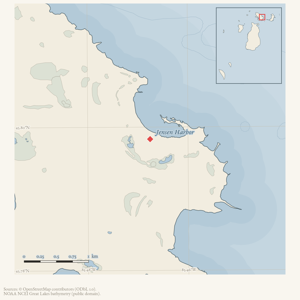
Jensen Harbor is a GNIS-named bay on Garden Island. A June 1965 Charlevoix Courier account of a Beaver Island excursion describes a boat trip to the shallow bays of Garden Island and says that a raw northeast wind made Jensen Harbor rough while the party fished for bass. The report provides direct local use of the name and a contemporary recreational/fishing context; it does not describe permanent harbor structures or define the bay’s shoreline.
Ecological profile
MNFI Report 2017-11 records a 59-acre Jensen Harbor coastal fen occurrence (EO 7888, report p. 38; rank A, G1G2/S2). The fen’s alkaline peat and marl (pH 8.0) overlie wet alkaline sands (also pH 8.0). Numerous marl pools and crayfish burrows create a fine-grained wetland mosaic; the occurrence is ecological context for the named harbor, not the harbor’s complete shoreline or legal boundary.
The MNFI occurrence is not a current legal boundary, ownership determination, or complete survey of Jensen Harbor.
Spike-rush, twig-rush, beak-rush, tufted bulrush, and sedges dominate the ground cover. Shrubby cinquefoil, Kalm’s St. John’s-wort, sweet gale, alder-leaved buckthorn, bog rosemary, and Labrador tea occur in the low shrub layer. Scattered northern white-cedar, tamarack, and trembling aspen occupy the understory. Other characteristic plants include state-special-concern butterwort, pitcher-plant, false asphodel, grass-of-Parnassus, bird’s-eye primrose, hardstem bulrush, Kalm’s lobelia, blue-joint, white beak-rush, round-leaved sundew, and small cranberry.
The survey states that the fen supports a population of Hine’s emerald dragonfly, identified as state- and federally threatened. No threats were observed during the survey. MNFI recommends allowing Great Lakes water-level fluctuations to operate naturally, retaining a surrounding natural-community buffer to protect groundwater seepage, and monitoring invasive plants. These are 2017 occurrence- level observations and recommendations, not a current dragonfly census, hydrologic record, or complete fauna inventory. The occurrence is not a complete survey of Jensen Harbor.
Open questions
- Can a chart or Garden Island map establish the harbor’s shoreline and relation to Indian Harbor and other named bays?
- What is the origin of the name “Jensen Harbor,” and which Jensen family or property records might explain it?
- Are there additional historic navigation or fishing references that distinguish Jensen Harbor from nearby Garden Island waters?
- How does the MNFI fen relate to the GNIS bay point, current shoreline change, crayfish habitat, and land-status records?
Maps for this place
These Atlas plates provide regional context. They do not establish a precise boundary, current ownership, access right, operating status, or field condition.
- EnvironmentSoils, wetlands, hydrography, and terrain
- GeologyGeneralized geology and landforms
- HydrologyMapped water and wetland context
- AccessMapped routes, facilities, and protected areas
Sources
- GNIS feature 629260; feature class 'Bay'.federal · gnis · gnis_names
- Charlevoix Courier, June 16, 1965, "Clevenger Basks in Therapy of Islands."A Beaver Island excursion account places Jensen Harbor among the shallow bays of Garden Island and describes fishing there during a visit by Congressman Raymond Clevenger and companions. No public copy of this file is known; the archive holds one and can provide it on request.
- Project-generated MNFI 2017 soil, vegetation, and wildlife crosswalk, preserving MNFI Report 2017-11, Jensen Harbor coastal fen occurrence (EO 7888), report p. 38.Described in this archive: MNFI soil, vegetation, tree, and wildlife crosswalk, 2017.The 59-acre MNFI coastal-fen occurrence is associated with the named harbor; it is not a current legal boundary, ownership determination, wetland delineation, or complete survey of Jensen Harbor. No public copy of this file is known; the archive holds one and can provide it on request.research · island_farming · crosswalks · mnfi_soil_vegetation_wildlife_crosswalk
- Visual page evidence held with provenance sidecar; the image anchors the occurrence description and does not establish modern geometry or current condition.research · island_farming · evidence · mnfi-report-2017-11-page-0038-jensen-harbor-coastal-fen
Added 28 July 2026 · revised 3 August 2026. Recent changes
Cite this article
Beaver Island Archive, “Jensen Harbor”, https://beaverislandarchive.org/places/jensen-harbor/, accessed [date], citing U.S. Geological Survey, Geographic Names Information System, Domestic Names (Michigan), retrieved 2026-07-28. (and 3 further sources listed on the page).
Last revised 2026-08-03. Fill in [date] with the date you read it — this page is static and cannot know that.