

- Coordinates
- 45.8047° N, 85.4945° WGoogle Maps: Garden Island Boreal ForestDownload KML
- Eras
- Modern era
- Concepts
- environmentgeologysoilswetlandshydrologyforeststreesvegetationplantswildlifeanimalsconservationstewardshipinvasive-species
- Within
- Garden Island
Summary
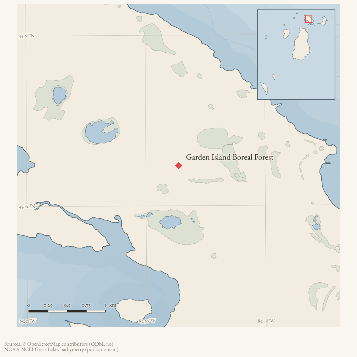
Garden Island Boreal Forest is a source-defined 906-acre MNFI natural-community occurrence (EO 7487, rank A, GU, S3; Report 2017-11, p. 22). It consists of three uneven-aged shoreline polygons in the southern, northwestern, and northern portions of Garden Island. The record is retained as a named place because it is a stable ecological site identifier, not because it is a GNIS feature or surveyed preserve.
The coordinate is the containing Garden Island locator, not the boundary or centroid of the three occurrence polygons. The occurrence is not a current legal boundary, ownership determination, or complete survey of Garden Island.
Ecological profile
The forest occupies rolling terrain formed from former cobble shore and contains inclusions of rich conifer swamp and northern hardwoods. MNFI describes shallow 1–4-centimeter alkaline loams and loamy organics, approximately pH 7.5–8.0, over limestone cobble. This is an occurrence observation rather than a soil map for all of Garden Island.
Northern white-cedar dominates the canopy, with balsam fir, paper birch, white spruce, trembling aspen, and white pine. Cored trees included northern white-cedar estimated at more than 145 and 165 years old and white pine estimated at more than 135 years old. Canopy trees generally range from 30 to 50 cm DBH, with closure from about 50 to 90 percent; windthrow creates more open patches and a high coarse-woody-debris load dominated by early-successional fir, birch, and aspen.
The understory includes balsam fir, round-leaved dogwood, mountain maple, red elderberry, beaked hazelnut, trembling aspen, and sugar maple. Low shrubs include Canadian fly honeysuckle, bush honeysuckle, yew, wild raspberry, white ash, and sugar maple. Ground cover includes starflower, Canada mayflower, twinflower, wild sarsaparilla, woodferns, sedge, oak fern, large-leaved aster, gay-wings, false spikenard, and herb Robert. MNFI also noted bittersweet nightshade and helleborine as scattered non-native plants.
The report observed no threats and recommends allowing natural processes, retaining an intact surrounding buffer, and monitoring invasive species and deer herbivory. These recommendations and the recorded tree ages describe the 2017 occurrence; they do not establish current condition, treatment history, or present wildlife occupancy.
Open questions
- Can the three MNFI polygons be located against current Garden Island shoreline, land-status, and canopy data without treating them as legal parcels?
- How do this boreal occurrence’s cobble-shore soils and windthrow structure connect to the adjacent Red Oak Garden and Taganing dune-and-swale records?
Maps for this place
These Atlas plates provide regional context. They do not establish a precise boundary, current ownership, access right, operating status, or field condition.
- EnvironmentSoils, wetlands, hydrography, and terrain
- GeologyGeneralized geology and landforms
- HydrologyMapped water and wetland context
- AccessMapped routes, facilities, and protected areas
Sources
- Project-generated MNFI 2017 soil, vegetation, and wildlife crosswalk, preserving MNFI Report 2017-11, Garden Island Boreal Forest occurrence (EO 7487), report p. 22.Described in this archive: MNFI soil, vegetation, tree, and wildlife crosswalk, 2017.The 906-acre record is a named MNFI natural-community occurrence in three shoreline polygons; it is not a current legal boundary, ownership determination, or complete survey of Garden Island. No public copy of this file is known; the archive holds one and can provide it on request.research · island_farming · crosswalks · mnfi_soil_vegetation_wildlife_crosswalk
- Visual page evidence held with provenance sidecar; the image anchors the occurrence description and does not establish modern geometry or current condition.research · island_farming · evidence · mnfi-report-2017-11-page-0022-garden-island-boreal-forest
- GNIS feature 626637 supplies the containing-island point used as an approximate locator. It is not the boundary or centroid of the three MNFI shoreline polygons.federal · gnis · gnis_names
- PIN 013-335-012-00 is a 39.7-acre Garden Island parcel owned by the Michigan Department of Natural Resources, with a representative point near the island-level occurrence anchor. It confirms current DNR land context for part of Garden Island, but does not locate or bound the MNFI forest occurrence.county · charlevoix · parcels_arcgis · 2026-08-01 · island_parcel_attributes
Added 3 August 2026 · revised 6 August 2026. Recent changes
Cite this article
Beaver Island Archive, “Garden Island Boreal Forest”, https://beaverislandarchive.org/places/garden-island-boreal-forest/, accessed [date], citing Project-generated MNFI 2017 soil, vegetation, and wildlife crosswalk, preserving MNFI Report 2017-11, Garden Island Boreal Forest occurrence (EO 7487), report p. 22. (and 3 further sources listed on the page).
Last revised 2026-08-06. Fill in [date] with the date you read it — this page is static and cannot know that.
BibTeX for “Garden Island Boreal Forest”RIS for “Garden Island Boreal Forest”