

- Intersects
- South End Road · West Side Drive
- Coordinates
- 45.5819° N, 85.5872° WGoogle Maps: Betsy Smith TrailDownload KML
- Eras
- Modern era
- Concepts
- trailstransportationtoponymy
- Within
- Beaver Island archipelago
- Media
- Beaver Island History Map, 1978 revision
Summary
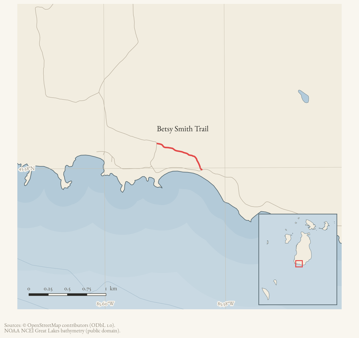
Betsy Smith Trail is a named road on Beaver Island’s current OpenStreetMap
map. One held way carries that name, and its geometry is the whole route:
about 738 m. It meets two other named roads, listed under intersects_road.
Access and ownership
Betsy Smith Trail functions as a residential access road serving private lakefront lots near Iron Ore Bay, not as a maintained hiking trail. It runs past the Vann house and other platted lots on the Iron Ore Bay Company survey, and no source in the archive states that it is publicly owned or maintained.
The clearest documented public use is as an emergency detour rather than a destination in its own right. A September 2010 Beaver Beacon item reports that Gillespie Enterprises was awarded the contract to rebuild the Iron Ore Creek culvert, that South End Road would close for a few weeks, and that “travelers will be directed to the Betsy Smith Trail to get around this obstacle.” That establishes the road was passable and used by the general public for through traffic during that closure — it does not establish who owns the road, who maintains it day to day, or whether that 2010 permission implies any standing public right of way today.
Names
The trail’s name is popularly linked, in island tradition, to the schooner Betsy Smith, said to have wrecked nearby carrying iron ore and to have given Iron Ore Bay its name. The full account of that tradition — and the sources that instead credit a different wrecked vessel, and that record the ship’s own name as contested between “Betsy” and “Bessie” Smith — is held at Iron Ore Bay, where it is flagged unresolved. This article does not repeat that claim as established; the road’s name and the bay’s namesake tradition are related but separately sourced questions.
Evidence and limits
The name and the alignment are what mappers last entered, and OpenStreetMap is
volunteered work rather than a survey: it settles neither the right-of-way nor
who maintains the road. Where the name came from is a separate question. Plats,
road-commission minutes, and island memory answer that one. Put an older
spelling from any of them into alt_names or former_names, with the source
that attests it.
Open questions
- No source held here dates when the road was named for the schooner (or for the bay’s namesake tradition) — is there a plat, road-commission record, or dated newspaper item that fixes when “Betsy Smith Trail” first appears as a road name, independent of the shipwreck tradition itself?
- Who owns and maintains Betsy Smith Trail today — is it a private association road on the Iron Ore Bay Company survey, an unrecorded public easement, or a dedicated right-of-way? No source in the archive says.
- The 2010 detour routed public through-traffic onto the trail during the South End Road closure — was permission for that detour sought from the road’s owners, or does the record show only that it happened?
If you can answer any of these, or correct anything above, the archive wants to hear it — see Corrections.
Documented associations
These source-backed records provide context for the mapped route:
- Vann house on Betsy Smith Trail — The Vann house is a source-qualified residential structure on Betsy Smith Trail near Iron Ore Bay. A 2014 Beaver Beacon property profile describes Bill Vann’s 2,400-square-foot, three-bedroom house on a 5.37-acre lot with 169.5 feet of beach frontage. It highlights a lighthouse-like tower, bridges, decks, and the wooded hollow and pond near the trail. A…
Research status
The local newspaper and website corpus contains exact-name mentions in 2 file(s). Those files are research leads; the relation layer is added only when the surrounding source text establishes that the record involves this road.
Maps for this place
These Atlas plates provide regional context. They do not establish a precise boundary, current ownership, access right, operating status, or field condition.
- EnvironmentSoils, wetlands, hydrography, and terrain
- GeologyGeneralized geology and landforms
- HydrologyMapped water and wetland context
- AccessMapped routes, facilities, and protected areas
- Land surveyPLSS geometry and historic GLO patent-location context
Sources
- Current mapped road name 'Betsy Smith Trail'; grouped OSM way ids: 265425063. This is a volunteered map record, not a surveyed right-of-way or proof of historical naming.osm · roads
- Beaver Beacon, September 2010.Reports that Gillespie Enterprises was awarded the contract to rebuild the culvert at Iron Ore Creek, that South End Road would be closed for a few weeks, and that 'travelers will be directed to the Betsy Smith Trail to get around this obstacle' -- documented use of the trail as a public detour, not a statement of ownership or a permanent right of way.
Added 2 August 2026. Recent changes
Cite this article
Beaver Island Archive, “Betsy Smith Trail”, https://beaverislandarchive.org/places/betsy-smith-trail/, accessed [date], citing OpenStreetMap contributors, roads via Overpass API, retrieved 2026-08-01 (ODbL 1.0). (and 1 further source listed on the page).
Last revised 2026-08-02. Fill in [date] with the date you read it — this page is static and cannot know that.