

- Coordinates
- 45.7919° N, 85.4640° WGoogle Maps: Taganing MarshDownload KML
- Eras
- Modern era
- Concepts
- environmentgeologysoilswetlandshydrologyforeststreesvegetationplantsconservationstewardshipinvasive-species
- Within
- Garden Island
Summary
Taganing Marsh is a source-defined MNFI Great Lakes marsh occurrence on Garden Island. MNFI Report 2017-11 records 225 acres (EO 20450, report p. 63; rank A, G2/S3). It is retained as a separate place record because the name identifies a large ecological occurrence, while its approximate anchor keeps it distinct from the Garden Island boundary, a parcel, or a legal wetland delineation.
Map status
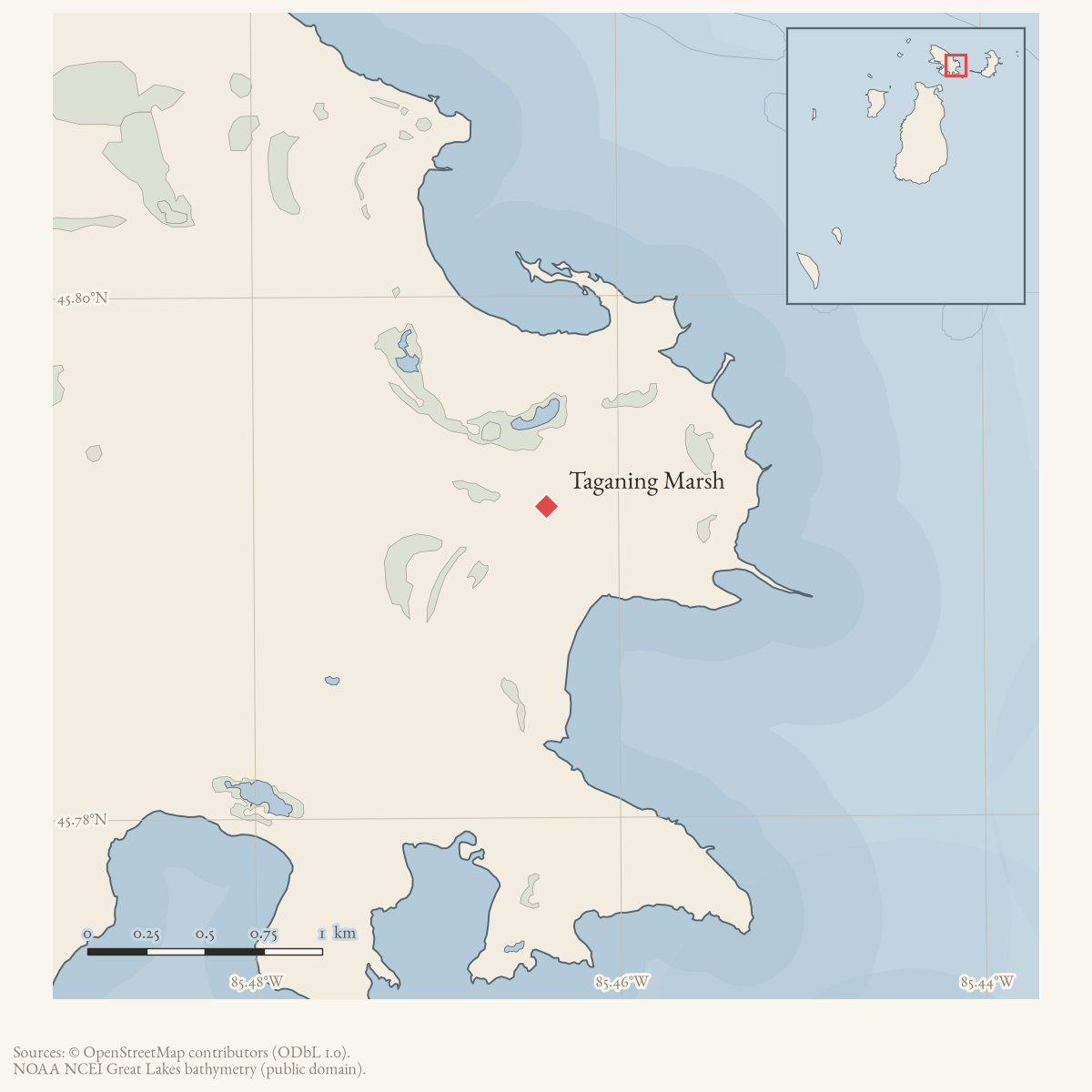
The coordinate is an approximate representative anchor calculated from Jensen Harbor and Sturgeon Bay. It is useful for opening the occurrence in a map, but does not claim that the marsh occupies the intervening water point or that it has a single compact polygon there.
Ecological profile
The marsh contains emergent zones and sand-and-gravel flats. Beak-rush is locally dominant on the flats. The marsh grades locally into coastal fen and limestone cobble shore, and the margin shifts with Great Lakes water-level fluctuations. Further inland, the shoreline is backed by rich conifer swamp and boreal forest. These transitions connect the marsh to the broader Taganing dune, swale, forest, and shoreline mosaic rather than making it an isolated wetland type.
Emergent graminoids include Baltic rush, threesquare, twig-rush, blue-joint, spike-rush, beak-rush, native reed, and three-way sedge. Other recorded plants include Indian paintbrush, Ohio goldenrod, fringed gentian, false asphodel, grass-of-Parnassus, horned bladderwort, and Kalm’s lobelia. Sand and cobble spits and transitional margins support northern white-cedar, balsam poplar, tamarack, paper birch, willows, red-osier dogwood, and shrubby cinquefoil.
MNFI observed no threats during the survey and recommended allowing natural processes to continue, retaining an intact shoreline buffer, and monitoring for invasive species. These recommendations and plant associations are bounded by the 2017 occurrence record; they are not a current water-level series, complete flora inventory, or complete wildlife survey. The occurrence is not a current legal boundary or ownership determination and is not a complete survey of Garden Island’s marsh systems.
Open questions
- How does the MNFI occurrence relate to current shoreline, wetland, and land-status data around the Taganing dune-and-swale complex?
- What later surveys document water-level change, invasive species, or plant zonation across the marsh and its sand-and-cobble flats?
Maps for this place
These Atlas plates provide regional context. They do not establish a precise boundary, current ownership, access right, operating status, or field condition.
- EnvironmentSoils, wetlands, hydrography, and terrain
- GeologyGeneralized geology and landforms
- HydrologyMapped water and wetland context
- AccessMapped routes, facilities, and protected areas
Sources
- Project-generated MNFI 2017 soil, vegetation, and wildlife crosswalk, preserving MNFI Report 2017-11, Taganing Marsh Great Lakes marsh occurrence (EO 20450), report p. 63.Described in this archive: MNFI soil, vegetation, tree, and wildlife crosswalk, 2017.The 225-acre record is a named MNFI natural-community occurrence on Garden Island, not a current legal boundary, ownership determination, or complete survey of the island shoreline. No public copy of this file is known; the archive holds one and can provide it on request.research · island_farming · crosswalks · mnfi_soil_vegetation_wildlife_crosswalk
- Visual page evidence held with provenance sidecar; the image anchors the occurrence description and does not establish modern geometry or current condition.research · island_farming · evidence · mnfi-report-2017-11-page-0063-taganing-marsh
- Project-generated representative occurrence anchor, retrieved 2026-08-06.The point is the arithmetic mean of the held representative coordinates for Jensen Harbor and Sturgeon Bay, the two Garden Island shoreline margins named by MNFI. It is a map anchor for the occurrence, not a surveyed marsh point, polygon centroid, or boundary. No public copy of this file is known; the archive holds one and can provide it on request.kb · articles · places · taganing-marsh
Added 3 August 2026 · revised 6 August 2026. Recent changes
Cite this article
Beaver Island Archive, “Taganing Marsh”, https://beaverislandarchive.org/places/taganing-marsh/, accessed [date], citing Project-generated MNFI 2017 soil, vegetation, and wildlife crosswalk, preserving MNFI Report 2017-11, Taganing Marsh Great Lakes marsh occurrence (EO 20450), report p. 63. (and 2 further sources listed on the page).
Last revised 2026-08-06. Fill in [date] with the date you read it — this page is static and cannot know that.