

- Coordinates
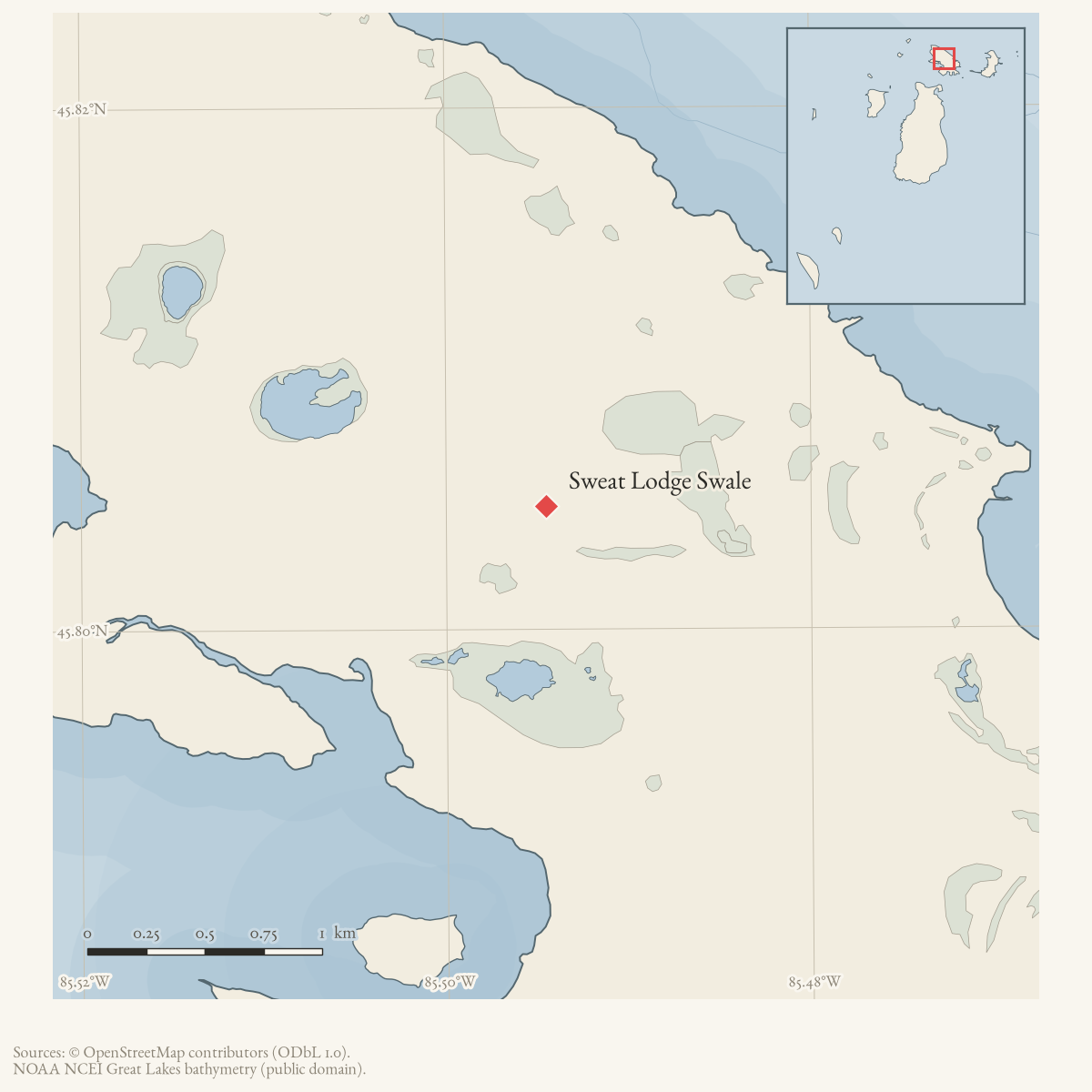
- 45.8047° N, 85.4945° WGoogle Maps: Sweat Lodge SwaleDownload KML
- Eras
- Modern era
- Concepts
- environmentgeologysoilswetlandshydrologyforeststreesvegetationplantsconservationstewardshipinvasive-species
- Within
- Garden Island
Summary
Sweat Lodge Swale is a source-defined 6.7-acre coastal fen on Garden Island (MNFI EO 9513, rank B, G1G2/S2; Report 2017-11, p. 44). The record names a natural-community occurrence rather than a GNIS feature or surveyed legal boundary.
Ecological profile
MNFI describes the fen as backed by boreal forest and bordered lakeward by limestone cobble. Shallow alkaline organic soils, about pH 7.5–8.0, overlie cobble. Sphagnum hummocks and a marl pool occur in the eastern part of the swale. The plant community includes tufted bulrush, threesquare, twig-rush, Baltic rush, Kalm’s lobelia, native reed, horned bladderwort, and silverweed, with shrubby cinquefoil, Kalm’s St. John’s wort, and northern white-cedar in the shrub layer.
The report observed no threats and recommends allowing natural Great Lakes water-level fluctuations, retaining buffers and groundwater inputs, and monitoring invasive plants. The coordinate is the containing Garden Island locator, not the two-polygon site geometry. This is a historical ecological observation, not a current legal boundary, ownership determination, or complete survey of the swale or Garden Island; its modern geometry and condition remain unresolved.
Open questions
- Can the source-defined occurrence be located against current Garden Island shoreline and wetland data?
- What current land status, hydrology, and invasive-species condition apply to the swale?
Maps for this place
These Atlas plates provide regional context. They do not establish a precise boundary, current ownership, access right, operating status, or field condition.
- EnvironmentSoils, wetlands, hydrography, and terrain
- GeologyGeneralized geology and landforms
- HydrologyMapped water and wetland context
- AccessMapped routes, facilities, and protected areas
Sources
- Project-generated MNFI 2017 soil, vegetation, and wildlife crosswalk, preserving MNFI Report 2017-11, Sweat Lodge Swale coastal fen occurrence (EO 9513), report p. 44.Described in this archive: MNFI soil, vegetation, tree, and wildlife crosswalk, 2017.The 6.7-acre record is a named MNFI natural-community occurrence on Garden Island; it is not a current legal boundary, ownership determination, or complete survey of the swale or island. No public copy of this file is known; the archive holds one and can provide it on request.research · island_farming · crosswalks · mnfi_soil_vegetation_wildlife_crosswalk
- Visual page evidence held with provenance sidecar; image anchors occurrence and does not establish modern geometry or current condition.research · island_farming · evidence · mnfi-report-2017-11-page-0044-sweat-lodge-swale-coastal-fen
- GNIS feature 626637 supplies the containing-island point used as an approximate locator. The MNFI site consists of two distinct polygons along the northern shore, so this point is not their boundary or centroid.federal · gnis · gnis_names
- PIN 013-335-012-00 is a 39.7-acre Garden Island parcel owned by the Michigan Department of Natural Resources, with a representative point near the island-level occurrence anchor. It confirms current DNR land context for part of Garden Island, but does not locate or bound the MNFI coastal-fen occurrence.county · charlevoix · parcels_arcgis · 2026-08-01 · island_parcel_attributes
Added 3 August 2026 · revised 6 August 2026. Recent changes
Cite this article
Beaver Island Archive, “Sweat Lodge Swale”, https://beaverislandarchive.org/places/sweat-lodge-swale/, accessed [date], citing Project-generated MNFI 2017 soil, vegetation, and wildlife crosswalk, preserving MNFI Report 2017-11, Sweat Lodge Swale coastal fen occurrence (EO 9513), report p. 44. (and 3 further sources listed on the page).
Last revised 2026-08-06. Fill in [date] with the date you read it — this page is static and cannot know that.