

- Coordinates
- 45.5941° N, 85.5950° WGoogle Maps: Southwest Old GrowthDownload KML
- Eras
- Modern era
- Concepts
- environmentgeologysoilsforeststreesvegetationplantswetlandswildlifeanimalsconservationstewardshipinvasive-species
- Within
- Beaver Island
Summary
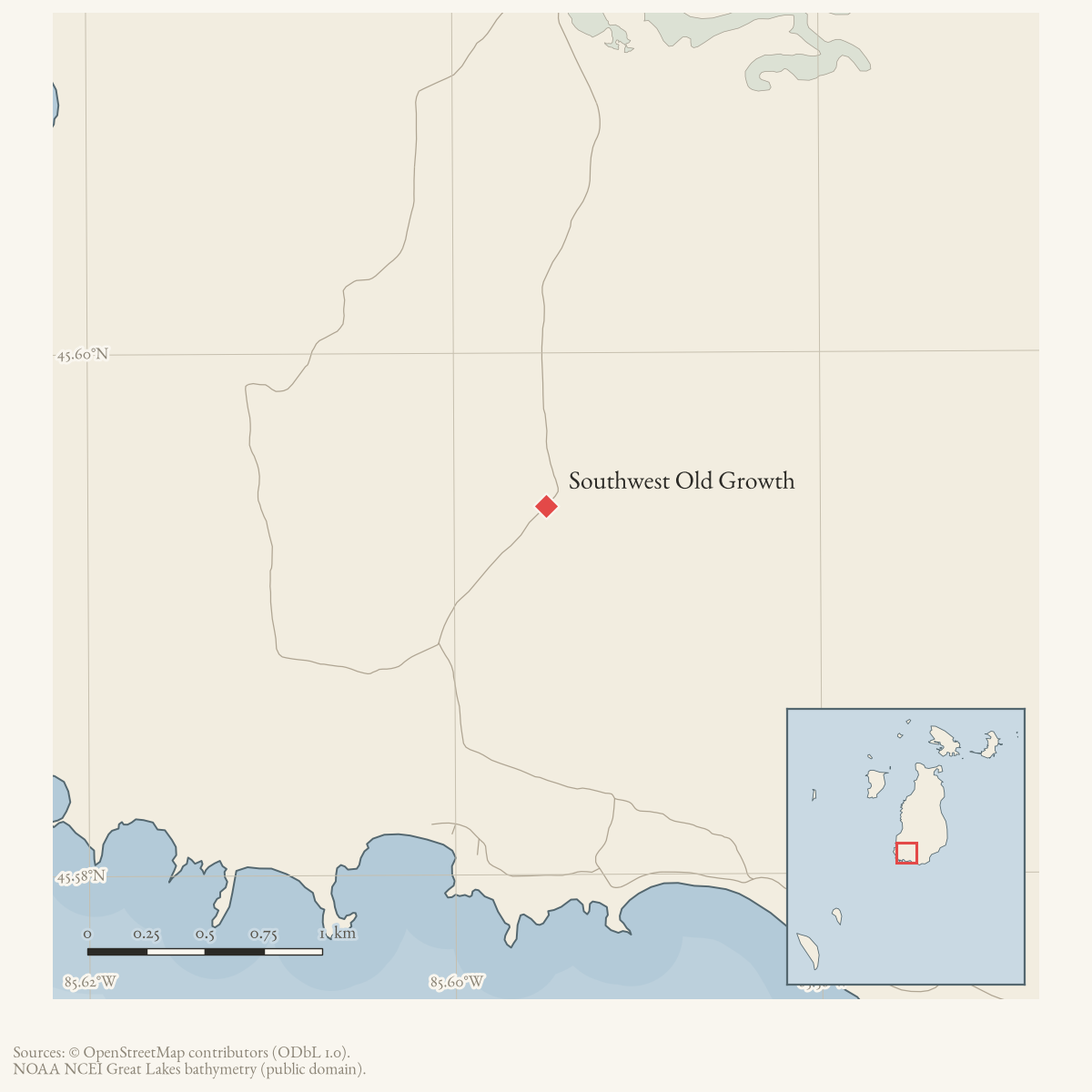
Southwest Old Growth is a source-defined MNFI natural-community site on the southwestern end of Beaver Island. MNFI Report 2017-11 records a 91-acre mesic northern forest occurrence (EO 10493, report pp. 95–96) that is beginning to accrue old-growth attributes. The occurrence includes land above and below a steep nearshore terrace and is crossed by West Side Drive. Its name and ecological evidence are established in the report, but its geometry is not treated here as a legal parcel, road corridor, or current protected-area boundary. The displayed point is only a West Side Drive orientation point.
The MNFI occurrence is not a current legal boundary, ownership determination, or complete survey of the southwestern end of Beaver Island.
Ecological profile
The upper terrace has rolling ground-moraine terrain and is dominated by deciduous trees; below the terrace, hemlock dominates rolling to moderate terrain. The site has well-developed pit-and-mound topography, moderate coarse woody debris, numerous canopy gaps, and many trees larger than 70 cm DBH. MNFI cored an 82 cm hemlock estimated at 250–300 years old. At the terrace base, groundwater discharge creates an ecotone where old-growth mesic northern forest intergrades with old-growth hardwood-conifer swamp.
In hemlock-dominated areas, a 5 cm acidic mor humus layer (pH 4.5) overlies leached sands (pH 4.5–5.0) and loamy sands (pH 5.0–5.5). The canopy includes large-diameter, 250-plus-year sugar maple, hemlock, American beech, and yellow birch, with local northern white-cedar. Hemlock dominates below the terrace; deciduous species dominate above it. The uneven-aged subcanopy includes sugar maple, beech, hemlock, balsam fir, and yellow birch. Starflower, Canada mayflower, twinflower, oak fern, naked miterwort, ground-pine, running ground-pine, and spinulose woodfern are among the recorded ground-layer plants.
Beech bark disease is producing canopy mortality, gaps, blowdown, and snags. MNFI documented invasive multiflora rose locally in the understory and notes that blowdowns may be vulnerable to further invasive incursions. Deer herbivory is likely limiting hemlock regeneration. The private portion could be logged. Recommendations include allowing fire and windthrow to operate without salvage logging, buffering the forest with unmanaged land, retaining late-successional features where surrounding forest is managed, monitoring invasive species and deer browse, and placing deer exclosures near coarse woody debris and nurse logs that support hemlock, white-pine, and yellow-birch regeneration. These are source-bounded 2017 recommendations, not evidence of current ownership, protection, or completed management.
Open questions
- Where are the MNFI polygons relative to West Side Drive, private parcels, and the nearshore terrace?
- What later forest-health or land-management records document beech mortality, multiflora rose, deer browse, or regeneration at this site?
Maps for this place
These Atlas plates provide regional context. They do not establish a precise boundary, current ownership, access right, operating status, or field condition.
- EnvironmentSoils, wetlands, hydrography, and terrain
- GeologyGeneralized geology and landforms
- HydrologyMapped water and wetland context
- AccessMapped routes, facilities, and protected areas
- Land surveyPLSS geometry and historic GLO patent-location context
Sources
- Project-generated MNFI 2017 soil, vegetation, and wildlife crosswalk, preserving MNFI Report 2017-11, Southwest Old Growth mesic northern forest occurrence (EO 10493), report pp. 95–96.Described in this archive: MNFI soil, vegetation, tree, and wildlife crosswalk, 2017.The 91-acre record is a named MNFI natural-community occurrence on Beaver Island, not a GNIS feature, current legal boundary, ownership determination, or complete survey of the southwestern end. No public copy of this file is known; the archive holds one and can provide it on request.research · island_farming · crosswalks · mnfi_soil_vegetation_wildlife_crosswalk
- Visual page evidence held with provenance sidecar; the image anchors the occurrence description and does not establish modern geometry or current condition.research · island_farming · evidence · mnfi-report-2017-11-page-0095-southwest-old-growth
- The point is a representative point on West Side Drive, which the MNFI report says passes through part of the occurrence; it is an orientation point, not the occurrence centroid or boundary.osm · roads
Added 3 August 2026. Recent changes
Cite this article
Beaver Island Archive, “Southwest Old Growth”, https://beaverislandarchive.org/places/southwest-old-growth/, accessed [date], citing Project-generated MNFI 2017 soil, vegetation, and wildlife crosswalk, preserving MNFI Report 2017-11, Southwest Old Growth mesic northern forest occurrence (EO 10493), report pp. 95–96. (and 2 further sources listed on the page).
Last revised 2026-08-03. Fill in [date] with the date you read it — this page is static and cannot know that.
BibTeX for “Southwest Old Growth”RIS for “Southwest Old Growth”