

- Coordinates
- 45.6559° N, 85.4953° WGoogle Maps: 7 Bridges TrailDownload KML
- Eras
- Modern era
- Concepts
- trailstransportationrecreationModern eratoponymy
- Within
- Beaver Island
Summary
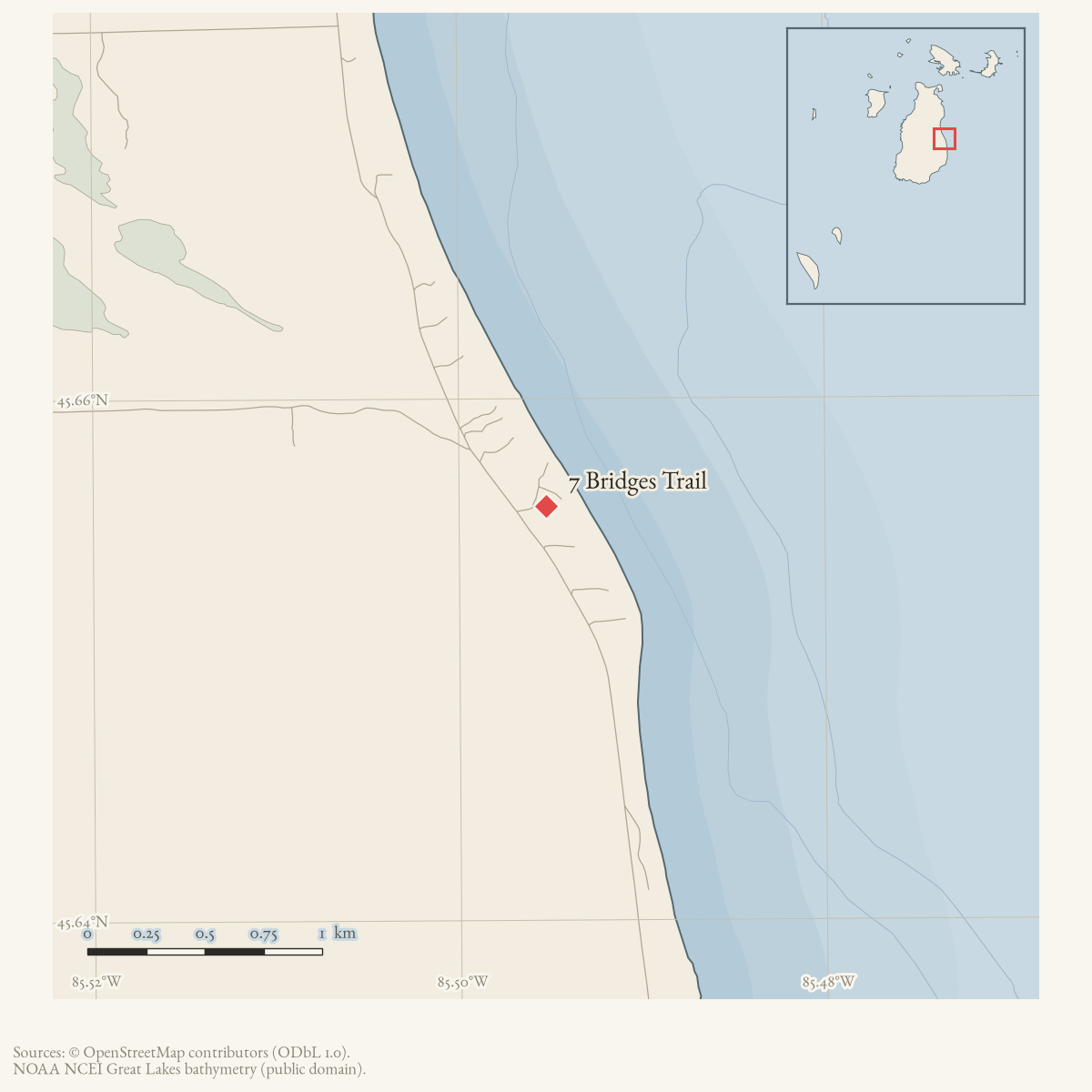
7 Bridges Trail (Seven Bridges Trail) is a well-attested named trail. A 2019 community exchange also helps distinguish the public 7 Bridges route near the fire station and campground from a separate private trail near Protar’s Tomb. The held sources describe the public trail but do not supply a current GIS line, and the present OSM trail snapshot has no feature with this name.
Official map: Seven Bridges / Hannigan’s Trail (BITA, July 2019). The sheet is an association visual guide and does not establish present access or geometry.
Map status
The full line remains unresolved. The coordinate is only an approximate trailhead anchor across from the documented Bill Wagner Campground endpoint; the forum directions should not be used as a substitute for a route survey or legal-access record. Pending update: obtain the township/DNR/BIATA route map or a field GPS track and add it as a provenance-bearing line.
The route runs 2.3 miles between the Bill Wagner Campground trailhead on East Side Drive and a parking area at King’s Highway and Hannigan’s Road, with three signed loop options connecting the campground end to Hannigan’s Road in under a mile. Both the township’s narrative guide and BITA’s own trail sheet call it wet: the King’s Highway end floods from beaver activity into early June, and the BITA sheet’s “more than seven bridges” line records that the crossings have outgrown the name.
Access and ownership
The trail crosses a mix of state land and private ground and is published and walked but not currently mapped in OpenStreetMap. BIATA carries its standing disclaimer on the printed sheet:
“BIATA Trail Maps are not official DNR maps. They were prepared as an imperfect visual guide for the user and should not be relied upon for complete accuracy. Trails can become overgrown and unrecognizable in many areas.”
A 2019 forum exchange is the clearest access statement the archive holds: one reply identifies the public 7 Bridges route as the one beginning near East Side Drive opposite the fire station and Wagner Campground, while another warns that a separate trail near Protar’s Tomb is private and not open to the public — the two are easily confused because both run through the same part of the island. No source in the archive states who owns the ground the trail itself crosses, or on what legal basis the public may walk it; volunteer clearing by Beaver Island Archipelago Trails Association is documented, not a right of way.
The 2023-2028 Peaine Township Parks & Recreation Plan draft still lists “finish the bridges on the Seven Bridges Trail” as a goal, meaning the crossings that give the trail its name are, by the township’s own account, incomplete.
As walked in 2019. a walked account contributed in 2019 parks in the South Fire Station lot just south of Hannigan Road and starts from the trailhead just north of the station on East Side Drive; the trailhead also carries Beaver Island Birding Trail marker #15. A public toilet is recorded across the road at Bill Wagner Campground. The account warns that the trail dead-ends into another trail partway along, where the route continues right and then left into a grassy area, and that the Hannigan’s Road end can be hard going in mud at some times of year.
Evidence and limits
Published: the 2015 trails map, the 2016 DNR trails report, the
township’s narrative guide, and BITA’s July 2019 sheet all name and describe
the route. Walked: documented only by volunteer work-party testimony
(2017) and forum directions (2019), not a field GPS track. Mapped: no
current OpenStreetMap way carries this name, so geometry_status is
approximate and the plotted point is a trailhead anchor, not a line. The
two published distance figures — 2.3 miles one-way (township guide) and 4.3
miles for the full loop with Hannigan’s Road and East Side Drive (BITA
sheet) — describe different routes, not a conflict, and are both reported
here as attributed.
Open questions
- Has the DNR completed the bridge work Peaine Township’s 2023 recreation plan still lists as a goal, and how many of the “more than seven” crossings BITA describes in 2019 are passable now?
- Does a field GPS track of the full route exist anywhere, so the trail can finally be mapped rather than anchored to the campground point?
- Where exactly does the private trail near Protar’s Tomb run, and how close does it come to the public 7 Bridges route the 2019 forum thread distinguishes it from?
If you can answer any of these, or correct anything above, the archive wants to hear it — see Corrections.
See also
Documented associations
No source-confirmed non-road entity is linked yet. Exact-name research leads remain in scripts/audit_road_links.py; a name collision is not treated as a road association.
Research status
The local newspaper and website corpus contains exact-name mentions in 0 file(s). Those files are research leads; the relation layer is added only when the surrounding source text establishes that the record involves this road.
Maps for this place
These Atlas plates provide regional context. They do not establish a precise boundary, current ownership, access right, operating status, or field condition.
- EnvironmentSoils, wetlands, hydrography, and terrain
- GeologyGeneralized geology and landforms
- HydrologyMapped water and wetland context
- AccessMapped routes, facilities, and protected areas
- Land surveyPLSS geometry and historic GLO patent-location context
Sources
- The Association announced a volunteer work session for August 26, meeting at the fire hall across from the Wagner Campground, and a follow-up reported that volunteers cleared part of the trail while more work remained on the west portion. This is organizer and participant testimony of a maintenance effort, not a surveyed route, formal access record, or complete restoration report.forum · www.beaverislandforum.com · 12 · t012153
- A local reply identifies the publicly accessible trail beginning near East Side Drive across from the fire station and campground as 7 Bridges Trail, while another reply distinguishes a separate private trail near Protar's Tomb that is not open to the public. These are community directions, not a surveyed route, official access easement, or authoritative property determination.forum · www.beaverislandforum.com · 14 · t014483
- The legend prints “7 Bridges Trail.”
- Uses the full name Seven Bridges Trail and discusses its condition.
- Pages 3-4 describe three signed loop options linking the Seven Bridges trailhead across from Bill Wagner Campground to Hannigan's Road, the shortest under 1 mile. Pages 9-10 give the trail as 2.3 miles between the Wagner Campground trailhead and the King's Highway/Hannigan's Road parking area, say the King's Highway end floods from beaver activity into early June, and put walking time at about 1 1/4-1 1/2 hours. Provides route context but no held GIS line.governance · peaine · trails · all-trail-descriptions
- The named campground point is used as an approximate trailhead anchor because the township description places one Seven Bridges Trail endpoint across from the campground. It is not the full trail line or the exact opposite-side trailhead point.
- Gives the trail's alternate name Hannigan's Trail, says it is called 7 Bridges because more than seven bridges are now needed to cross wet areas in what it calls a wilderness area, and gives a 4.3-mile figure for the full loop using the trail, Hannigan's Road and East Side Drive. Carries BIATA's standing disclaimer that its trail maps are not official DNR maps, are an imperfect visual guide, and that trails can become overgrown and unrecognizable.governance · peaine · trails · bita-seven-bridges-hannigans-trail-2019-07
- Goal 12 objectives include "Work with the DNR to finish the bridges on the Seven Bridges Trail," confirming the crossings are an unfinished, still-tracked township project as of this draft.governance · peaine · trails · peaine-park-and-rec-plan-draft-2023-11-27
- Kamrin, Michael. 'An Insiders Guide to Beaver Island Hiking Trails: A Companion to the Wojan/Cashman Beaver Island Map.' Unpublished typescript, created 8 August 2019, last revised 17 February 2020.Walked account. Parking in the South Fire Station lot just south of Hannigan Road, trailhead just north of the fire station on East Side Drive, Birding Trail marker #15. Records small wooden bridges carrying the wet ground at the start, side trails that 'may cause confusion', a dead end into another trail where the route continues right then left into a grassy area, and mud near the Hannigan's Road end at some times of year. About 1.5 miles to the dead end and 1 mile on to Hannigan's Road. Blaze: yellow diamond.fieldwork · accounts · kamrin-insiders-guide-bi-hiking-trails
Added 2 August 2026. Recent changes
Cite this article
Beaver Island Archive, “7 Bridges Trail”, https://beaverislandarchive.org/places/seven-bridges-trail/, accessed [date], citing Beaver Island Archipelago Trails Association, “Come help to clear the 7 Bridges Trail,” Beaver Island Forum, August 19–27, 2017. (and 8 further sources listed on the page).
Last revised 2026-08-02. Fill in [date] with the date you read it — this page is static and cannot know that.