

- Along road
- Blue Spruce Lane · Dear Hollow Court · Fraser Court · Garden Island View Court · Hemlock Trail · High Island Court · Lake Michigan Court · Lake Shore Road + 7 more
- Coordinates
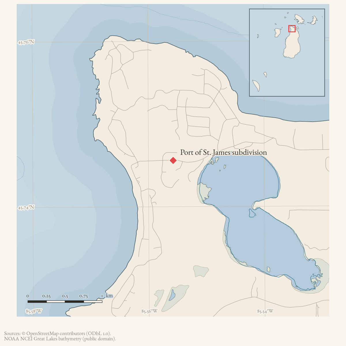
- 45.7456° N, 85.5558° WGoogle Maps: Port of St. James subdivisionDownload KML
- Eras
- Modern era
- Concepts
- housingcommunitytourismland-use
- Within
- Beaver Island
Summary
The Port of St. James subdivision is a late-1960s summer residential development on Beaver Island. The Port of St. James Association describes more than 1,000 properties, shared beaches and recreation facilities, and protective covenants.
The dated county parcel snapshot provides a useful road-level bridge: its Port-of-St.-James plat labels co-occur with property-site labels corresponding to the roads listed here. That is an administrative research association, not a surveyed subdivision boundary or a claim about ownership, occupancy, or legal road status. The county’s spelling and suffix variants are preserved for road name review rather than silently normalized.
Open questions
- Which recorded plats define each numbered Port of St. James section?
- Can the road suffix and spelling variants be reconciled against recorded plats and township maps?
- Which common properties and trails remain under Association management?
Maps for this place
These Atlas plates provide regional context. They do not establish a precise boundary, current ownership, access right, operating status, or field condition.
- EnvironmentSoils, wetlands, hydrography, and terrain
- GeologyGeneralized geology and landforms
- HydrologyMapped water and wetland context
- AccessMapped routes, facilities, and protected areas
- Land surveyPLSS geometry and historic GLO patent-location context
Sources
- The Association describes PSJA as a late-1960s summer residential subdivision of slightly over 1,000 properties with common beaches, a pavilion, a campground, trails, and protective covenants. It does not publish a surveyed boundary or a complete road list.
- Described in this archive: Current named-feature and property join records.Dated parcel rows carry Port St. James plat/legal-description labels alongside property-site road labels including Blue Spruce, Deer Hollow, Fraser, Garden Island View, Hemlock, High Island, Lake Michigan, Rolling Hills, Squaw Island, Stephen, Tamarack, Wandering Woods, Wayside, and White Cedar. The snapshot is a road/subdivision research bridge, not a legal boundary, title record, current-owner assertion, or proof that every mapped road segment belongs to the subdivision. County abbreviations and spellings (for example Deer/Squaw/Stephen and Road/Trail/Court) are retained as review leads.county · charlevoix · parcels_arcgis · 2026-08-01 · island_parcel_attributes
- The point at approximately -85.5557621, 45.7456106 is the mean of 461 current parcel-record centroids labeled Port St. James or carrying Port St. James plat/legal-description labels. It is a broad cluster representative for map navigation, not a recorded-plat centroid, common-property point, or legal subdivision boundary.county · charlevoix · parcels_arcgis · 2026-08-01 · island_parcel_attributes
Added 2 August 2026. Recent changes
Cite this article
Beaver Island Archive, “Port of St. James subdivision”, https://beaverislandarchive.org/places/port-of-st-james-subdivision/, accessed [date], citing Port of St. James Association, “Home,” retrieved 2026-08-02. (and 2 further sources listed on the page).
Last revised 2026-08-02. Fill in [date] with the date you read it — this page is static and cannot know that.
BibTeX for “Port of St. James subdivision”RIS for “Port of St. James subdivision”