

- Coordinates
- 45.7176° N, 85.5099° WGoogle Maps: Little Sand Bay TrailDownload KML
- Eras
- Modern era
- Concepts
- trailsrecreationvegetationModern eratoponymytransportation
- Within
- Beaver Island
Summary
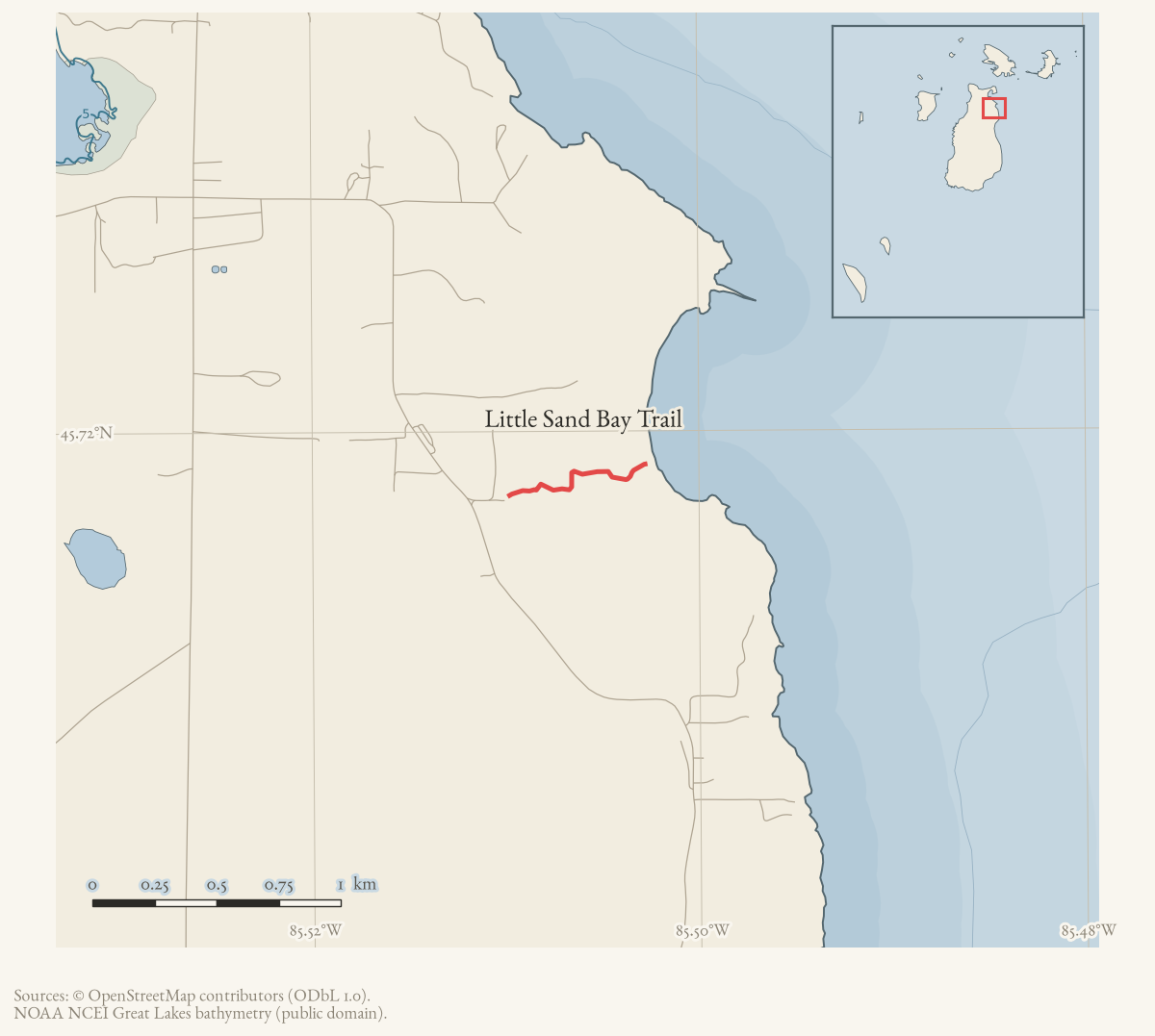
The Little Sand Bay Trail runs from a parking area beside an old house through old meadow and a spring-fed cedar swamp to the Lake Michigan shore, on a Little Traverse Conservancy preserve on the east side of Beaver Island. Much of the swamp section is boardwalk. The interdunal wetland at its end holds Michigan monkey-flower, a species endangered at both state and federal level.
The route
Published in the township trail guide and in the recreation plan; not separately walked into this archive.
From East Side Drive a marked turn leads 0.1 miles to a parking lot beside the old Gallagher house. From the gate, the trail runs 0.42 miles to the beach — 0.22 miles through old meadow and junipers, then 0.2 miles through cedar swamp “with running springs, much of which is on boardwalk”. A loop is possible by walking north along the beach 0.23 miles to a cut in the dune and returning on a two-track, making about 1.38 miles in all.
History
The preserve was assembled by Little Traverse Conservancy, whose 1994 purchase of sixty acres with 1,300 feet of frontage was reported at the time as securing one of a very small number of sites in the world holding Michigan monkey-flower.
The trail was deliberately made longer in 2012. Rather than move the Gallagher house — also known as the Early or Doney home, and thought to be among the oldest on the island, dating from the Mormon period — the conservancy reconfigured the trailhead and parking around it, adding about 950 feet to the walk while keeping the gate opening wide enough for a wheelchair to pass. The change followed a 2009 request from the island’s historical society.
Natural history
The Michigan Natural Features Inventory surveyed three natural communities here in 2017: an interdunal wetland, a boreal forest and a rich conifer swamp. The interdunal wetland record notes Michigan monkey-flower (Mimulus michiganensis), state and federally endangered, along the mouth of a small stream, together with butterwort and Lake Huron tansy, both of state special concern, and Pitcher’s thistle. The boreal-forest record notes a beaver-flooded cedar swale and reads the absence of yew as a signature of deer browsing.
The Beaver Island Birding Trail lists the site for winter wrens in the cedar swamp; the adjacent Luney’s Point, reached through the preserve, for swampy forest grading to cobble beach.
Access and ownership
The preserve is owned and managed by Little Traverse Conservancy and is open to the public on foot. The recreation plan records sixty acres, 1,300 feet of lake frontage, a parking lot, trail, boardwalk, beach and bench. Conservancy preserves carry their own rules; the plants here are protected and the wetland is fragile.
Names
The house at the trailhead is called the Gallagher house in the conservancy’s own account and the Early or Doney home elsewhere.
Evidence and limits
Well documented by the standards of this network: a published route, a dated acquisition, a dated and explained trail reroute, and a formal natural-community survey. What is missing is a walked track and any pre-1994 account of the path itself.
Open questions
- Was there a path to Little Sand Bay before the conservancy’s acquisition, and did it follow the present line? Mooney’s Trail is said to have run to a homestead at Little Sand Bay.
- What is the documented history of the Gallagher, Early or Doney house, and which name is the earliest attested?
- Has the monkey-flower population been monitored since the 2017 survey?
If you can answer any of these, or correct anything above, the archive wants to hear it — see Corrections.
See also
Documented associations
No source-confirmed non-road entity is linked yet. Exact-name research leads remain in scripts/audit_road_links.py; a name collision is not treated as a road association.
Research status
The local newspaper and website corpus contains exact-name mentions in 0 file(s). Those files are research leads; the relation layer is added only when the surrounding source text establishes that the record involves this road.
Maps for this place
These Atlas plates provide regional context. They do not establish a precise boundary, current ownership, access right, operating status, or field condition.
- EnvironmentSoils, wetlands, hydrography, and terrain
- GeologyGeneralized geology and landforms
- HydrologyMapped water and wetland context
- AccessMapped routes, facilities, and protected areas
- Land surveyPLSS geometry and historic GLO patent-location context
Sources
- Turn-by-turn narrative descriptions with cumulative mileages for the island's named trails. Undated in the file; retrieved from the township document centre in August 2026. No author is named in the document or its metadata.governance · peaine · trails · all-trail-descriptions
- Recreation-site inventory and goals. This is the pre-adoption draft; the adopted plan is dated 4 January 2024.governance · peaine · trails · peaine-park-and-rec-plan-draft-2023-11-27
- Element-occurrence surveys for natural communities across the archipelago, with associated rare-plant records.research · island_farming · mnfi_natural_community_surveys_beaver_archipelago_2017_11
- Beaver Beacon, 1994-07.Reports Little Traverse Conservancy's purchase of 60 acres with 1,300 feet of frontage at Little Sand Bay, citing the site as one of only thirteen places in the world where Michigan monkey-flower is found.
- Community-contributed geometry of unknown survey provenance, simplified for display. It establishes that a way of this name is currently mapped; it is not a surveyed right-of-way, a statement of public access, or proof of historical naming.osm · trails
Added 16 August 2026. Recent changes
Cite this article
Beaver Island Archive, “Little Sand Bay Trail”, https://beaverislandarchive.org/places/little-sand-bay-trail/, accessed [date], citing Peaine Township, 'All Trail Descriptions', trail guide, undated. (and 4 further sources listed on the page).
BibTeX for “Little Sand Bay Trail”RIS for “Little Sand Bay Trail”