

- Coordinates
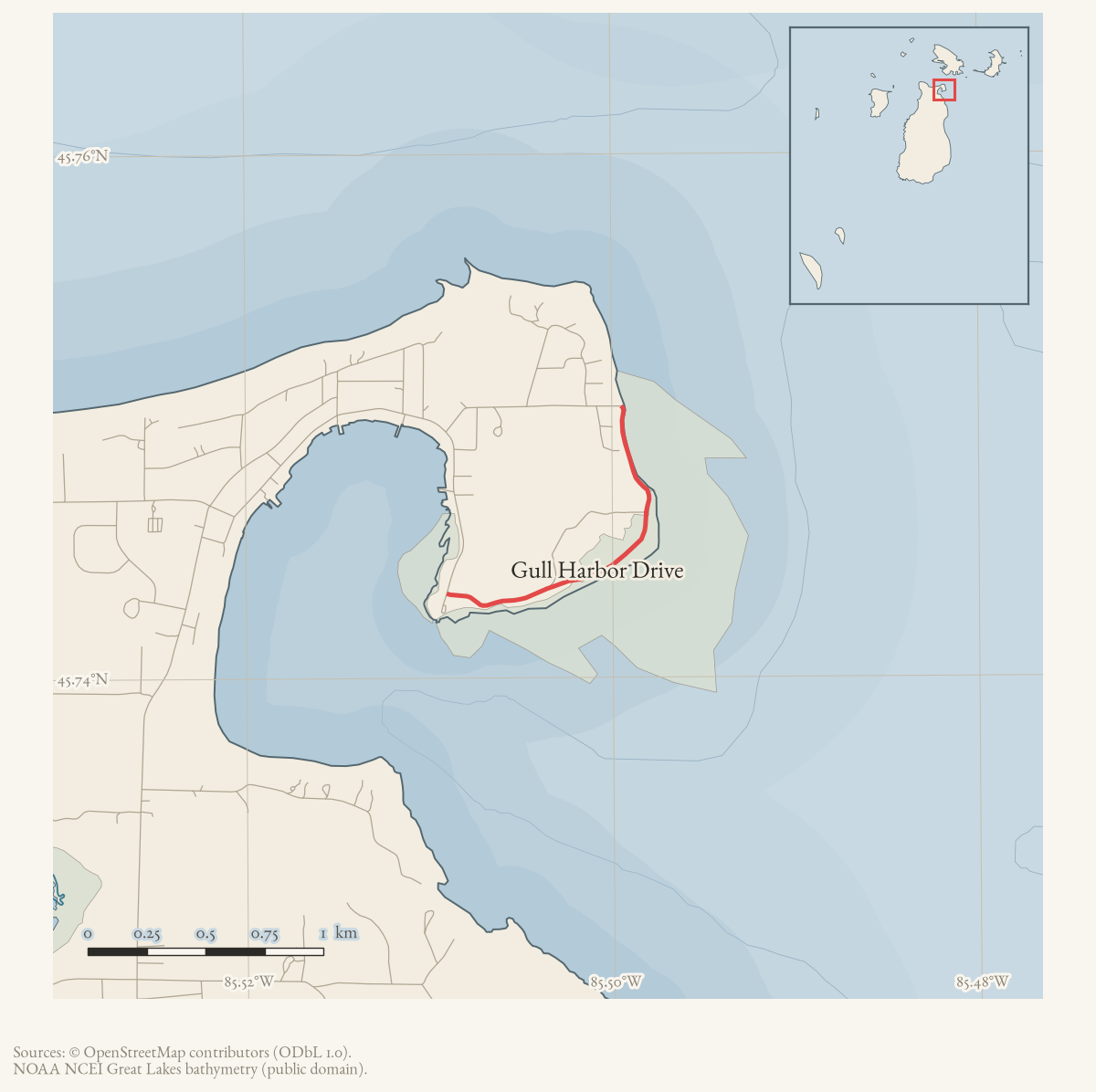
- 45.7437° N, 85.5019° WGoogle Maps: Gull Harbor DriveDownload KML
- Eras
- Modern era
- Concepts
- transportationtoponymyconservation
- Within
- Township of Saint James · Beaver Island
Summary
Gull Harbor Drive is an OpenStreetMap-mapped track on northeastern Beaver Island. A 2024–2028 recreation-plan description of access to Gull Harbor Natural Area calls the route Gull Harbor Road and gives the local name Car Wash Road.
Evidence and limits
The held records preserve current map and planning labels. They do not settle the official road name, ownership, public right of way, road condition, or whether a map line exactly captures all routes used to reach the natural area.
See also
Documented associations
These source-backed records provide context for the mapped route:
- St. James Gull Harbor future-trail easement authorization, 2022 — On December 13, 2022, the St. James Township Board authorized work with adjacent property owners to create easements for a future trail from the Township’s old DNR property to Gull Harbor Nature Area.
- Gull Harbor Natural Area — Gull Harbor Natural Area is a St. James Township public natural-area record on Beaver Island’s northeast coast. The 2023 Master Plan lists a 14-acre site east of St. James Harbor with trails, wetland/coastal frontage, and woods. The 2024–2028 recreation plan describes it as a coastal wetland reached by Gull Harbor Road, locally called Car Wash Road…
Research status
The local newspaper and website corpus contains exact-name mentions in 10 file(s). Those files are research leads; the relation layer is added only when the surrounding source text establishes that the record involves this road.
Maps for this place
These Atlas plates provide regional context. They do not establish a precise boundary, current ownership, access right, operating status, or field condition.
- EnvironmentSoils, wetlands, hydrography, and terrain
- GeologyGeneralized geology and landforms
- HydrologyMapped water and wetland context
- AccessMapped routes, facilities, and protected areas
- Land surveyPLSS geometry and historic GLO patent-location context
The dated record
Sources
- Maps a track named Gull Harbor Drive. The dataset supplies current volunteered map geometry and a road label, not a legal road status, right-of-way, public-access determination, or complete local naming history.osm · trails
- Described in this archive: Peaine Township Five-Year Parks and Recreation Plan, 2024–2028.Describes the road to Gull Harbor Natural Area as Gull Harbor Road, locally known as Car Wash Road. It does not settle the official road name, jurisdiction, alignment, maintenance, or present access.planning · beaver_island_master_plan · 2024-2028-beaver-island-recreation-plan-fa1f69af
- Participant discussion records repeated concerns about speeding and pedestrian/animal safety on Gull Harbor Road and nearby roads; a post gives a non-emergency number and another reports a prior animal fatality on Allen’s Lakeview Road. These are attributed participant accounts, not an official traffic study, crash record, or legal determination of speed limits.forum · www.beaverislandforum.com · posts · 14 · t014429
Added 2 August 2026 · revised 7 August 2026. Recent changes
Cite this article
Beaver Island Archive, “Gull Harbor Drive”, https://beaverislandarchive.org/places/gull-harbor-drive/, accessed [date], citing OpenStreetMap contributors, way 17759872, retrieved 2026-07-28 (ODbL 1.0). (and 2 further sources listed on the page).
Last revised 2026-08-07. Fill in [date] with the date you read it — this page is static and cannot know that.