

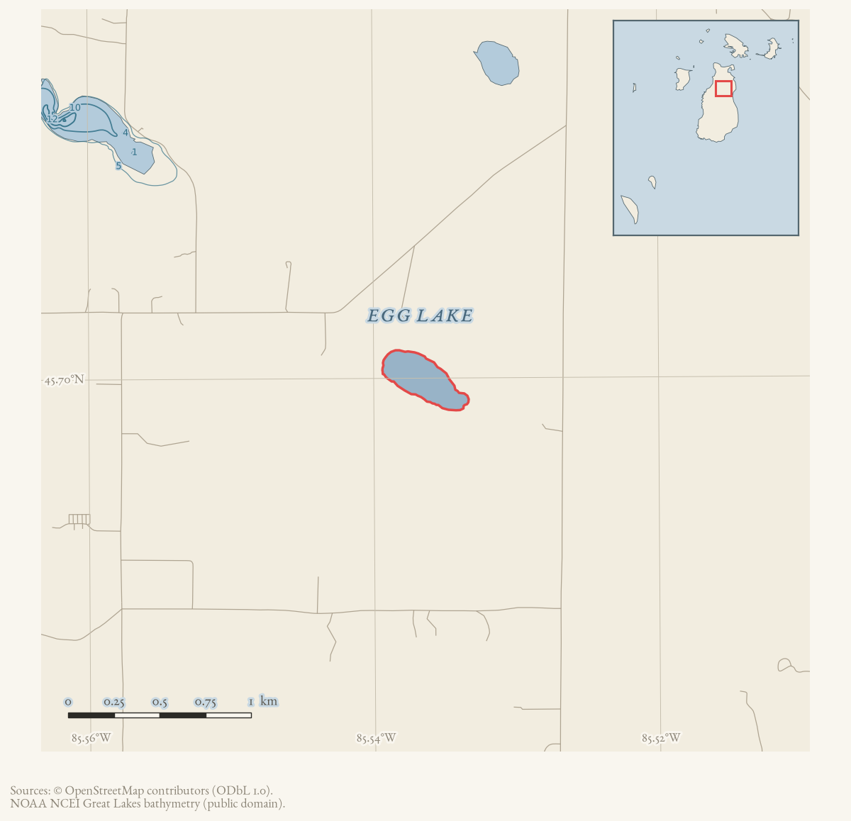
- Coordinates
- 45.6999° N, 85.5365° WGoogle Maps: Egg LakeDownload KML
- Eras
- Modern era
- Concepts
- environmentwetlandsconservationgeologysoilshydrologyvegetationplantstreesforestsstewardship
- Within
- Beaver Island
- Media
- Plat of Big Beaver Island, 1901 · Plat of the north end of Beaver Island, 1930s
Summary
Egg Lake is a named inland lake in Beaver Island’s interior. The 2023 Beaver Island Master Plan cautions that its name understates its ecology: it functions more like a bog than a lake, is privately owned, and supports some of Michigan’s rarest plant species. The plan says conservation groups have prioritized it as a natural area needing protection from human disturbance.
The Master Plan also places Egg Lake within the Island’s connected inland-lake and wetland system and notes that public access is allowed through Central Michigan University despite private ownership. These are current planning descriptions; they do not establish the individual plant records, the date of the access arrangement, or the history behind the name “Egg.”
Ecological profile
MNFI’s 2017 record identifies a 40-acre poor fen associated with Egg Lake (EO 2988; occurrence rank B; global/state ranks G3/S3; Report 2017-11, p. 126). It is an open peatland on a poorly drained, flat lakeplain, with saturated and inundated sphagnum and sedge peat ranging from weakly minerotrophic to ombrotrophic. A margin sample exceeded one metre and was slightly acidic (pH 6.5–6.8); a central sample also exceeded one metre, with very strongly acidic hummocks near pH 4.5 and peat around them near pH 5.5. Floating mats were observed as approximately 50 cm of peat over water.
The report says soil- and water-chemistry gradients produce fine-scale zones and high floristic diversity, with more than 60 species noted during the 2006 survey described in the 2017 report. Graminoid areas include twig-rush, several sedges, white beak-rush, and golden-seeded spike-rush. Other named plants include pitcher-plant, marsh fern, cranberries, rose pogonia, marsh cinquefoil, bog buckbean, cottongrass, round-leaved sundew, false asphodel, bog goldenrod, horned bladderwort, and bluejoint grass.
Shrub and sapling cover increases toward the upland margin, where groundwater influence is stronger. The record names leatherleaf, bog laurel, Labrador tea, bog rosemary, alder-leaved buckthorn, sweet gale, Canada blueberry, bog willow, huckleberry, and scattered tamarack, black spruce, northern white-cedar, and red maple. MNFI recommends leaving adjacent forest and swamp uncut and maintaining a forested buffer to protect the fen’s hydrologic regime.
This is a source-bounded fen occurrence associated with the named lake, not a complete plant list, current condition assessment, or legal wetland boundary.
Open questions
- Which rare plant species have been documented at Egg Lake, and where are the underlying surveys held?
- What is the legal and practical basis for public access through Central Michigan University?
- When and why did the “Egg Lake” name become established?
Maps for this place
These Atlas plates provide regional context. They do not establish a precise boundary, current ownership, access right, operating status, or field condition.
- EnvironmentSoils, wetlands, hydrography, and terrain
- GeologyGeneralized geology and landforms
- HydrologyMapped water and wetland context
- AccessMapped routes, facilities, and protected areas
- Land surveyPLSS geometry and historic GLO patent-location context
Sources
- GNIS feature 625400; feature class 'Lake'.federal · gnis · gnis_names
- Describes Egg Lake as functioning more like a bog than a lake, privately owned, unusually biodiverse, and prioritized by conservation groups for protection from human disturbance.
- Project-generated MNFI 2017 soil, vegetation, and wildlife crosswalk, preserving MNFI Report 2017-11, Egg Lake poor fen occurrence, report p. 126.Described in this archive: MNFI soil, vegetation, tree, and wildlife crosswalk, 2017.The occurrence is a poor fen associated with Egg Lake; its page-bounded evidence is not a legal lake or fen boundary and does not establish current conditions. No public copy of this file is known; the archive holds one and can provide it on request.research · island_farming · crosswalks · mnfi_soil_vegetation_wildlife_crosswalk
- Visual page evidence held with provenance sidecar.research · island_farming · evidence · mnfi-report-2017-11-page-0126-egg-lake-poor-fen
Added 28 July 2026 · revised 3 August 2026. Recent changes
Cite this article
Beaver Island Archive, “Egg Lake”, https://beaverislandarchive.org/places/egg-lake/, accessed [date], citing U.S. Geological Survey, Geographic Names Information System, Domestic Names (Michigan), retrieved 2026-07-28. (and 3 further sources listed on the page).
Last revised 2026-08-03. Fill in [date] with the date you read it — this page is static and cannot know that.