

- Coordinates
- 45.6070° N, 85.5490° WGoogle Maps: Doty’s SwampDownload KML
- Eras
- Modern era
- Concepts
- environmentgeologysoilsforeststreesvegetationplantswetlandshydrologywildlifeanimalsconservationstewardshipinvasive-species
- Within
- Beaver Island
Summary
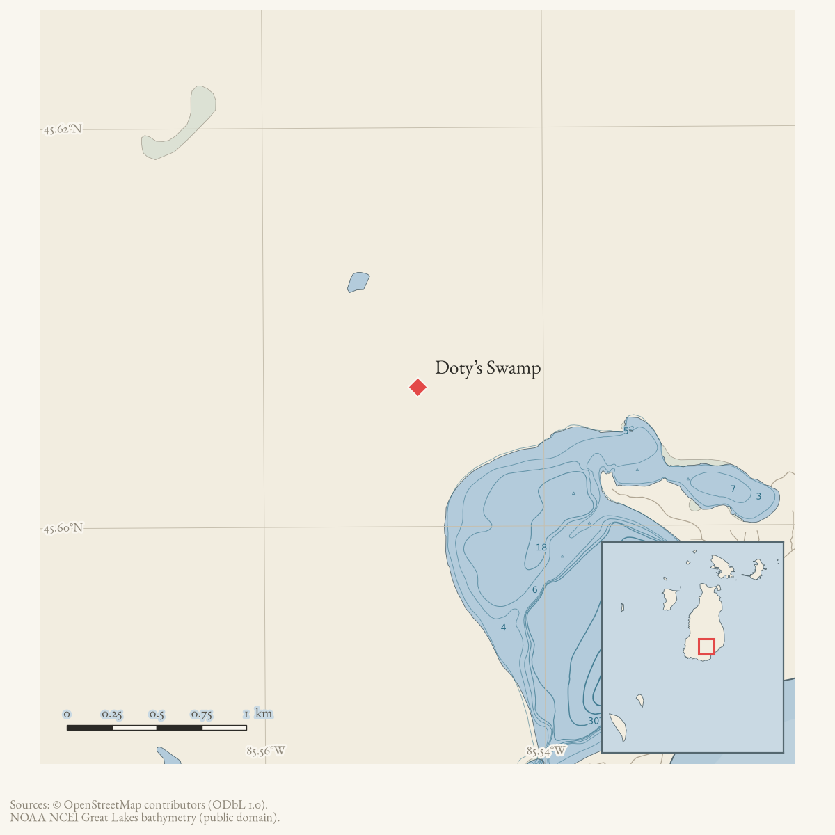
Doty’s Swamp is a source-defined MNFI rich conifer swamp occurrence northwest of Lake Geneserath on Beaver Island. MNFI Report 2017-11 records 118 acres (EO 20690, report p. 130; rank BC, G4/S3). The name is retained as a place record because it is the report’s stable site identifier, not because a separate GNIS feature, parcel, or legal preserve boundary has been established. The displayed point is only a northwest-of-Lake-Geneserath orientation anchor derived from the current mapped lake polygon; it does not locate the occurrence precisely.
Ecological profile
The swamp’s soils consist of shallow 10–40 cm hemic-to-sapric peats, slightly acidic to alkaline (pH 6.5–8.0), over wet medium-textured sands ranging from pH 6.8 to 8.0. Charcoal in the soil profile and the report’s interpretation that parts of the swamp likely followed wildfire preserve a disturbance history in the substrate as well as in the vegetation.
Northern white-cedar dominates the canopy, with local tamarack and associates including paper birch, trembling aspen, balsam poplar, black ash, black spruce, hemlock, and white pine. MNFI cored cedars 30.1 cm and 38.1 cm in diameter and estimated them at 108 and 123 years old. Cedar reproduces primarily by layering, which contributes to the swamp’s structural complexity. Islands of old-growth hemlock with 50–60 cm DBH canopy trees occur within the swamp, while typical canopy trees range from 20 to 40 cm DBH. Balsam fir, mountain maple, winterberry, and black ash occur in the understory; alder-leaved buckthorn, Labrador tea, Canadian fly honeysuckle, and swamp fly honeysuckle occur in the low shrub layer.
The ground layer includes several sedges, starflower, wild sarsaparilla, Canada mayflower, twinflower, goldthread, dwarf raspberry, bunchberry, blue-bead lily, oak fern, large-leaved aster, naked miterwort, creeping snowberry, royal fern, cinnamon fern, and dwarf scouring rush. More open canopy areas support tamarack and a stronger graminoid component. Windthrow and heavy blowdown are prevalent. Deer browse likely limits cedar regeneration and affects floristic composition and structure.
MNFI recommends allowing natural processes to continue, retaining an intact buffer around the swamp, monitoring invasive species and deer browse, and reducing local deer pressure. These are occurrence-level recommendations, not evidence of a completed deer-management action, wildfire date, or current ownership condition. The occurrence is not a current legal boundary or a complete inventory of the larger swamp complex. It is not a complete survey of Doty’s Swamp or the surrounding wetland system.
Open questions
- Where are the MNFI occurrence limits relative to Lake Geneserath, Doty’s Camp Trail, and current land-status records?
- Can later forest or wetland surveys document cedar layering, hemlock islands, browse pressure, or the invasive-species monitoring recommendation?
Maps for this place
These Atlas plates provide regional context. They do not establish a precise boundary, current ownership, access right, operating status, or field condition.
- EnvironmentSoils, wetlands, hydrography, and terrain
- GeologyGeneralized geology and landforms
- HydrologyMapped water and wetland context
- AccessMapped routes, facilities, and protected areas
- Land surveyPLSS geometry and historic GLO patent-location context
Sources
- Project-generated MNFI 2017 soil, vegetation, and wildlife crosswalk, preserving MNFI Report 2017-11, Doty’s Swamp rich conifer swamp occurrence (EO 20690), report p. 130.Described in this archive: MNFI soil, vegetation, tree, and wildlife crosswalk, 2017.The 118-acre record is a named MNFI natural-community occurrence in a larger swamp complex northwest of Lake Geneserath; it is not a current legal boundary, ownership determination, or complete survey of the swamp complex. No public copy of this file is known; the archive holds one and can provide it on request.research · island_farming · crosswalks · mnfi_soil_vegetation_wildlife_crosswalk
- Visual page evidence held with provenance sidecar; the image anchors the occurrence description and does not establish modern geometry or current condition.research · island_farming · evidence · mnfi-report-2017-11-page-0130-dotys-swamp-rich-conifer-swamp
- The point is a reproducible northwest-of-Lake-Geneserath orientation anchor derived just northwest of the mapped lake polygon. It is used because MNFI places Doty’s Swamp northwest of the lake; it is not the 118-acre occurrence centroid, boundary, access point, or a surveyed wetland location.osm · water
- PIN 012-009-001-00 is an exempt Michigan Department of Natural Resources parcel with current situs North Arm Road Access and a representative point near the Doty’s Swamp orientation area. It provides current public-land context, but is not evidence that the parcel contains the full 118-acre MNFI occurrence.county · charlevoix · parcels_arcgis · 2026-08-01 · island_parcel_attributes
Added 3 August 2026 · revised 6 August 2026. Recent changes
Cite this article
Beaver Island Archive, “Doty’s Swamp”, https://beaverislandarchive.org/places/dotys-swamp/, accessed [date], citing Project-generated MNFI 2017 soil, vegetation, and wildlife crosswalk, preserving MNFI Report 2017-11, Doty’s Swamp rich conifer swamp occurrence (EO 20690), report p. 130. (and 3 further sources listed on the page).
Last revised 2026-08-06. Fill in [date] with the date you read it — this page is static and cannot know that.