

- Along road
- Sloptown Road
- Coordinates
- 45.7042° N, 85.5795° WGoogle Maps: Bonner’s Bluff State BeachDownload KML
- Eras
- Modern era
- Concepts
- recreationconservationtransportation
- Within
- Beaver Island
- Media
- Beaver Island History Map, 1978 revision
Summary
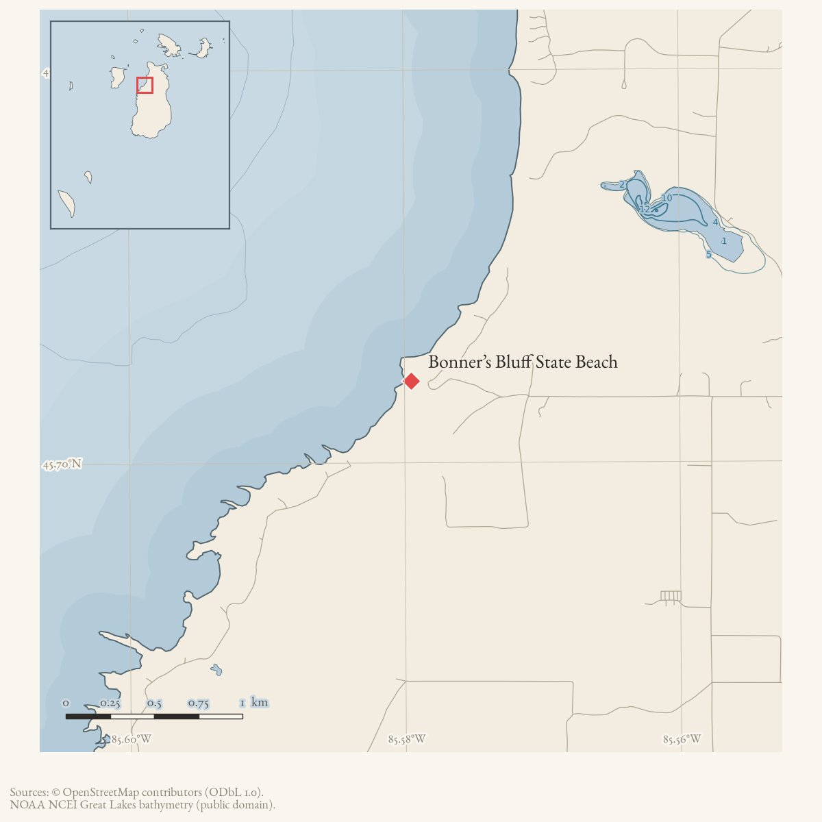
Bonner’s Bluff State Beach, also identified in the recreation inventory as Bonner’s Landing, is a public Lake Michigan beach at the end of a private road off Sloptown Road. The inventory describes approximately 1,500 feet of beach and access over private land.
Evidence and limits
The source establishes the public-recreation designation and broad access setting, not a surveyed shoreline, private-road name, easement instrument, or current access condition.
Open questions
- Which private road and parcel provide the access?
- What record establishes the public beach designation and current access terms?
- Can a current map resolve the beach polygon and access route?
Maps for this place
These Atlas plates provide regional context. They do not establish a precise boundary, current ownership, access right, operating status, or field condition.
- EnvironmentSoils, wetlands, hydrography, and terrain
- GeologyGeneralized geology and landforms
- HydrologyMapped water and wetland context
- AccessMapped routes, facilities, and protected areas
- Land surveyPLSS geometry and historic GLO patent-location context
Sources
- The beach inventory names Bonner’s Landing as an alternate name, so the GNIS point is used as a representative access/location point; it is not a surveyed 1,500-foot beach boundary or access-road endpoint.federal · gnis · gnis_names
- The inventory lists Bonner’s Bluff State Beach (Bonner’s Landing) at the end of a private road off Sloptown Road, with 1,500 feet of public Lake Michigan beach and access over private land. It does not establish the private-road name, a surveyed beach boundary, an easement instrument, or current access condition.planning · beaver_island_master_plan · 2017-beaver-island-resilient-master-plan-8cbeebcd
- PIN 012-106-001-00 is an exempt Michigan Department of Natural Resources parcel on Sloptown Road whose representative point lies near the GNIS Bonner Landing point. It supplies current public-land context for the beach access area, but does not establish the 1,500-foot shoreline boundary, private-road easement, or current access terms.county · charlevoix · parcels_arcgis · 2026-08-01 · island_parcel_attributes
Added 2 August 2026 · revised 6 August 2026. Recent changes
Cite this article
Beaver Island Archive, “Bonner’s Bluff State Beach”, https://beaverislandarchive.org/places/bonners-bluff-state-beach/, accessed [date], citing U.S. Geological Survey, GNIS feature 1617454, Bonner Landing, retrieved 2026-07-28. (and 2 further sources listed on the page).
Last revised 2026-08-06. Fill in [date] with the date you read it — this page is static and cannot know that.
BibTeX for “Bonner’s Bluff State Beach”RIS for “Bonner’s Bluff State Beach”