

- Coordinates
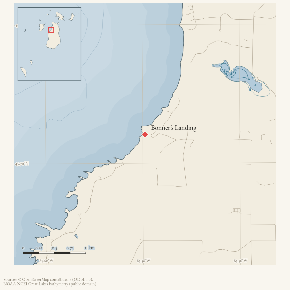
- 45.7042° N, 85.5795° WGoogle Maps: Bonner’s LandingDownload KML
- Eras
- Modern era
- Concepts
- toponymy
- Within
- Beaver Island
- Media
- Beaver Island History Map, 1978 revision · Plat of Big Beaver Island, 1901 · Plat of the north end of Beaver Island, 1930s
Summary
USGS GNIS records Bonner Landing as a populated place on Beaver Island. The 2023 Beaver Island Master Plan also labels “Bonner’s Landing” on its map of island places. Later island histories associate the place with John “Black John” Bonner, an early Irish fisherman, mariner, and farmer. Collar’s compilation quotes an account that Bonner acquired an 1857 tract where he built a dock, but the exact historical shoreline point and the earliest use of “Bonner’s Landing” remain unresolved.
The 1856 tradition
The 1978 Historical Map says Bonner rushed from Gull Island when the Mormons departed. A 1963 Beacon account similarly says he learned at Gull Island that Strang had been shot and sailed into Saint James. Collar’s notes preserve a different recollection that he first landed at Bonner’s Bluff, alongside Pat Bonner’s version that he entered the harbor. The broad post-Strang settlement association is supported by several later traditions, but a precise route or first landing is not established.
Open questions
- Where was the landing, and what transportation or settlement functions did it serve?
- Can local maps, property records, or contemporary reporting establish a date range?
Maps for this place
These Atlas plates provide regional context. They do not establish a precise boundary, current ownership, access right, operating status, or field condition.
- EnvironmentSoils, wetlands, hydrography, and terrain
- GeologyGeneralized geology and landforms
- HydrologyMapped water and wetland context
- AccessMapped routes, facilities, and protected areas
- Land surveyPLSS geometry and historic GLO patent-location context
Sources
- GNIS feature 1617454; feature class 'Populated Place'.federal · gnis · gnis_names
- Map label “Bonner's Landing.” This is a cartographic attestation, not a narrative account of the landing.
- Retrospective account says John Bonner moved from Gull Island into Saint James after learning Strang had been shot and bought an 80-acre island farm in 1857. It supports the associated settler/farm chronology, not the landing’s exact point or name.data1 · beaver-island-archive · beaver_beacon · 1963-09_Beaver-Beacon
- Preserves conflicting testimony about whether Bonner first landed at Bonner’s Bluff or in the harbor, and quotes a biography saying he acquired a tract in 1857 where he built a dock. Useful name-origin context, not a surveyed location.web · collar_biographical_papers
- Described in this archive: Beaver Island History Map, 1978 revision.Groups Bonner’s Landing, Bluff, and Farm and associates them with John Bonner’s 1856 movement from Gull Island. Later accounts support the broad association but disagree on his first landing.
Added 28 July 2026 · revised 7 August 2026. Recent changes
Cite this article
Beaver Island Archive, “Bonner’s Landing”, https://beaverislandarchive.org/places/bonner-landing/, accessed [date], citing U.S. Geological Survey, Geographic Names Information System, Domestic Names (Michigan), retrieved 2026-07-28. (and 4 further sources listed on the page).
Last revised 2026-08-07. Fill in [date] with the date you read it — this page is static and cannot know that.