

- Along road
- Barney's Lake Road South · Barney's Lake Nature Preserve Access
- Coordinates
- 45.7140° N, 85.5603° WGoogle Maps: Barney's Lake Nature PreserveDownload KML
- Eras
- Modern era
- Concepts
- conservationenvironmentrecreation
- Within
- Beaver Island
Summary
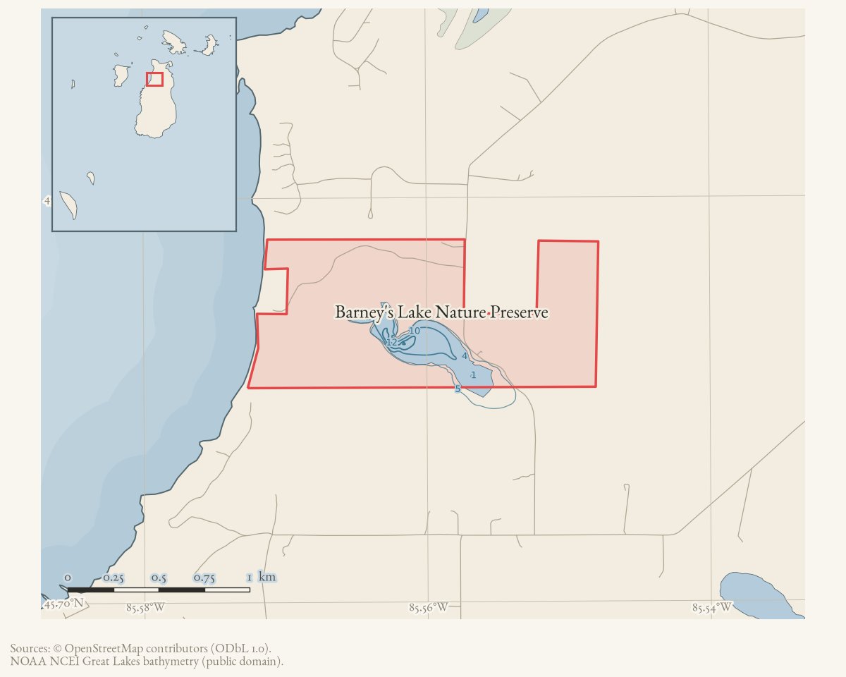
Barney’s Lake Nature Preserve is a Little Traverse Conservancy preserve in the north-central part of Beaver Island. The Conservancy describes 363 acres, open bog, sedge meadow, cedar swamp, an old farmstead, nearly three miles of trails, and frontage on both Barney’s Lake and Lake Michigan. Its current directions give 35795 Barney’s Lake Road South and say the preserve lies on both sides of that road, with another parking area near the northern edge reached from the road.
The preserve’s original land was donated in 1988, with later additions in 2007, 2014, and 2025 according to the Conservancy. The mapped polygon is a current OSM representation and is not a legal boundary.
Maps for this place
These Atlas plates provide regional context. They do not establish a precise boundary, current ownership, access right, operating status, or field condition.
- EnvironmentSoils, wetlands, hydrography, and terrain
- GeologyGeneralized geology and landforms
- HydrologyMapped water and wetland context
- AccessMapped routes, facilities, and protected areas
- Land surveyPLSS geometry and historic GLO patent-location context
The dated record
Sources
- A forum user reported that a canoe and rowboat remained at the Barney’s Lake boat-storage area after a requested November 1 removal deadline and said stored boats were supposed to carry an owner name and phone number. This is a contemporaneous user observation and management reminder, not a Conservancy notice, complete inventory, or proof of what happened to the boats.forum · www.beaverislandforum.com · 17 · t017988
- Reports a 363-acre preserve with 5,800 feet of Barney’s Lake frontage and 1,770 feet of Lake Michigan frontage, nearly three miles of trails, a half-mile of Kuebler Trail, the 1988 donation, later additions, and the address 35795 Barney’s Lake Road South. The page is a current stewardship description, not a deed or surveyed boundary.
- Reports Little Traverse Conservancy educators leading Beaver Island school classes through Barney’s Lake Nature Preserve. It does not establish the preserve’s full acreage or boundary. The holding institution's portal restricts automated access; the archive holds a copy of this issue and can provide it on request.data1 · beaver-island-archive · beaver_beacon · 1992-10_Beaver-Beacon
- The held sixteen-page issue scan is paired with the OCR source and confirms the published notice or report; it does not expand the source-specific identity, event, or outcome claims.data1 · beaver-island-archive · scans · beaver_beacon · issues · 1992-10_Beaver-Beacon
- OSM way 265446952 is tagged as a protected-area/nature-reserve polygon operated by Little Traverse Conservancy. The geometry is a current volunteered map representation, not a legal survey.osm · protected_areas
- Reports a planned end to boat storage and rack removal by the end of 2024. This is useful current-management context, but the forum archive lacks the original Conservancy notice and proof of implementation.forum · www.beaverislandforum.com · 18 · t018327
- The Conservancy asked users to remove boats stored at the nature-preserve boat access by November 1, 2021, saying the number of boats had become a problem and that it was considering options for the following year. This first-party notice documents a management concern and deadline, not the later disposition of every boat or a permanent policy.forum · www.beaverislandforum.com · 16 · t016775
Added 2 August 2026 · revised 3 August 2026. Recent changes
Cite this article
Beaver Island Archive, “Barney's Lake Nature Preserve”, https://beaverislandarchive.org/places/barneys-lake-nature-preserve/, accessed [date], citing jacquel, “Barney's Lake Boat Storage,” Beaver Island Forum, November 5, 2023, topic 17988. (and 6 further sources listed on the page).
Last revised 2026-08-03. Fill in [date] with the date you read it — this page is static and cannot know that.
BibTeX for “Barney's Lake Nature Preserve”RIS for “Barney's Lake Nature Preserve”