

- Date
- 1849
- Eras
- Early American era
- Concepts
- land-surveyheritageenvironmentfishing
- Within
- Whiskey Island
Summary
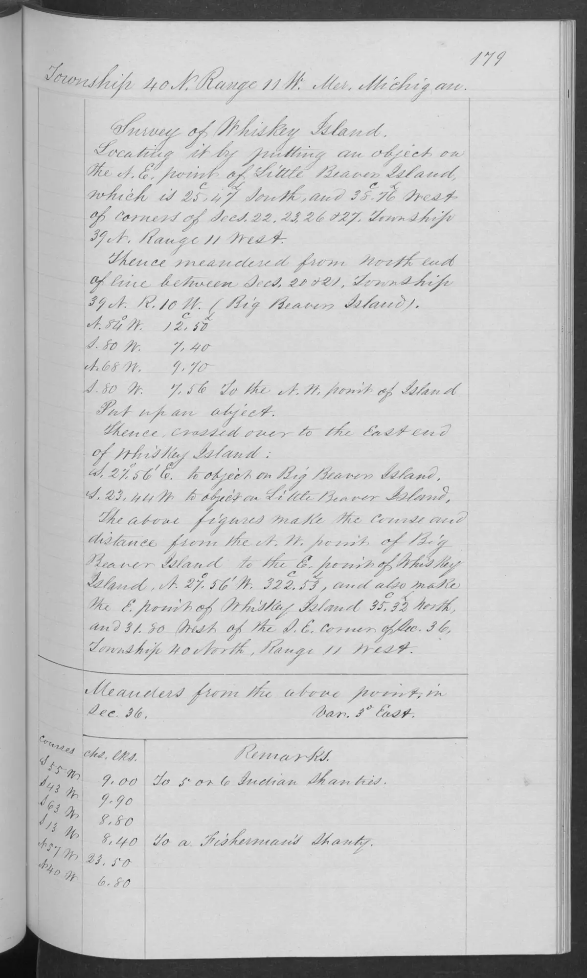
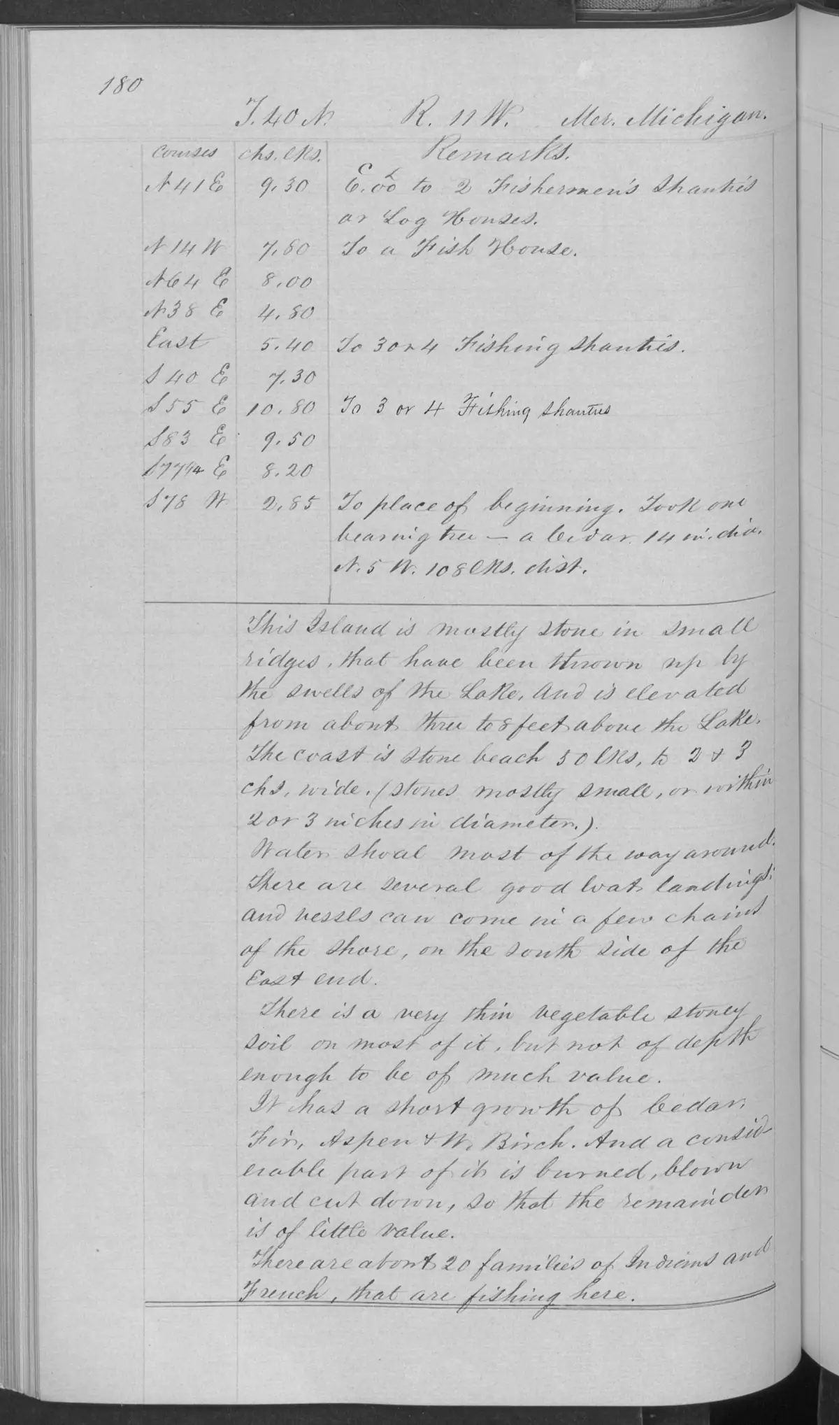
These checked pages from BLM Field Note Volume 168138 record the 1849 federal survey and general description of Whiskey Island in T40N R11W. The survey page records several fishing shanties and a fish house; the following page describes the island’s shore, landform, vegetation, and fishing community in the surveyor’s period language.
Dated observations
The surveyor described small stone ridges, a low elevation above Lake Michigan, thin vegetative soil, short cedar, fir, aspen, and white-birch growth, and burning and cutting of some growth. The notes also report several landings where vessels could come in near the south side of the east end.
The general description says that about twenty families of “Indian and French” people were fishing there. This is a 1849 observation recorded in the federal surveyor’s terminology. It does not identify people or communities, establish tribal affiliation or land rights, or show how long any group lived or fished there before or after the survey.
Evidence and limits
These pages preserve the surveyor’s time-bounded observations of structures, fishing activity, shore, landform, vegetation, and cutting or burning. They do not establish a current or historical title, ownership, parcel boundary, access right, continuous settlement, or present environmental condition.
See also
Sources
- Described in this archive: BLM GLO field-note volumes linked to Beaver Island-area surveys.Visual page-image verification of both retained pages. Page 0179 is headed 'Survey of Whiskey Island' and records the meander operation, fishing shanties, and a fish house. Page 0180 gives the general description, including the surveyor's statement that about twenty families of ‘Indian and French’ people were fishing there. The wording is retained as a source-bounded 1849 observation; it does not identify individuals, tribal affiliation, residency duration, land rights, title, ownership, access, current habitat, or a continuous community history.federal · glo_field_notes · page_evidence · field-note-volume-168138-page-0179-whiskey-island-survey
- Bureau of Land Management, General Land Office Records, Field Note Volume 168138, p. 0180, Whiskey Island general description, 1849.The visually checked general-description page records the surveyor's observations of low stone ridges, thin soil, vegetation, burning/cutting, and several small-boat landings. These are not current navigation, ecological, or land-status findings. No public copy of this file is known; the archive holds one and can provide it on request.federal · glo_field_notes · page_evidence · field-note-volume-168138-page-0180-whiskey-island-general-description
Added 2 August 2026. Recent changes
Cite this article
Beaver Island Archive, “GLO field-note pages: Whiskey Island survey, 1849”, https://beaverislandarchive.org/documents/glo-field-note-whiskey-island-survey-1849/, accessed [date], citing Bureau of Land Management, General Land Office Records, Field Note Volume 168138, pp. 0179-0180, T40N R11W, Whiskey Island survey and general description, 1849. (and 1 further source listed on the page).
Last revised 2026-08-02. Fill in [date] with the date you read it — this page is static and cannot know that.
BibTeX for “GLO field-note pages: Whiskey Island survey, 1849”RIS for “GLO field-note pages: Whiskey Island survey, 1849”