

- Date
- 1849-06-28
- Eras
- Early American era
- Concepts
- land-surveyheritageenvironmentfishing
- Within
- Trout Island
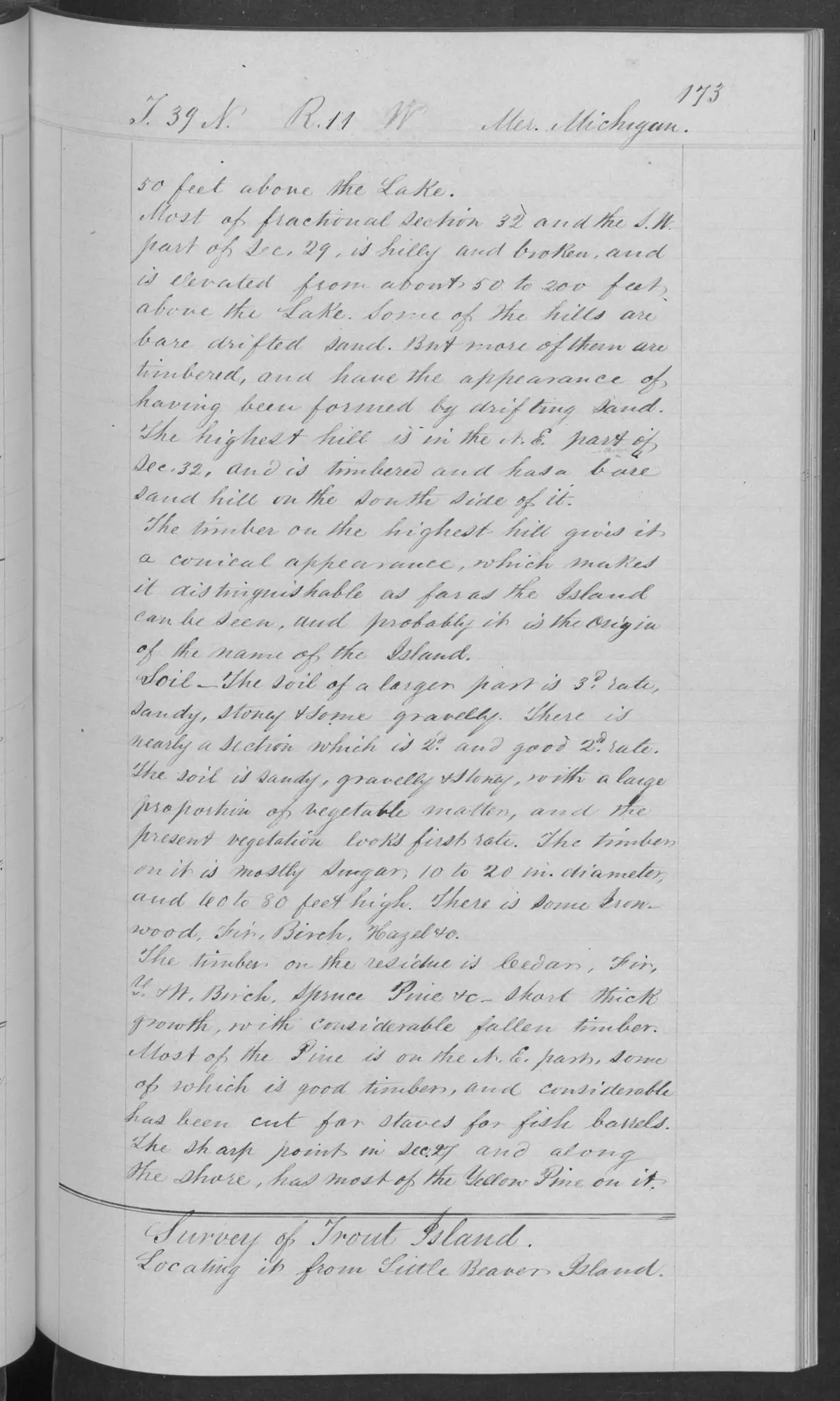
Summary
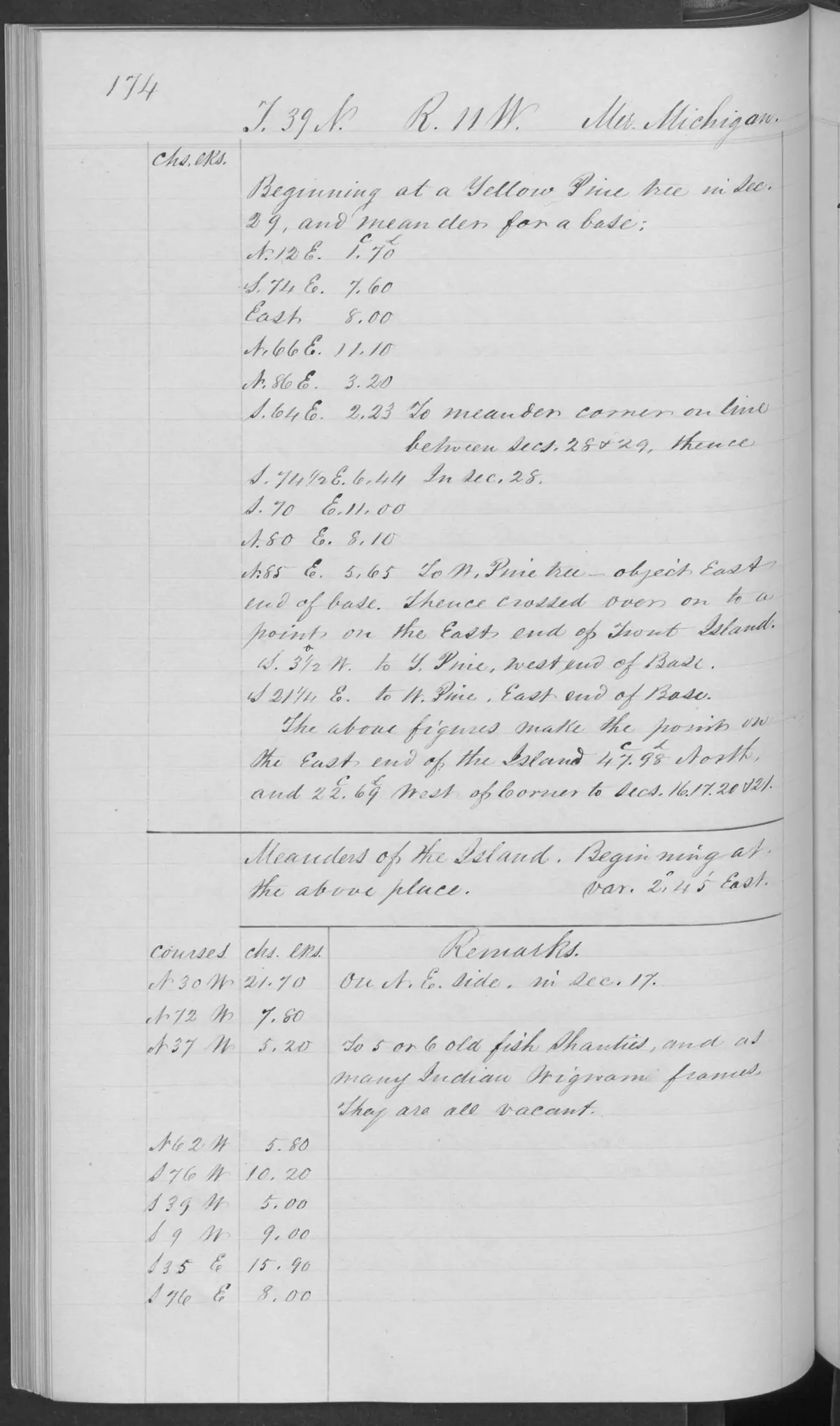
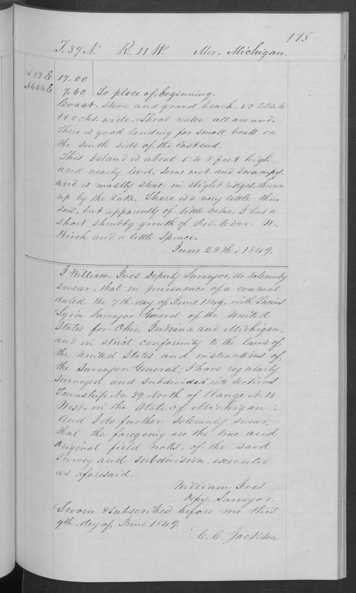
These checked pages record the federal survey of Trout Island in T39N R11W, certified by Deputy Surveyor William Ives on 28 June 1849. They include meander measurements, a general description, and an observation of five or six old fish shanties and an equal number of vacant wigwam frames, using the source’s period wording.
Dated observations
The notes describe a 50-to-100-link-wide stone-and-gravel beach and a reported small-boat landing on the east end’s south side. They characterize the island as roughly five to eight feet high, nearly level but wet and swampy in places, with low lake-formed stone ridges, a short shrubby growth of fir, cedar, white birch, and some spruce. The surveyor also recorded good northern timber, including timber already cut for staves used in fish barrels.
Evidence and limits
The field notes show the surveyor’s 1849 observations of structures, a landing, landform, vegetation, and timber use. They do not identify the fishers or occupants, establish an Anishinaabe or any other community affiliation, prove the duration or continuity of use, or establish a historical or current title, ownership, boundary, access right, or present habitat condition.
See also
Sources
- Described in this archive: BLM GLO field-note volumes linked to Beaver Island-area surveys.Visual page-image verification of all three retained pages. The handwritten pages begin the Trout Island survey, record a meander operation and the surveyor’s observations, and carry William Ives’s 28 June 1849 certificate. Page 0174 reports five or six old fish shanties and as many vacant “Indian wigwam” frames, using the source’s terminology. These source-bounded observations do not identify builders or occupants, establish tribal affiliation, land rights, title, ownership, access, or a continuous settlement history.federal · glo_field_notes · page_evidence · field-note-volume-168138-page-0173-trout-island-survey
- Bureau of Land Management, General Land Office Records, Field Note Volume 168138, pp. 0174–0175, Trout Island meander and general description, 1849.The two continuation pages record the reported small-boat landing, shore materials, low ridges, vegetation, and timber cut for staves used in fish barrels. They are 1849 survey observations, not current ecological or navigation conditions. No public copy of this file is known; the archive holds one and can provide it on request.federal · glo_field_notes · page_evidence · field-note-volume-168138-page-0174-trout-island-survey
- Bureau of Land Management, General Land Office Records, Field Note Volume 168138, p. 0175, T39N R11W, Trout Island general description, 1849.Visual page-image verification. Page 0175 continues the Trout Island general description and certificate; it records 1849 survey observations, not current ecological or navigation conditions. No public copy of this file is known; the archive holds one and can provide it on request.federal · glo_field_notes · page_evidence · field-note-volume-168138-page-0175-trout-island-general-description
Added 2 August 2026. Recent changes
Cite this article
Beaver Island Archive, “GLO field-note pages: Trout Island survey, 1849”, https://beaverislandarchive.org/documents/glo-field-note-trout-island-survey-1849/, accessed [date], citing Bureau of Land Management, General Land Office Records, Field Note Volume 168138, pp. 0173–0175, T39N R11W, Survey of Trout Island, 28 June 1849. (and 2 further sources listed on the page).
Last revised 2026-08-02. Fill in [date] with the date you read it — this page is static and cannot know that.
BibTeX for “GLO field-note pages: Trout Island survey, 1849”RIS for “GLO field-note pages: Trout Island survey, 1849”