

- Date
- 1755
- Eras
- French era
- Concepts
- toponymyheritageFrench era
- Within
- Beaver Island archipelago
Summary
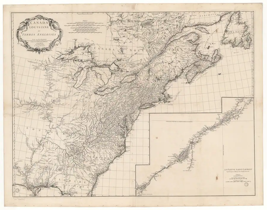
This held d’Anville map sheet prints I. au Castors for the Beaver Island group. The spelling is an additional mid-eighteenth-century French map attestation, distinct from the English Beaver I. printed by Mitchell in the same year.
Evidence and limits
The map establishes the form printed on this sheet. It does not demonstrate that the form was locally spoken, settle the exact modern group boundary, or prove a historical naming act, occupation, or title.
See also
Sources
- Visual and provenance verification: the held sheet prints “I. au Castors” for the Beaver Island group. It is a 1755 cartographic attestation, not evidence of local speech, a modern boundary, title, or a complete island inventory.maps · commons · danville_1755_canada_louisiane_sheet1
- Project provenance sidecar for d’Anville 1755 map sheet.Records the Gallica/Commons source URL, retrieval timestamp, checksum, and public-domain status. No public copy of this file is known; the archive holds one and can provide it on request.maps · commons · danville_1755_canada_louisiane_sheet1.provenance

Added 2 August 2026 · revised 4 August 2026. Recent changes
Cite this article
Beaver Island Archive, “d’Anville Canada and Louisiana map, sheet 1, 1755”, https://beaverislandarchive.org/documents/danville-canada-louisiane-map-1755/, accessed [date], citing Jean-Baptiste Bourguignon d’Anville, *Canada, Louisiane et Terres Angloises*, sheet 1 (1755), held map scan. (and 1 further source listed on the page).
Last revised 2026-08-04. Fill in [date] with the date you read it — this page is static and cannot know that.
BibTeX for “d’Anville Canada and Louisiana map, sheet 1, 1755”RIS for “d’Anville Canada and Louisiana map, sheet 1, 1755”