

- Date
- 1755
- Eras
- French era
- Concepts
- toponymyheritageFrench era
- Within
- Beaver Island archipelago
Summary
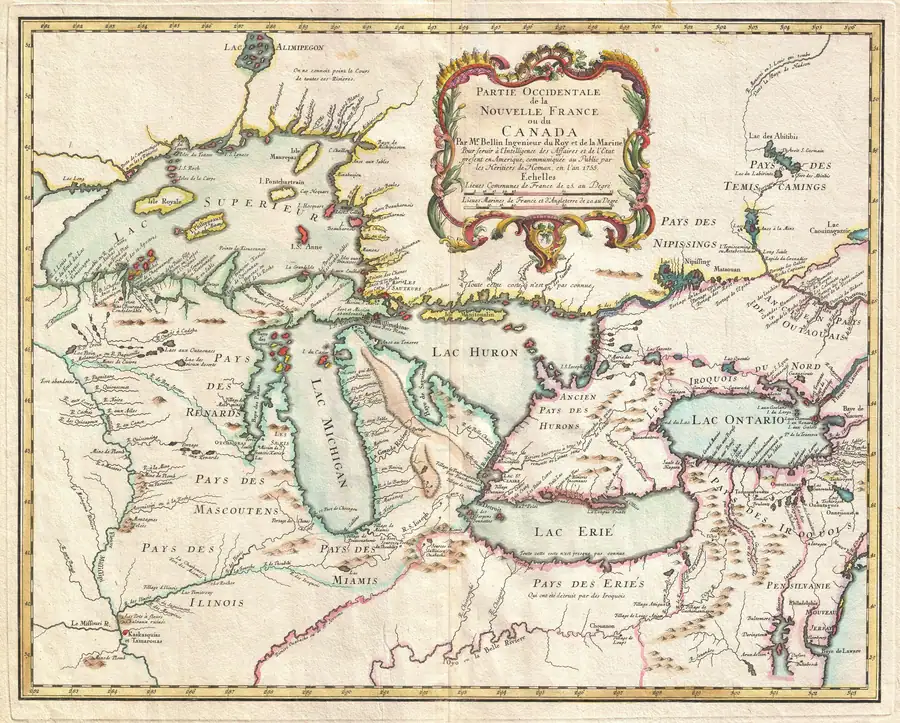
This held 1755 Bellin–Homann map prints I. du Castor for the Beaver Island group. It independently continues the French “Castor” cartographic form already seen in the 1744 Bellin map.
Evidence and limits
The map establishes what its engraver printed at a regional scale. It does not identify every modern island in the group, prove local usage, establish a legal boundary or title, or explain the origin of the name.
See also
Sources
- Visual and provenance verification: the held map prints “I. du Castor” for the Beaver Island group. It is a 1755 cartographic attestation, not evidence of local speech, a modern boundary, title, or a complete island inventory.maps · commons · bellin_1755_partie_occidentale
- Project provenance sidecar for Bellin–Homann 1755 map.Records the Commons/Geographicus source URL, retrieval timestamp, checksum, and public-domain status. No public copy of this file is known; the archive holds one and can provide it on request.maps · commons · bellin_1755_partie_occidentale.provenance

Added 2 August 2026 · revised 4 August 2026. Recent changes
Cite this article
Beaver Island Archive, “Bellin–Homann Great Lakes map, 1755”, https://beaverislandarchive.org/documents/bellin-homann-great-lakes-map-1755/, accessed [date], citing Jacques-Nicolas Bellin, *Partie Occidentale de la Nouvelle France* (Homann Heirs, 1755), held map scan. (and 1 further source listed on the page).
Last revised 2026-08-04. Fill in [date] with the date you read it — this page is static and cannot know that.
BibTeX for “Bellin–Homann Great Lakes map, 1755”RIS for “Bellin–Homann Great Lakes map, 1755”