

The archive's own cartography · 1 m LiDAR
Relief in three dimensions
Prefer it flat and large? The same surveys are drawn as five printable sheets — to hang, plot, cut or carve.
The island's bare-earth surface, drawn from the same 1-metre LiDAR the atlas plates are drawn from. It opens wearing the aerial photograph — USDA NAIP 2022 at 60 cm — and switches to the relief model on the same mesh, which is where the point is: the photograph stops at the canopy, and the relief sees the ground beneath it. The frames below drop to 1-metre posting over the south end, St James, and two places worth a closer look. Turn them, tilt them, and — because the features worth looking at are a few tenths of a metre high — exaggerate the vertical.
Every three-dimensional view here is vertically exaggerated. The factor is printed beside the frame and never hidden. At true scale these frames are flat: the island rises 64 m across 22 km, the detail frames 18–28 m across 1.4–3.6 km, and the made features — roads, grades, a lane — are 0.05–0.3 m of that, smaller than the beach ridges they sit among.
×1 is true scale. The default ×3 is the lowest factor at which a road prism reads at all on the 1-metre frames; the island frame is landform, and reads at any of them.
Drag to turn the block. Shift-drag — or drag with the right button, or two fingers on a touchscreen — to move across it, which is how you reach the ends of the island frame. Zoom with the buttons above, with + and − once the view has focus, by pinching, or by holding Ctrl (⌘ on a Mac) while you scroll — a plain scroll is left alone so the page still scrolls past the figure. From the keyboard, arrows turn and shift-arrows move.
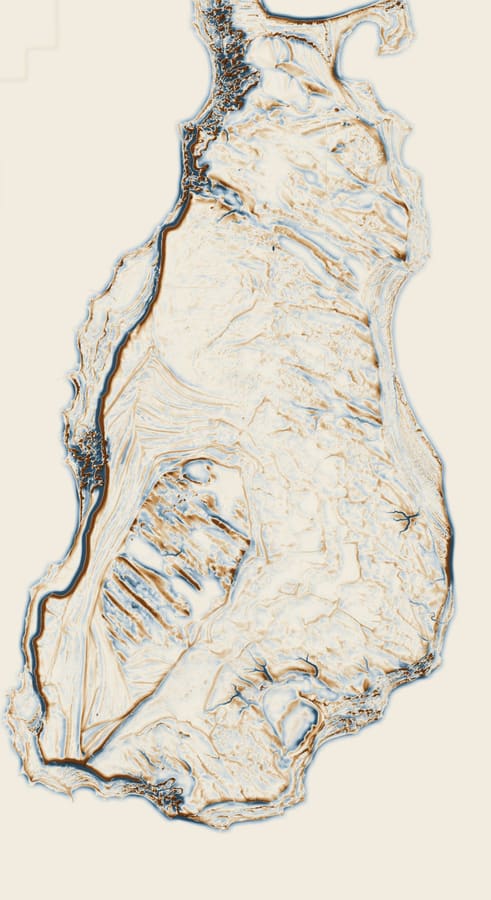
Beaver Island. Frame 12,000 × 22,016 m. Elevation 170.2–240.3 m.
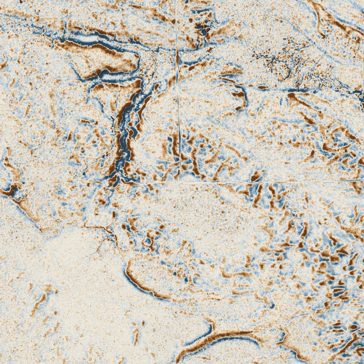
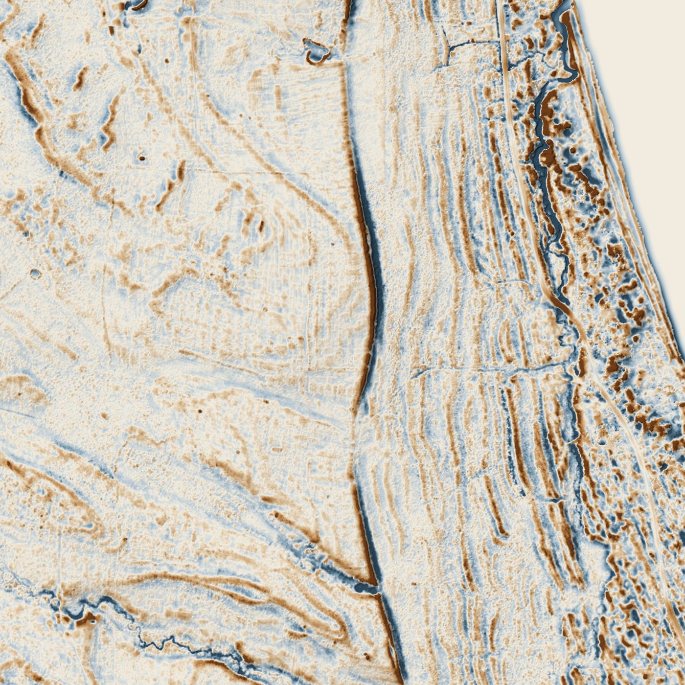
Beaver Island — flat plate (1500 px) · Cable's Creek, Nomad and Galilee — flat plate (2800 px) · St James and the north end — flat plate (3600 px) · King's Highway at Hannigan's Road — flat plate (1400 px) · The unexplained north-south lane — flat plate (1400 px)
The frames
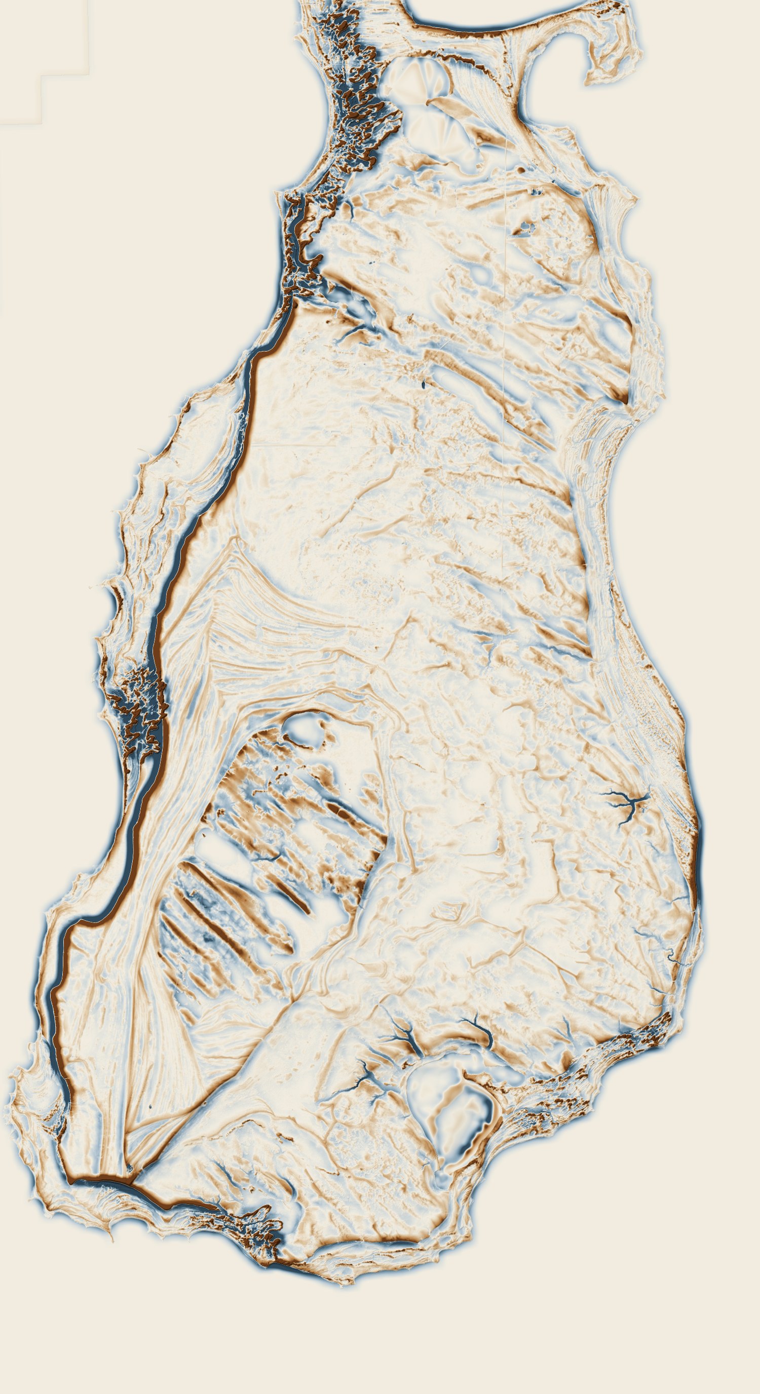
Beaver Island
12,000 × 22,016 m · elevation 170.2–240.3 m (70.2 m of relief) · 45.6556° N, 85.5521° W · posting 32 m, 16 m, 8 m
The whole island at 8-metre posting, 12 km by 22 km — the frame this page opens on. At this scale the question is not where a road is but which way the land lies: the ridge-and-swale bands that fan across the south end and run the length of the east shore are relict beach ridges, the lake's own record of its former levels, and they are the grain everything else has to be read against.
This is an overview and not a search sheet. The made features on this island are a few centimetres to a few tenths of a metre high, and at 8 m posting they are under a pixel; the detail frames below are where those live. What this frame is good for is shape — the bluffs down the west side, the basins, and how completely the beach ridges organise the southern half.
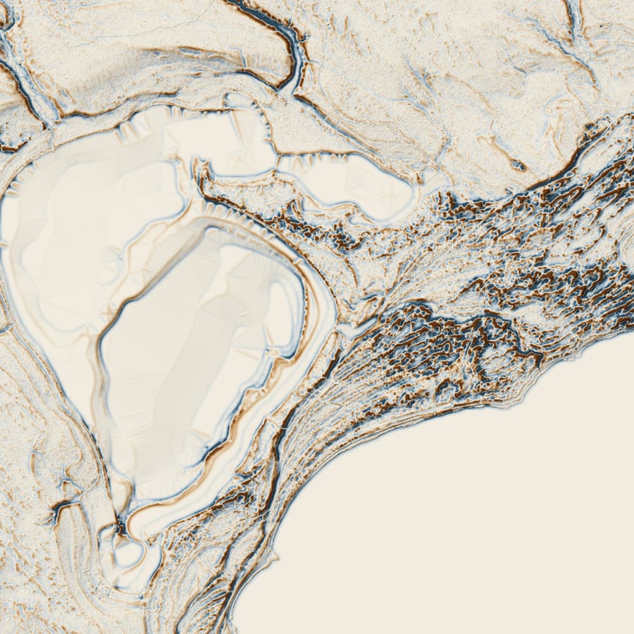
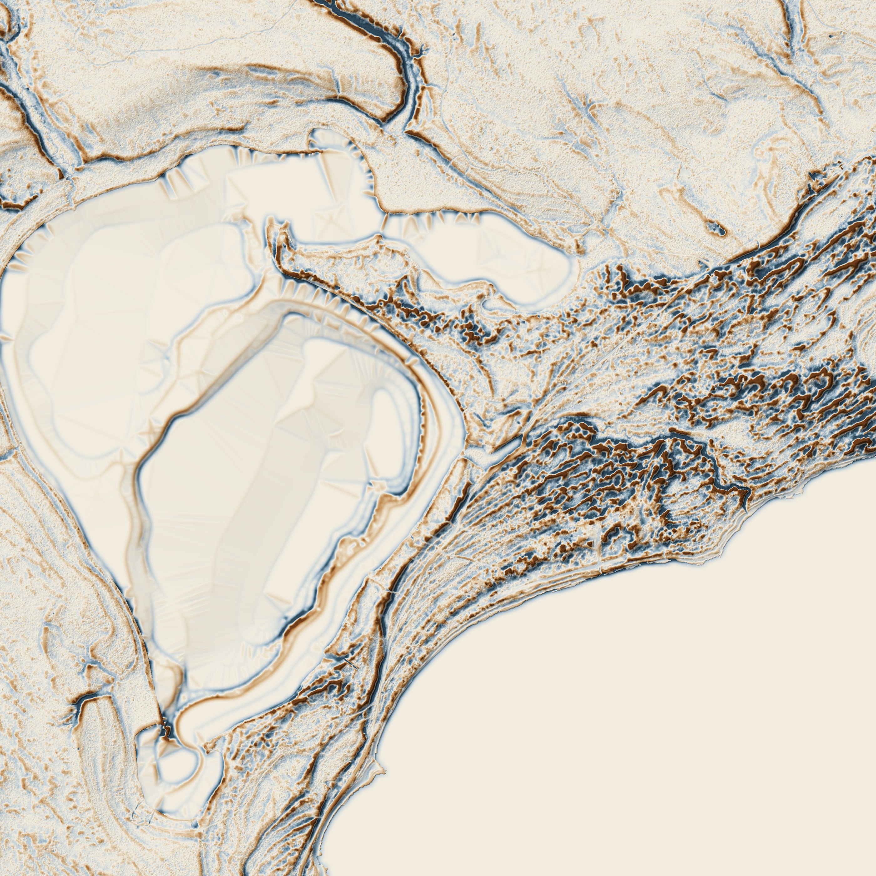
Cable's Creek, Nomad and Galilee
2,800 m across · elevation 170.2–201.8 m (31.7 m of relief) · 45.5965° N, 85.5290° W · posting 4 m, 2 m, 1 m
The south end where Cable's Creek runs from Lake Geneserath to Lake Michigan, holding three things at once: the lake Strang called Galilee, the mapped channel between them, and Nomad — Garrett Cole's sawmill settlement of about 1902 — on the shore at the eastern edge.
The USGS types that channel Canal/Ditch rather than stream, and it stops 26 m short of Lake Michigan. A marker at the creek records that James Cable settled here in 1852 to get away from James Strang, built a dock and ran a trading post, and that the place was renamed Galilee — a Historical Society reading, not a primary source. The blank flat filling the lake and the lower right is water: a bare-earth model carries it as one elevation, which is why it is the flattest thing here and its shore the sharpest edge.
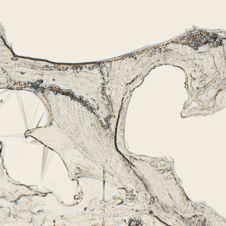
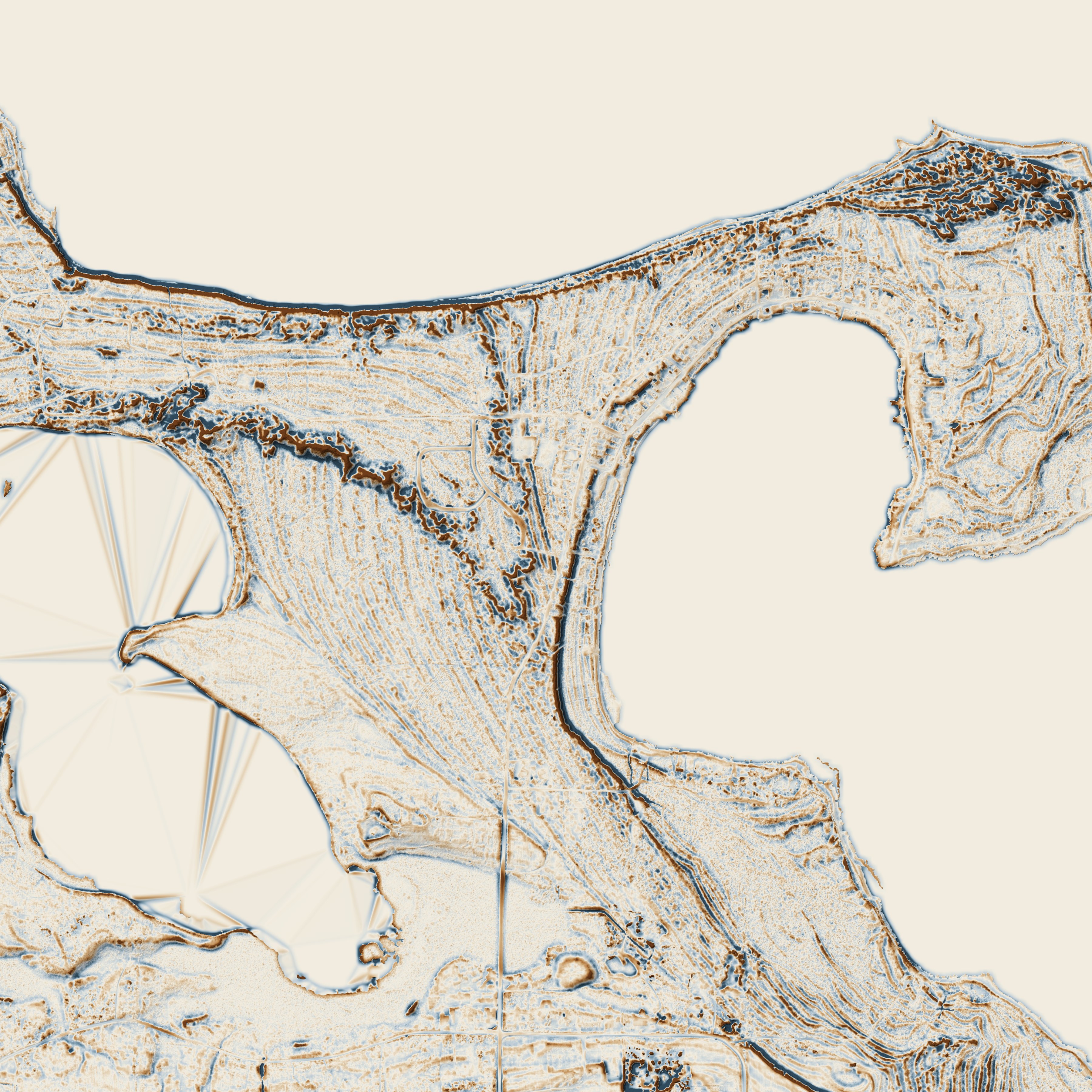
St James and the north end
3,600 m across · elevation 175.7–204.0 m (28.3 m of relief) · 45.7430° N, 85.5240° W · posting 4 m, 2 m, 1 m
St James and the north end: the harbour, Font Lake, and the most densely built ground on the island — 481 buildings and 31 km of road inside this frame, against 22 buildings between the three other detail frames put together.
And almost none of it is buildings, because this is a bare-earth model and bare-earth means the buildings have been classified away. What survives is the ground they stand on: the road grid, the cut and fill of the lots, the harbour works. Everything else you can see — the banded ridges wrapping the harbour, the flats — is deposited, not built. It is the best frame here for learning the difference before judging an anomaly somewhere emptier.
King's Highway at Hannigan's Road
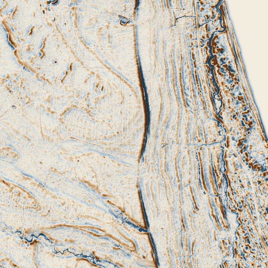
1,400 m across · elevation 191.7–210.1 m (18.4 m of relief) · 45.6596° N, 85.5270° W · posting 4 m, 2 m, 1 m
The control frame, centred on a junction the archive already holds. Two roads that are certainly there cross it: King's Highway running north–south, Hannigan's Road running east–west. Both are ordinary island roads on the ground — and neither is the raised prism you might expect in the model. Measured against the ground 12–25 m to either side, King's Highway sits about 0.06 m below it, a shallow cut rather than a crown, and Hannigan's Road is level with it to within a centimetre. What makes them read here is shape and continuity at 1 m posting, not height.
If those two do not read as roads in the view, the view is wrong. That is what this frame is for, and it is the thing to look at first, before believing anything the other three appear to show.
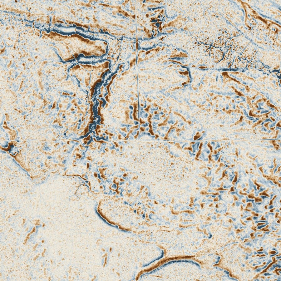
The unexplained north-south lane
1,400 m across · elevation 176.0–202.6 m (26.6 m of relief) · 45.6673° N, 85.5105° W · posting 4 m, 2 m, 1 m
A straight north–south line, unbroken across the full 1,400 m of the frame, in the island's north end. It crosses the banded ridge-and-swale ground of the frame's eastern half at an angle to the banding rather than along it.
Shown because it is unaccounted for, not because it is explained. A straight linear feature in a bare-earth model can be a road, a two-track, a fence line, a cleared line, a drainage cut, a logging skid or a seam between LiDAR flight lines, and nothing on this page tells those apart. The archive has not matched it to a record.
How this is drawn, and what it is not
The surface is the USGS 3DEP 1-metre bare-earth DEM for Charlevoix County, flown in 2018 at quality level 2 — the same file the atlas's hillshaded plates are drawn from. Each frame is cut from it in UTM zone 16N and normalised to its own elevation range, so a height value here is exact to the millimetre against the source: the encoding is elevation = minimum + raw ÷ 65,535 × range, and reconstructing the whole King's Highway frame that way and differencing it against the DEM gives a root-mean-square error of 0.6 mm.
Colour is the archive's local relief model: the surface minus a 15-metre box mean of itself, clipped at ±0.75 m and run through the cartography tokens' RELIEF ramp — blue where the ground sits below its neighbourhood, brown where it sits above, bare parchment at zero. Those are the identical tokens the print plates use. Shading is computed live from the height texture at its own posting, with the sun in the north-west at 45°, which is the archive's standing hillshade geometry.
Three postings are published per frame — 1 m, 2 m and 4 m. The coarse levels are block means, not every-nth-pixel decimation: a 3–8 m road prism sampled by decimation appears and disappears between levels, which would make the LOD swap itself look like evidence. The page loads the 4 m level first and upgrades to 1 m in the background, or on request.
What this is not. It is not a map of roads, and nothing here is a claim that a linear feature is one. A bare-earth model records the shape of the ground; what made a shape is a separate question that wants a document, a photograph or a visit. Vertical exaggeration makes every slope steeper than it is — a 0.4 m prism at ×6 looks like an embankment and is not one. Elevations are metres above the DEM's vertical datum as delivered, not a survey.
USGS 3DEP (public domain). Relief model and rendering: Beaver Island Archive.