

- Built
- c. 1900
- Until
- 1965-02-08
- Coordinates
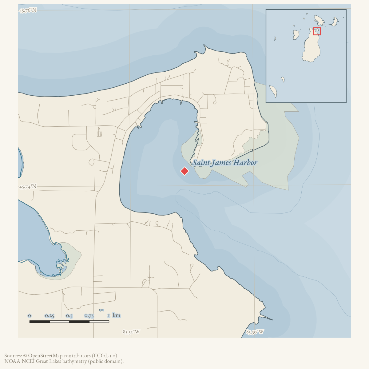
- 45.7517° N, 85.5150° WGoogle Maps: Gallagher DockDownload KML
- Eras
- Modern era
- Concepts
- maritimefishingshippingheritageeconomy
- Within
- Saint James Harbor
Summary
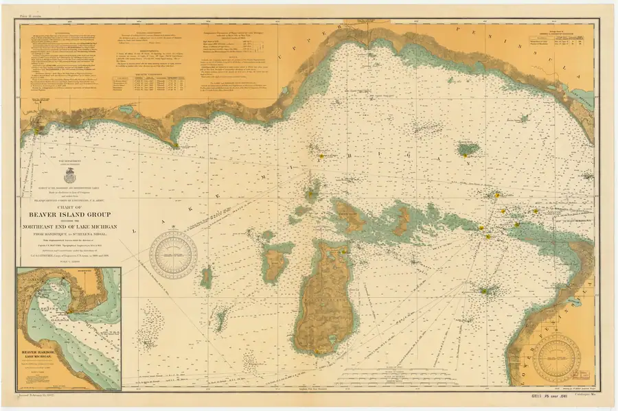
The Gallagher Dock was a Saint James harbor fishing and yacht dock. A 1907 U.S. Army Corps of Engineers chart labels “Gallagher Dock” in the Beaver Harbor inset, establishing a date-bounded mapped-name and harbor-context attestation. It does not identify an owner, construction date, exact legal footprint, or a modern shoreline correspondence. A February 1965 Beaver Beacon retrospective places construction at the turn of the twentieth century: it says the Roe Brothers built it on more than 250 pilings; Booth Fisheries later bought it and rebuilt it on the original pilings in 1917; and “Young” James Gallagher bought it from Booth in 1933.
The source says the dock was demolished on February 8, 1965, when Jewell Gillespie’s truck winch pulled down the shed to make room for expansion of the Yacht Dock. The article remembers the dock as a center for large commercial fishing-tug landings, while preserving the source’s retrospective and incomplete character.
Fishing and boating history
The account says fish were once measured in tons rather than pounds and remembers catches of lake trout, whitefish, and perch. It identifies the Shamrock as the steam tug associated with the largest remembered catch, more than eight tons of lake trout, brought in by James “Shing” Martinson. The retrospective also describes how catches were handled at the dock: trout were cleaned for packing with the heads cut off and fed to gulls that followed the boats, but the cheeks — described as a solid piece of meat on each side of the upper jaw — were saved, and island women canned them for winter meals.
The account names the tugs it remembers calling the dock home: the Silver Moon, La Fond, C & C, Silvia S., Agnes S., A & M Link, Nautilus, Two Sisters, Catherine B., Gypsy, Shirley G., Meadow Mac, Lillian Mae, Silver Star, Lady Agnes, Elliot, Shamrock, Evelyn, Estonia, Irene, Elizabeth G., William J., Panther and Sidonia, along with boats from High Island: Little Joe’s Margaret, Nanigaw’s Sea Gull, Alec Cornstalk’s Stella, Jack Anthony’s Sarah, Paul Kenwabikise’s Whitefish and Pete Napont’s Elizabeth. The source supplies no registries, dimensions, ownership records, or individual service dates for any of them.
By the time of the 1965 demolition the dock had also become the island’s yacht dock: the account says pleasure boaters visiting before 1960 knew “Young” James Gallagher as their host there, alongside his continued fish buying from the dwindling number of tugs still working and his own farm.
The retrospective records two storm episodes. In the mid-1930s a severe ice shove driven by a hard southeaster nearly wrecked the dock, requiring extensive repair to keep it in service. In the early 1950s high water threatened to float the deck off its pilings, and Gallagher hauled tons of rock onto the dock to hold it down until the water receded.
Evidence and limits
This article treats the dock’s dates and ownership sequence as a local retrospective attestation, not a deed history. The 1907 chart is a navigational map and supports only the dock’s displayed label and mapped harbor setting at that date. The plan printed with the 1965 story shows areas to be dredged, an existing dock to be removed, and new construction for the Seaker Island Boat Company, but it does not provide a surveyed location or establish the legal relationship among every dock label.
Open questions
- Can deeds, harbor plans, or photographs establish the dock’s exact footprint and the Roe Brothers’ identity?
- What records reconcile the “Allen’s (Gallagher) Dock” label with the later Gallagher ownership description?
- Which of the named fishing tugs can be matched to vessel registries or other local records?
See also
The dated record
Sources
- Direct visual reading of the held chart’s Beaver Harbor inset: it labels “Gallagher Dock” on the west side of the harbor. The chart supports a 1907 mapped-name and harbor-context attestation, not ownership, construction, legal footprint, or correspondence to a present-day shoreline.federal · noaa_charts · images · 1907_CHART-OF-BEAVER-ISLAND-GROUP-INCLUDING-THE-NORTHEAST-END-OF-LAKE-MICHI_LC0000Ma_02_1907_LS
- Says the dock was built at the turn of the century by the Roe Brothers on more than 250 pilings, rebuilt on the original pilings in 1917 after Booth Fisheries bought it, bought by “Young” James Gallagher in 1933, and demolished on February 8, 1965 to make room for Yacht Dock expansion. Also describes trout-cleaning and cheek-canning practice at the dock, the dock's later role hosting pleasure boaters as the island's yacht dock, and two storm episodes (a mid-1930s ice shove and early-1950s high water). It preserves a retrospective list of fishing tugs but gives no survey, deed, coordinates, or complete ownership chronology.data1 · beaver-island-archive · beaver_beacon · 1965-02_Beaver-Beacon
- The held eight-page issue scan is paired with the OCR source and confirms the published notice or report; it does not expand the source-specific identity, event, or outcome claims.data1 · beaver-island-archive · scans · beaver_beacon · issues · 1965-02_Beaver-Beacon
- The current Gallagher Street endpoint at approximately -85.514951, 45.751746 is used as a modern shoreline proxy for the chart-described west-side harbor location; it is not evidence that the demolished historical dock occupied the same footprint.osm · roads
- The plan places a maintained boat-launch easement at the end of Gallagher Street, west of Beaver Island Municipal Marina North, providing a present-day reference for the west-side harbor area but not historical dock continuity.planning · beaver_island_master_plan · 2024-2028-beaver-island-recreation-plan-fa1f69af

Added 1 August 2026 · revised 9 August 2026. Recent changes
Cite this article
Beaver Island Archive, “Gallagher Dock”, https://beaverislandarchive.org/structures/gallagher-dock-1900-1965/, accessed [date], citing U.S. Army Corps of Engineers / NOAA Historical Map & Chart Collection, “Chart of Beaver Island Group,” LSMa, issued February 15, 1907, Beaver Harbor inset. (and 4 further sources listed on the page).
Last revised 2026-08-09. Fill in [date] with the date you read it — this page is static and cannot know that.