

- Along road
- Mrs Redding Trail
- Coordinates
- 45.6800° N, 85.5756° WGoogle Maps: Sarah A. Martin Nature PreserveDownload KML
- Eras
- Modern era
- Concepts
- conservationenvironmentrecreation
- Within
- Beaver Island
Summary
Sarah A. Martin Nature Preserve is a Little Traverse Conservancy preserve identified in the 2023 Beaver Island Master Plan as a 106-acre working-forest reserve on Mrs. Redding’s Trail. The Conservancy’s Beaver Island preserves flyer lists the same preserve among its public nature preserves.
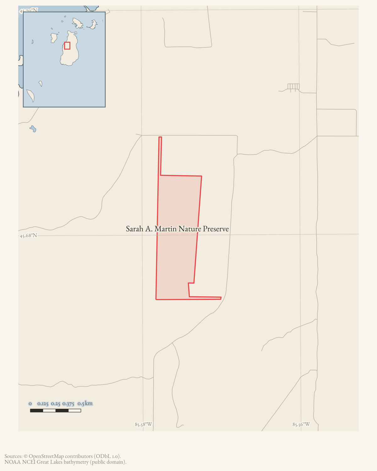
The OSM polygon supplies a current mapped representation and places the preserve along the Mrs. Redding Trail corridor. Neither the planning table nor the map establishes a deed, exact acreage today, legal boundary, or access easement.
Maps for this place
These Atlas plates provide regional context. They do not establish a precise boundary, current ownership, access right, operating status, or field condition.
- EnvironmentSoils, wetlands, hydrography, and terrain
- GeologyGeneralized geology and landforms
- HydrologyMapped water and wetland context
- AccessMapped routes, facilities, and protected areas
- Land surveyPLSS geometry and historic GLO patent-location context
Sources
- Lists Sarah Martin Forest Preserve on Mrs. Redding’s Trail as a 106-acre Little Traverse Conservancy working-forest reserve with public access. The table does not provide a deed or surveyed boundary.planning · beaver_island_master_plan · 2023-beaver-island-master-plan-fe5d5c6b
- Lists Sarah A. Martin Nature Preserve among the Conservancy’s Beaver Island preserves. The flyer is a public-information map, not a title or boundary survey.maps · cited · landtrust.org · Beaver-Island-Regional-Flyer
- OSM way 995235174 is tagged as a nature-reserve polygon. Its current geometry overlaps the mapped Mrs Redding Trail corridor; that spatial relation does not establish a legal access easement.osm · protected_areas
Added 2 August 2026. Recent changes
Cite this article
Beaver Island Archive, “Sarah A. Martin Nature Preserve”, https://beaverislandarchive.org/places/sarah-a-martin-nature-preserve/, accessed [date], citing Beaver Island Master Plan (2023), protected-land inventory. (and 2 further sources listed on the page).
Last revised 2026-08-02. Fill in [date] with the date you read it — this page is static and cannot know that.
BibTeX for “Sarah A. Martin Nature Preserve”RIS for “Sarah A. Martin Nature Preserve”