

- Along road
- Old Church Crest Road · East Side Drive
- Coordinates
- 45.7265° N, 85.5221° WGoogle Maps: Old Rectory Real Estate Partnership tractDownload KML
- Eras
- Modern era
- Concepts
- land-surveyland-uselegal-instrument
- Within
- Beaver Island
Summary
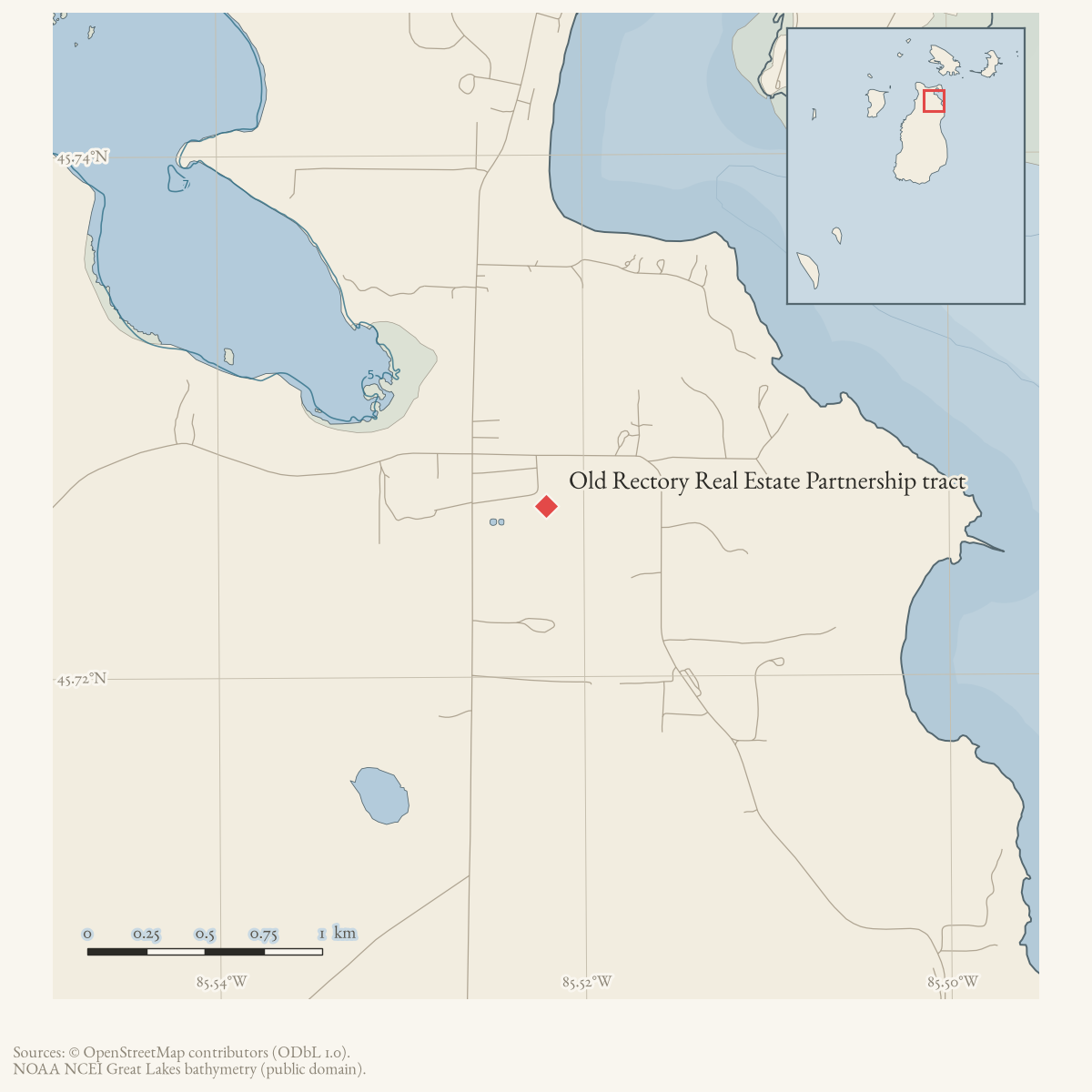
A July–August 2003 Charlevoix Courier legal notice described a 17.682-acre tract in Peaine Township associated with Old Rectory Real Estate Partnership. The metes-and-bounds description follows the center line of Old Church Crest Road and then the south line of East Side Drive before returning to the point of beginning.
This record preserves the legal description as a source-bounded land lead. It does not provide a surveyed polygon, complete title chain, current ownership, or proof that the tract is identical to any present business or structure.
Open questions
- Can the legal description be joined to the current county parcel layer?
- What was the relationship between this tract, the Old Rectory, and Circle M?
- Do recorded deeds or court files clarify the notice’s legal proceeding?
Maps for this place
These Atlas plates provide regional context. They do not establish a precise boundary, current ownership, access right, operating status, or field condition.
- EnvironmentSoils, wetlands, hydrography, and terrain
- GeologyGeneralized geology and landforms
- HydrologyMapped water and wetland context
- AccessMapped routes, facilities, and protected areas
- Land surveyPLSS geometry and historic GLO patent-location context
Sources
- A participant asked whether the former Rectory would reopen; Connaghan replied that a reported sale had fallen through because of red tape. This is local recollection, not a deed or formal business record, but it conflicts with the November 2004 claim that Bud Martin had purchased the property; ownership and commercial use remain unresolved.forum · www.beaverislandforum.com · 00 · t000150
- Karen, Kathleen, and participants, “the rectory,” Beaver Island Forum, November 24–December 3, 2004.The discussion describes the former Rectory as a restaurant/pub and repeats an unverified claim that Bud Martin had recently purchased it; another participant explicitly distinguishes it from the Holy Cross parish rectory and directs genealogical inquiries to the parish. This is community recollection and confusion, not title evidence, but it supports preserving the relationship between the Old Rectory name and later commercial use as unresolved.forum · www.beaverislandforum.com · 00 · t000253
- Current parcels 012-234-006-40 (14.0 acres) and 012-234-006-30 (4.0 acres), both on Old Church Crest Road and both held by Bud Martin Properties LLC in the snapshot, begin at the same East quarter/East 1/8-line reference and together reproduce the 718.17-foot westward segment in the 2003 legal description (482.91 + 235.26 feet). Their acreage and current parcel subdivision do not exactly reproduce the notice’s 17.682 acres, so the coordinate is an acreage-weighted representative of the two-parcel candidate, not a surveyed historic boundary or title determination.county · charlevoix · parcels_arcgis · 2026-08-01 · island_parcel_attributes
- Charlevoix Courier, July–August 2003, legal notice 210.The legal notice describes a 17.682-acre tract in Section 34, T39N R10W, associated with Old Rectory Real Estate Partnership. Its metes-and-bounds description follows Old Church Crest Road and then East Side Drive. This is a published legal notice, not a complete deed, title chain, current parcel layer, or proof that every described boundary remains unchanged. No public copy of this file is known; the archive holds one and can provide it on request.
Added 2 August 2026. Recent changes
Cite this article
Beaver Island Archive, “Old Rectory Real Estate Partnership tract”, https://beaverislandarchive.org/places/old-rectory-17-acre-tract-2003/, accessed [date], citing Natedogg and Rory Connaghan, “The old Rectory,” Beaver Island Forum, April 14, 2004. (and 3 further sources listed on the page).
Last revised 2026-08-02. Fill in [date] with the date you read it — this page is static and cannot know that.
BibTeX for “Old Rectory Real Estate Partnership tract”RIS for “Old Rectory Real Estate Partnership tract”