

- Intersects
- Bay Street · Bonner Street · Forest Avenue · Frankie Lane · Freesoil Road · Gallagher Street · Michigan Avenue
- Coordinates
- 45.7493° N, 85.5166° WGoogle Maps: Main StreetDownload KML
- Eras
- Modern era
- Concepts
- transportationtoponymy
- Within
- Beaver Island archipelago
Summary
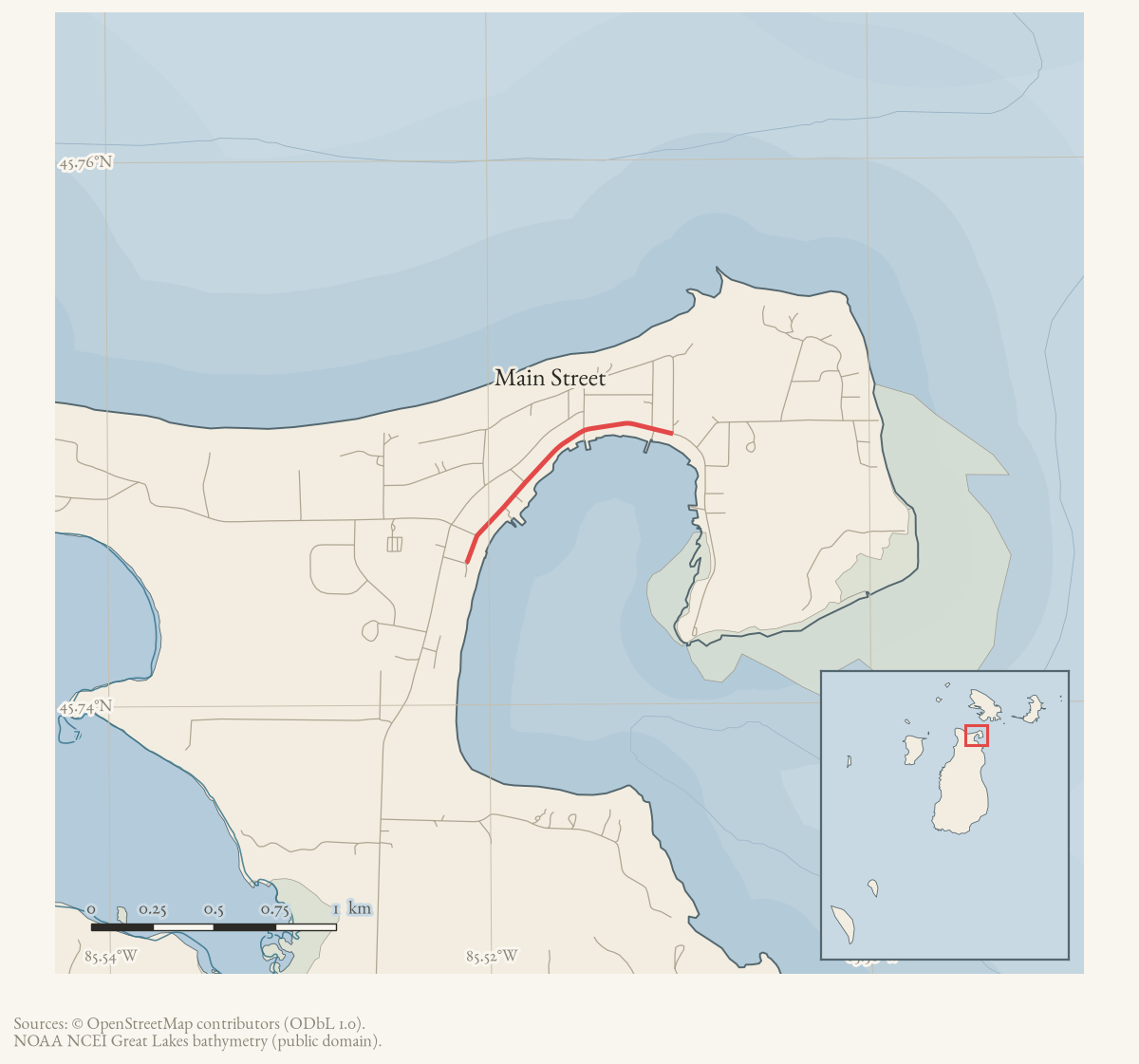
Main Street is a named road on Beaver Island’s current OpenStreetMap map. The
two held ways carrying that name are merged here into one route geometry of
about 1.1 km. It meets seven other named roads, listed under
intersects_road.
Evidence and limits
The name and the alignment are what mappers last entered, and OpenStreetMap is
volunteered work rather than a survey: it settles neither the right-of-way nor
who maintains the road. Where the name came from is a separate question. Plats,
road-commission minutes, and island memory answer that one. Put an older
spelling from any of them into alt_names or former_names, with the source
that attests it.
Open questions
- The county abandoned the Main Street segment “through several properties” south of Bonner Street around 1984, after property owners opposed improvement — was that segment ever later re-opened, improved, or formally vacated, and does the current mapped alignment include or exclude it?
- Main Street’s own naming history is undocumented here — was it always called Main Street, or does an earlier plat or Strang-era source give the street a different name, as with other island streets renamed after 1856?
- The 1961 “face-lifting” widened Main Street between King Strang Dock and the Killarney Inn — do those two landmarks correspond to identifiable locations today, and can the 1961 project’s extent be traced along the current road?
If you can answer any of these, or correct anything above, the archive wants to hear it — see Corrections.
Documented associations
These source-backed records provide context for the mapped route:
- St. James Township Trail Master Plan map, 2002 — This retained St. James Township schematic map labels a Trail Master Plan for Beaver Island. Its legend distinguishes several depicted trail categories from a red “Proposed Donegal Bay Trail Proposed 2002” alignment. The map therefore records a planning proposal and a contemporary way of representing the local trail network; it does not prove a…
- Beaver Island home sale and resident moves reported, 1962 — The June 1962 Beaver Beacon reports two changes in island residence. Gus and Mrs. Sendenburgh sold their Main Street home to Olin and Mrs. Wanty of Ypsilanti and moved to St. Ignace; the Wantys were identified as owners of the King Strang Hotel. Dora and Don Welke moved to Wixom after Don accepted a position.
- Beaver Island begins a Main Street face-lifting project, 1961 — The April 1961 issue describes a visible “face-lifting” of Beaver Island’s Main Street: widening between King Strang Dock and the Killarney Inn and preparation of a harbor-side fence using cedar posts. The same notice records demolition of an old ice house and the Carroll-Shoemaker farm barn. It preserves contemporary change to the built landscape without…
- St. James Township declines to improve Main Street south of Bonner Street, 1984 — In January 1984, St. James Township considered improving the portion of Main Street south of Bonner Street shown as a right-of-way on a section map. The minutes report that the County Road Commission had abandoned the segment through several properties and that affected property owners opposed improvement. The township voted not to improve it at that time…
- Mort Neff films Beaver Island Dawn Patrol and Parish Hall fire, 1961 — Mort Neff filmed the 1961 Dawn Patrol and Parish Hall fire for the Michigan Outdoors television program, then returned to film the new golf course and Main Street and interview John W. Greene. The Beacon says the film was shown on the program.
- Mort Neff — Mort Neff (1903–1990) was identified in August 1961 as the Michigan Outdoors broadcaster who filmed Beaver Island’s Dawn Patrol, Parish Hall fire, golf course, Main Street, and an interview with John W. Greene.
Research status
The local newspaper and website corpus contains exact-name mentions in 2462 file(s). Those files are research leads; the relation layer is added only when the surrounding source text establishes that the record involves this road.
Maps for this place
These Atlas plates provide regional context. They do not establish a precise boundary, current ownership, access right, operating status, or field condition.
- EnvironmentSoils, wetlands, hydrography, and terrain
- GeologyGeneralized geology and landforms
- HydrologyMapped water and wetland context
- AccessMapped routes, facilities, and protected areas
- Land surveyPLSS geometry and historic GLO patent-location context
Sources
- Current mapped road name 'Main Street'; grouped OSM way ids: 17757862, 265412088. This is a volunteered map record, not a surveyed right-of-way or proof of historical naming.osm · roads
Added 2 August 2026. Recent changes
Cite this article
Beaver Island Archive, “Main Street”, https://beaverislandarchive.org/places/main-street/, accessed [date], citing OpenStreetMap contributors, roads via Overpass API, retrieved 2026-08-01 (ODbL 1.0)..
Last revised 2026-08-02. Fill in [date] with the date you read it — this page is static and cannot know that.