

- Along road
- Lookout Drive
- Coordinates
- 45.7533° N, 85.5037° WGoogle Maps: Lookout PointDownload KML
- Eras
- Modern era
- Concepts
- maritimeheritageconservationtourismenvironmentgeologysoilsdunesvegetationplantstreeswildlifeanimalsstewardshipinvasive-species
- Within
- Beaver Island
Summary
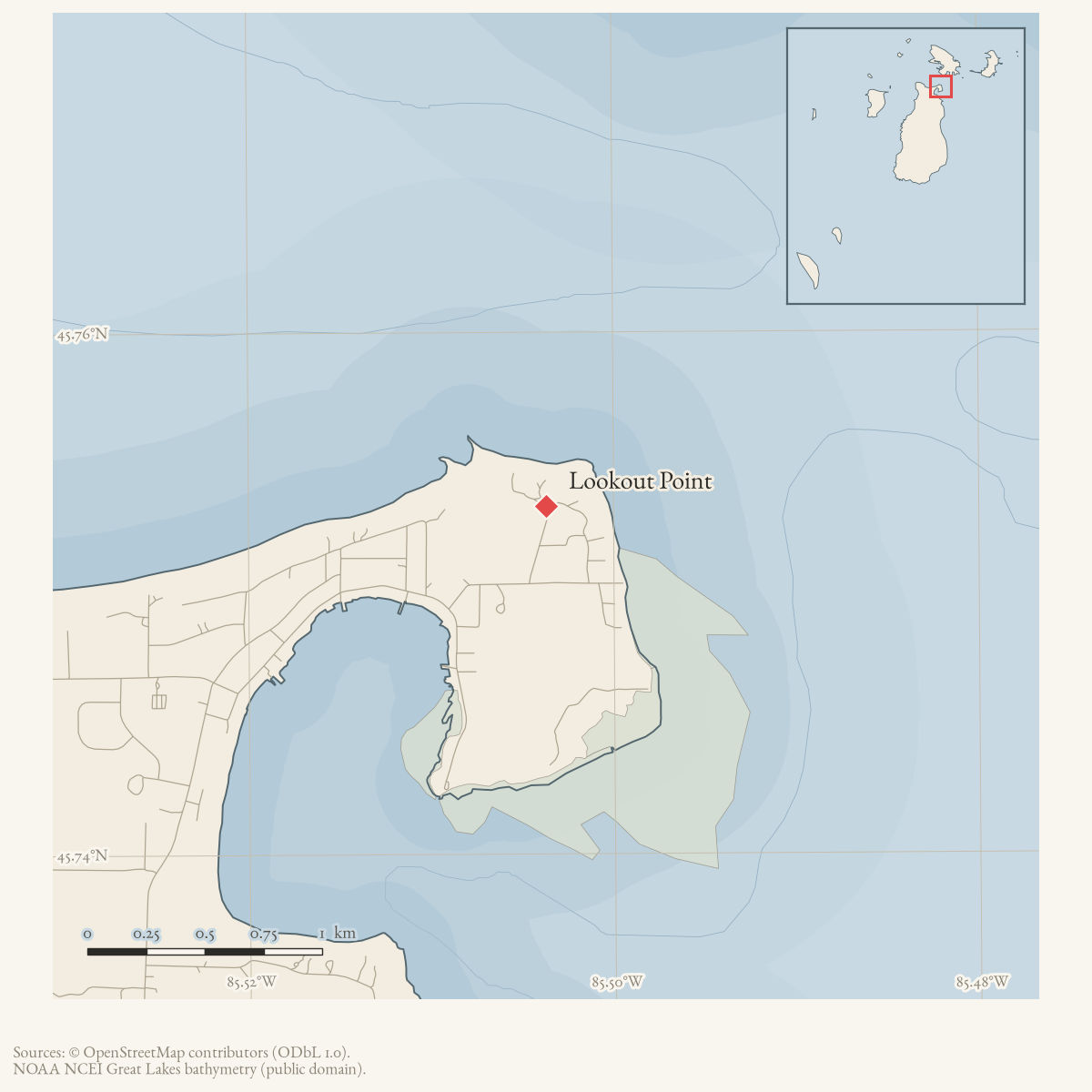
Lookout Point is a GNIS-named cape on Beaver Island. A July 2025 local-history account identifies a high point by Lookout Drive as the former site of a Coast Guard lookout tower with views toward Lake Michigan. It says Coast Guard personnel manned the tower daily with binoculars until the Mackinac Bridge was completed, and that paths between the tower and the station at Whiskey Point were formed by repeated foot patrols.
The same account connects the point to the George and Althea Petritz Nature Preserve. It reports that the small tower was later used as a playhouse and was eventually placed at Heritage Park, but the article presents this as local recollection rather than an official Coast Guard inventory. The 2015 Charlevoix Courier separately lists the preserve as a 28-acre Beaver Island birding site.
The 1978 Historical Map labels a “C. G. Lookout Tower—until 1974” in this vicinity. That date is not independently established: the 2025 account says daily manning ended by the Mackinac Bridge’s completion, while a 2012 account recalled the tower disappearing about thirty years earlier. These may describe different milestones. See Beaver Island Coast Guard lookout tower for the source-separated structure history.
Ecological profile
MNFI Report 2017-11 records a 21-acre open-dune occurrence at Lookout Point (EO 6701, rank CD, G3/S3; p. 112), extending for about a mile along Beaver Island’s northern shore. Fine-textured wind-blown and wave-worked sands are alkaline around pH 8.0. Sand reed grass, plains puccoon, wormwood, white camas, Gillman’s goldenrod, wheat grass, milkweed, Pitcher’s thistle, and Lake Huron tansy occur in the dunes. Bearberry, creeping juniper, sand cherry, and common juniper dominate low shrubs, with scattered white pine and several willow species.
Interdunal wetland inclusions contain Baltic rush, shrubby cinquefoil, and Kalm’s lobelia. MNFI also noted bare sand, residential devegetation, foot-traffic erosion, spotted knapweed, bladder campion, white sweet-clover, and bluegrasses in the shoreline flats. It recommends invasive-species monitoring and limiting human traffic to sanctioned trails. The source-defined occurrence is not a current legal boundary, preserve survey, complete plant or bird inventory, or present-condition assessment.
Open questions
- What Coast Guard records establish the tower’s construction, service dates, staffing, and removal?
- Is the building now at Heritage Park demonstrably the former Lookout Point tower, and when was it moved?
- What survey or preserve documents define the boundary between Lookout Point and the Petritz preserve?
Sources
- GNIS feature 1618183; feature class 'Cape'.federal · gnis · gnis_names
- Marilyn Clark Duda, "Petritz Preserve Paths," *Northern Light*, July 2025.Local history account places a Coast Guard lookout tower on the high point at Lookout Point, describes daily manning with binoculars before the Mackinac Bridge, and records paths between Whiskey Point and the tower. No public copy of this file is known; the archive holds one and can provide it on request.
- Charlevoix Courier, January 2015, "Beaver Island businesses gearing up for fall tourism."Lists the George and Althea Petritz Preserve among Beaver Island birding sites and identifies it as a 28-acre Little Traverse Conservancy preserve. No public copy of this file is known; the archive holds one and can provide it on request.
- Project-generated MNFI 2017 soil, vegetation, and wildlife crosswalk, preserving MNFI Report 2017-11, Lookout Point open dunes occurrence (EO 6701), report p. 112.Described in this archive: MNFI soil, vegetation, tree, and wildlife crosswalk, 2017.The 21-acre record is a source-defined open-dune occurrence along about a mile of northern Beaver Island shore; it is not a current legal boundary, ownership determination, or complete survey. No public copy of this file is known; the archive holds one and can provide it on request.research · island_farming · crosswalks · mnfi_soil_vegetation_wildlife_crosswalk
- Visual page evidence held with provenance sidecar; the image anchors the occurrence description and does not establish modern geometry or current condition.research · island_farming · evidence · mnfi-report-2017-11-page-0112-lookout-point-open-dunes
Added 28 July 2026 · revised 3 August 2026. Recent changes
Cite this article
Beaver Island Archive, “Lookout Point”, https://beaverislandarchive.org/places/lookout-point/, accessed [date], citing U.S. Geological Survey, Geographic Names Information System, Domestic Names (Michigan), retrieved 2026-07-28. (and 4 further sources listed on the page).
Last revised 2026-08-03. Fill in [date] with the date you read it — this page is static and cannot know that.