

- Coordinates
- 45.7291° N, 85.5558° WGoogle Maps: Green SwampDownload KML
- Eras
- Modern era
- Concepts
- environmentwetlandsgeologylumbering
- Within
- Beaver Island
Summary
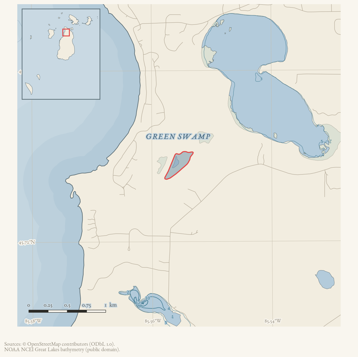
Green Swamp is a named Beaver Island interior feature whose classification is not settled by the held datasets. GNIS feature 627337 calls it a Lake, while the matching OSM way uses the same GNIS identifier and maps the feature as a wetland/bog. The name itself points toward the latter description, but this article does not silently override the federal feature class.
The current evidence establishes a named, mapped feature and a useful research conflict. It does not establish the feature’s hydrology, seasonal water regime, area, ownership, or historical use in the lumbering economy.
Open questions
- Is Green Swamp a permanently or seasonally inundated lake, a bog, or a wetland containing a small open-water feature?
- Which topographic maps, NHD records, soil survey units, or field studies explain the GNIS “Lake” classification?
- Did historical roads, logging, or fire records use Green Swamp as a named landmark?
Sources
- GNIS feature 627337; feature class 'Lake'. The official feature class conflicts with the feature's name and with the current OSM wetland mapping below; the article preserves the discrepancy.federal · gnis · gnis_names
- The mapped way carries GNIS feature ID 627337, name “Green Swamp,” natural=wetland, and wetland=bog. This is a present-day volunteered geographic representation, not an independent hydrologic survey.osm · water
- The regional geology layer is held as context for the island's wetland and surficial-deposit setting; it does not isolate or date Green Swamp itself.geology · vector · mi_quaternary_geology
Added 28 July 2026 · revised 1 August 2026. Recent changes
Cite this article
Beaver Island Archive, “Green Swamp”, https://beaverislandarchive.org/places/green-swamp/, accessed [date], citing U.S. Geological Survey, Geographic Names Information System, Domestic Names (Michigan), retrieved 2026-07-28. (and 2 further sources listed on the page).
Last revised 2026-08-01. Fill in [date] with the date you read it — this page is static and cannot know that.