

- Along road
- Donegal Bay Road · Font Lake Road
- Coordinates
- 45.7467° N, 85.5480° WGoogle Maps: Font Lake Boat LaunchDownload KML
- Eras
- Modern era
- Concepts
- transportationrecreationenvironment
- Within
- Beaver Island
Summary
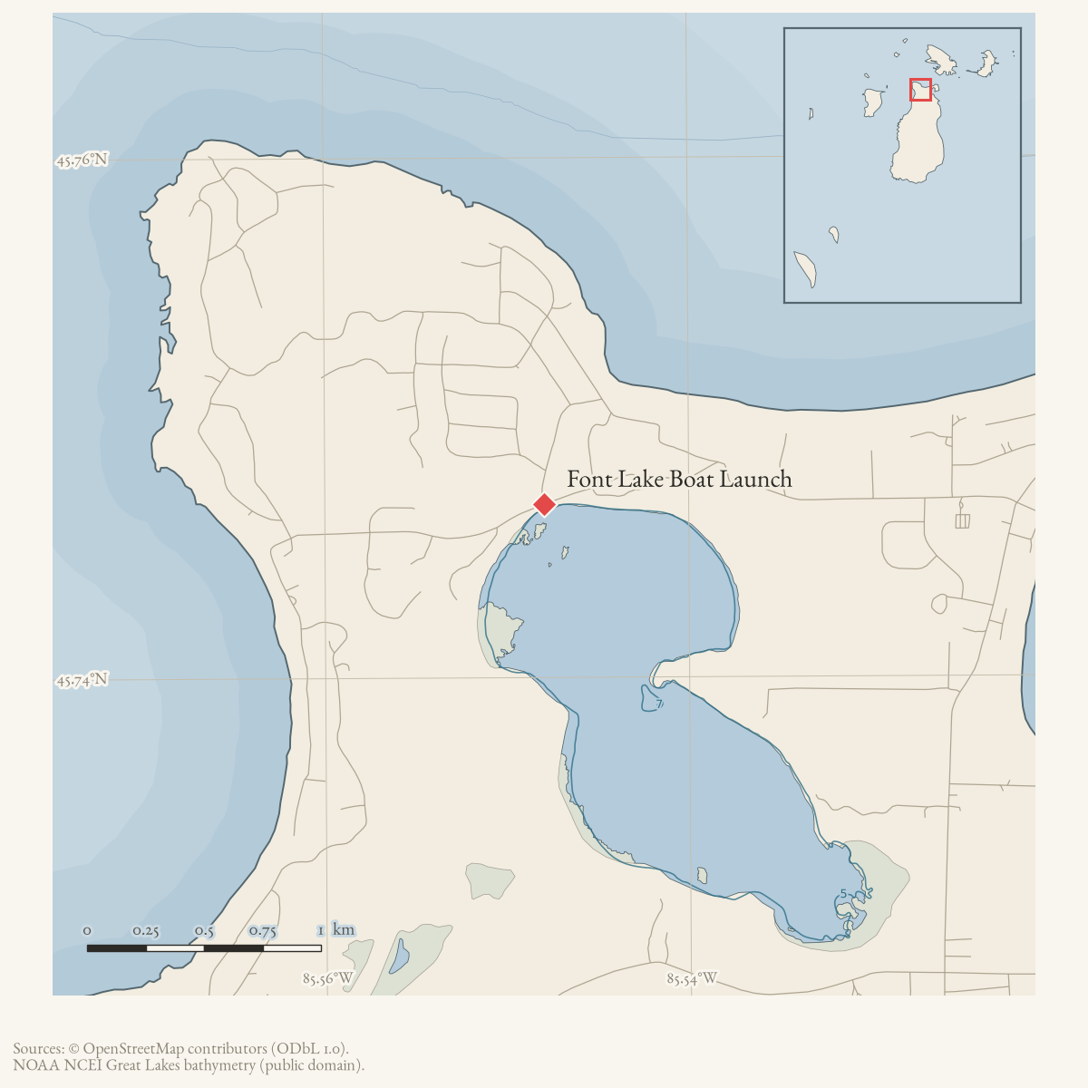
The Font Lake Boat Launch is an access point identified in Peaine Township’s 2024–2028 Recreation Plan. The plan places it on Donegal Bay Road, directly across from Font Lake Road, and says vehicles and trailers are parked on Font Lake Road in a widened berm. A nearby Port St. James common-property parcel provides ownership and subdivision context, but does not establish that it contains the launch or parking area. The record therefore links the access site to both roads while keeping its exact footprint unresolved.
Evidence and limits
The plan and a 2021 statement from the Port of St. James Association attribute the launch area to the association, although the forum thread preserves conflicting user claims about township versus association ownership. The plan attributes ownership to the Port of St. James and describes boating limits related to Font Lake’s shallow water, loon nesting, and floating vegetative mats. It does not supply a deed, easement, launch coordinates, construction history, or current inspection/access status.
Open questions
- What parcel or easement record defines the launch and parking area?
- When was the launch established, and is the Port of St. James still the owner?
- Can current map or site records resolve the launch footprint?
Maps for this place
These Atlas plates provide regional context. They do not establish a precise boundary, current ownership, access right, operating status, or field condition.
- EnvironmentSoils, wetlands, hydrography, and terrain
- GeologyGeneralized geology and landforms
- HydrologyMapped water and wetland context
- AccessMapped routes, facilities, and protected areas
- Land surveyPLSS geometry and historic GLO patent-location context
Sources
- Road-intersection point used as an approximate access proxy because the recreation plan places the launch directly across from Font Lake Road; it is not a surveyed launch boundary or parking footprint.osm · roads
- The plan says the Font Lake Boat Launch is owned by the Port of St. James, lies on Donegal Bay Road roughly two miles from St. James Harbor directly across from Font Lake Road, and that vehicles and trailers are parked on Font Lake Road in a widened berm. The plan does not provide a surveyed launch boundary, coordinates, easement instrument, construction date, or current operating condition.planning · beaver_island_master_plan · 2024-2028-beaver-island-recreation-plan-fa1f69af
- PIN 013-702-000-25 is a 0.3-acre Port St. James Association common-property parcel labeled “private park A” and associated with Font Lake. It is near the road-to-water proxy and is useful ownership/subdivision context, but the snapshot does not prove that this parcel contains the launch or the Font Lake Road parking berm; the displayed point remains the plan-described road intersection.county · charlevoix · parcels_arcgis · 2026-08-01 · island_parcel_attributes
- The thread contains conflicting user claims about whether Font Lake access was township-owned or private. The association treasurer’s first-party clarification said the canoe-launch area at Font Lake Road and Donegal Bay Road was Port St. James Association property, while township property lay east of it; he said PSJA had no plans to limit public use and had the location on a list for further development. This clarifies the association’s position but is not a deed or easement instrument.forum · www.beaverislandforum.com · 16 · t016472
- These duplicate threads preserve the same user dispute over Donegal Bay and Font Lake access, including the township-versus-PSJA claims. They are linked as duplicate forum structure, not treated as independent title evidence.forum · www.beaverislandforum.com · 16 · t016470
- These duplicate threads preserve the same user dispute over Donegal Bay and Font Lake access, including the township-versus-PSJA claims. They are linked as duplicate forum structure, not treated as independent title evidence.forum · www.beaverislandforum.com · 16 · t016471
- Three duplicate user topics reported that the access looked mowed, old boats had been removed, and trees had been trimmed. They provide a dated condition snapshot, not proof of ownership, public rights, maintenance responsibility, or a surveyed launch footprint.forum · www.beaverislandforum.com · 16 · t016727
- Three duplicate user topics reported that the access looked mowed, old boats had been removed, and trees had been trimmed. They provide a dated condition snapshot, not proof of ownership, public rights, maintenance responsibility, or a surveyed launch footprint.forum · www.beaverislandforum.com · 16 · t016728
- Three duplicate user topics reported that the access looked mowed, old boats had been removed, and trees had been trimmed. They provide a dated condition snapshot, not proof of ownership, public rights, maintenance responsibility, or a surveyed launch footprint.forum · www.beaverislandforum.com · 16 · t016729
Added 2 August 2026 · revised 6 August 2026. Recent changes
Cite this article
Beaver Island Archive, “Font Lake Boat Launch”, https://beaverislandarchive.org/places/font-lake-boat-launch/, accessed [date], citing OpenStreetMap, Font Lake Road and Donegal Bay Road features, downloaded 2026-08-06. (and 5 further sources listed on the page).
Last revised 2026-08-06. Fill in [date] with the date you read it — this page is static and cannot know that.
BibTeX for “Font Lake Boat Launch”RIS for “Font Lake Boat Launch”