

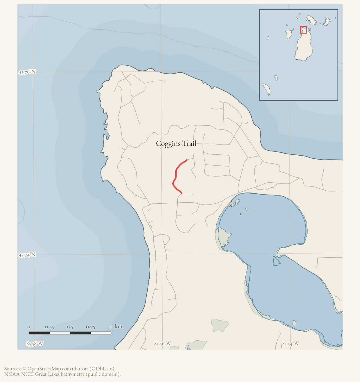
- Along road
- White Birch Road · Woodridge Court
- Coordinates
- 45.7485° N, 85.5577° WGoogle Maps: Coggins TrailDownload KML
- Eras
- Modern era
- Concepts
- trailstransportationrecreationtoponymy
- Within
- Beaver Island
Summary
Coggins Trail is a current mapped trail near the northwestern St. James road network. The held OSM line meets White Birch Road and Woodridge Court, providing the first structured cross-links for those access points.
No held source identifies the trail’s namesake, construction date, or legal access status. This is a clean negative finding rather than an oversight: the corpus was searched and nothing was found.
The route
Mapped only. OpenStreetMap way 1082059866 is the only record of this route; no township trail guide, recreation plan, or newspaper account mentions it under this name, and the archive holds no walked GPS track here.
Access and ownership
No source establishes ownership or a legal access status for this route. Its mapped intersections are with two residential ways — White Birch Road and Woodridge Court — in an area of platted subdivision lots, which suggests but does not establish that the trail crosses private residential land. No motorized-use designation is documented, and there are no designated public ORV trails on Beaver Island in any case.
Evidence and limits
The entire record for this route is a single volunteered OpenStreetMap way. Nothing else in the archive’s newspaper, township, or website corpus was found to name a “Coggins Trail.” A December 1986 Beaver Beacon report of an airport-extension dispute names a Donald Coggin as the owner of a seasonal home on Beaver Island — the one confirmed instance of the surname attached to island property found in this pass — but nothing in that report or elsewhere connects him, or any Coggin family, to this trail. The connection is recorded here as unconfirmed and should not be treated as established.
Open questions
- Who is the trail named for? A Donald Coggin is documented as an island property owner in 1986, but no source ties him or any Coggin family to this route; a plat, deed, or family recollection would settle it.
- When was the trail cut, and by whom?
- Is the trail on private residential land, and if so, is public use permitted or merely untested?
If you can answer any of these, or correct anything above, the archive wants to hear it — see Corrections.
See also
Documented associations
No source-confirmed non-road entity is linked yet. Exact-name research leads remain in scripts/audit_road_links.py; a name collision is not treated as a road association.
Research status
The local newspaper and website corpus contains exact-name mentions in 0 file(s). Those files are research leads; the relation layer is added only when the surrounding source text establishes that the record involves this road.
Maps for this place
These Atlas plates provide regional context. They do not establish a precise boundary, current ownership, access right, operating status, or field condition.
- EnvironmentSoils, wetlands, hydrography, and terrain
- GeologyGeneralized geology and landforms
- HydrologyMapped water and wetland context
- AccessMapped routes, facilities, and protected areas
- Land surveyPLSS geometry and historic GLO patent-location context
Sources
- Way 1082059866 is a current named trail line. Its mapped intersections with White Birch Road and Woodridge Court support the road links; the map is volunteered data, not a surveyed trail easement.osm · trails
- *Beaver Beacon*, December 1986, airport runway-extension report.Reports that Donald Coggin, described as the owner of a seasonal home on the Island, called committee members Martin and Visscher to voice displeasure with a proposed airport runway extension. This is the only documented instance found in this pass of the Coggin surname attached to island property; it does not name or otherwise connect any Coggin to this trail.
Added 2 August 2026 · revised 16 August 2026. Recent changes
Cite this article
Beaver Island Archive, “Coggins Trail”, https://beaverislandarchive.org/places/coggins-trail/, accessed [date], citing OpenStreetMap contributors, Coggins Trail way, retrieved 2026-08-02 (ODbL 1.0). (and 1 further source listed on the page).
Last revised 2026-08-16. Fill in [date] with the date you read it — this page is static and cannot know that.