

- Coordinates
- 45.5937° N, 85.6193° WGoogle Maps: Andy's TrailDownload KML
- Eras
- Modern era
- Concepts
- trailsrecreationvegetationModern eratoponymytransportation
- Within
- Beaver Island
Summary
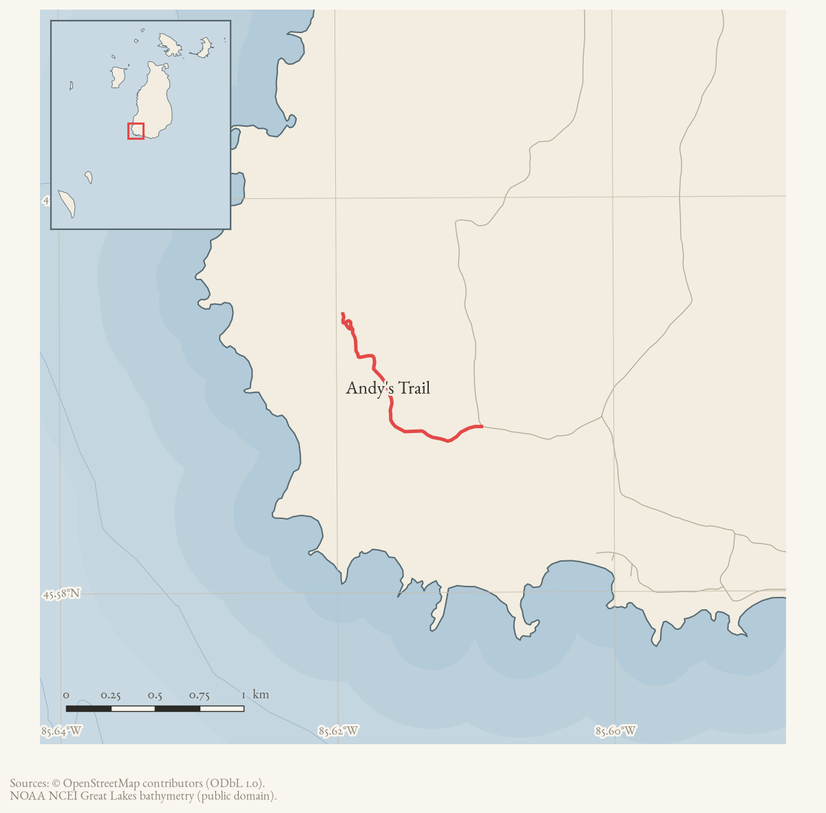
Andy’s Trail runs west from South French Bay Road to the Lake Michigan shore in the south-west of Beaver Island. It is among the shortest and easiest of the island’s named trails, and the township’s own recreation plan singles it out for the dwarf lake iris growing at its shore.
The route
The township trail guide describes the route as published and gives cumulative mileages, but the archive holds no walked track and OpenStreetMap carries a way of this name whose survey provenance is unknown.
From West Side Drive, South French Bay Road runs west past a large gravel pit on its north side. Where South French Bay Road turns north, Andy’s Trail continues downhill and west as a driveable two-track, through two turning loops, before narrowing and descending a bluff to the shore. Depending on where a walker parks, the guide gives the distance to the water as between 0.55 and 1.29 miles, and describes the walking as easy and dry throughout.
The bay at the end is rocky with a sand beach. French Bay is the next bay north.
Natural history
The township recreation plan lists the site as a trail “known for presence of Dwarf Lake Iris, rocky beach”, with a length of 0.45 miles, on Michigan Department of Natural Resources land and open to the public. Dwarf lake iris (Iris lacustris) is threatened at both state and federal level and is Michigan’s state wildflower. The Michigan Natural Features Inventory records it as a local dominant in the boreal forest at nearby French Bay.
The plants are protected. Michigan law protects native orchids, trilliums and club mosses, and the wider record for this island includes a documented removal of protected plants from a roadside population elsewhere.
Access and ownership
The recreation plan records the site as Michigan DNR land with public access, reached over South French Bay Road from West Side Drive. That is a statement of the position as the township described it in 2023-24 and not a present guarantee. No ORV designation applies: there are no designated public ORV trails on Beaver Island.
Trail conditions change. The trail association’s own sheets warn that island trails “can become overgrown and unrecognizable in many areas”, and nothing here should be used for navigation.
As walked in 2019. a walked account contributed in 2019 reaches the trail from West Side Drive by South French Bay Road — the same approach as French Bay Trail — and notes the turn has no road sign. Parking is either across from the gravel pit, which lengthens the walk, or in cleared areas beside the early two-track. The trailhead itself is unmarked. The account calls the walking easy apart from a few steep pitches, and has the trail ending on a Lake Michigan beach.
Evidence and limits
The route rests on a single undated township guide, corroborated for the site’s character by the recreation plan. The archive holds no walked GPS track here — the field tracks cover the south end only — and no historical account of who Andy was or when the trail was cut.
Open questions
- Who was Andy? No source in the archive names him or dates the trail.
- Is the 0.45-mile figure in the recreation plan measuring the same thing as the guide’s 0.55-1.29 miles, or only the final descent to the shore?
- Has the dwarf lake iris population here been surveyed and mapped, as the French Bay and Cable Bay occurrences have?
If you can answer any of these, or correct anything above, the archive wants to hear it — see Corrections.
See also
Documented associations
No source-confirmed non-road entity is linked yet. Exact-name research leads remain in scripts/audit_road_links.py; a name collision is not treated as a road association.
Research status
The local newspaper and website corpus contains exact-name mentions in 0 file(s). Those files are research leads; the relation layer is added only when the surrounding source text establishes that the record involves this road.
Maps for this place
These Atlas plates provide regional context. They do not establish a precise boundary, current ownership, access right, operating status, or field condition.
- EnvironmentSoils, wetlands, hydrography, and terrain
- GeologyGeneralized geology and landforms
- HydrologyMapped water and wetland context
- AccessMapped routes, facilities, and protected areas
- Land surveyPLSS geometry and historic GLO patent-location context
Sources
- Turn-by-turn narrative descriptions with cumulative mileages for the island's named trails. Undated in the file; retrieved from the township document centre in August 2026. No author is named in the document or its metadata.governance · peaine · trails · all-trail-descriptions
- Recreation-site inventory and goals. This is the pre-adoption draft; the adopted plan is dated 4 January 2024.governance · peaine · trails · peaine-park-and-rec-plan-draft-2023-11-27
- Community-contributed geometry of unknown survey provenance, simplified for display. It establishes that a way of this name is currently mapped; it is not a surveyed right-of-way, a statement of public access, or proof of historical naming.osm · trails
- Kamrin, Michael. 'An Insiders Guide to Beaver Island Hiking Trails: A Companion to the Wojan/Cashman Beaver Island Map.' Unpublished typescript, created 8 August 2019, last revised 17 February 2020.Walked account, and the fullest description of this trail held. Approach west off West Side Drive onto South French Bay Road, an unsigned turn about 2 miles south of Miller's Marsh or 2.5 miles north of Iron Ore Bay; past the gravel pit about half a mile to an unmarked trailhead on the left where South French Bay Road turns right. Records a side trail about 0.1 mile in, a small loop about 0.5 mile in that reads as a split but is not, a real split about 1.25 miles in to be taken right where the ground turns downhill and sandier, and a short steep pebbled pitch just before the trail ends at Lake Michigan.fieldwork · accounts · kamrin-insiders-guide-bi-hiking-trails
Added 16 August 2026. Recent changes
Cite this article
Beaver Island Archive, “Andy's Trail”, https://beaverislandarchive.org/places/andys-trail/, accessed [date], citing Peaine Township, 'All Trail Descriptions', trail guide, undated. (and 3 further sources listed on the page).