

- Date
- 1778
- Eras
- Early American era
- Concepts
- toponymyheritageEarly American era
- Within
- Beaver Island archipelago
Summary
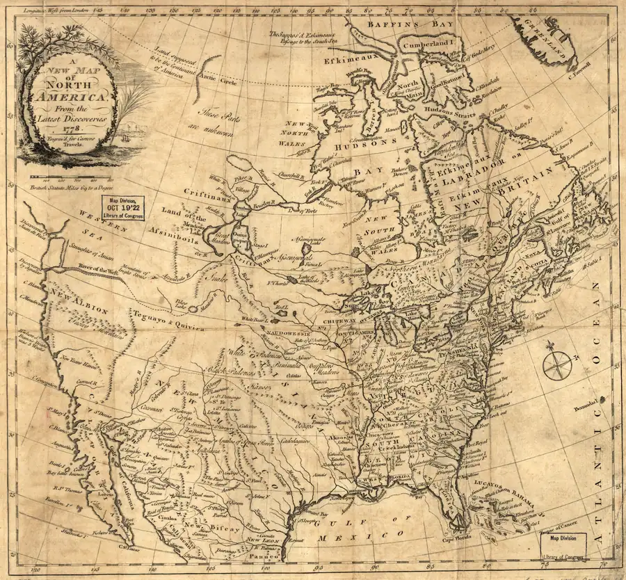
Jonathan Carver’s held 1778 continental map depicts the Beaver Island group in northern Lake Michigan without printing an individual label for the group or its islands. It is useful negative evidence in the cartographic name sequence: this edition’s lack of a printed Beaver label cannot be read as a lack of local name or presence.
Evidence and limits
The held Library of Congress TIFF and its provenance establish the map’s 1778 date, title, holding, and rights status. Visual review supports only the scale-bounded observation that the group is depicted without an individual label. This continental map is not evidence of a modern island boundary, local usage, title, settlement, or a complete island inventory.
See also
Sources
- Held Library of Congress master TIFF. Direct visual review confirms the continental-scale map depicts the Beaver Island group in northern Lake Michigan without printing an individual group or island label; that negative cartographic evidence is scale-bounded.maps · loc · carver_1778_ct000662 · ct000662
- Project provenance sidecar for the Jonathan Carver 1778 map.Records the Library of Congress master-TIFF source URL, retrieval timestamp, checksum, 52,587,700-byte file size, title, and public-domain/no-known-restrictions status. No public copy of this file is known; the archive holds one and can provide it on request.maps · loc · carver_1778_ct000662 · ct000662.provenance
Added 2 August 2026 · revised 4 August 2026. Recent changes
Cite this article
Beaver Island Archive, “Jonathan Carver map of North America, 1778”, https://beaverislandarchive.org/documents/jonathan-carver-map-of-north-america-1778/, accessed [date], citing Jonathan Carver, *A New Map of North America from the Latest Discoveries* (1778), Library of Congress master TIFF, control number ct000662. (and 1 further source listed on the page).
Last revised 2026-08-04. Fill in [date] with the date you read it — this page is static and cannot know that.
BibTeX for “Jonathan Carver map of North America, 1778”RIS for “Jonathan Carver map of North America, 1778”