

- Date
- 1849
- Eras
- Early American era
- Concepts
- land-surveyheritageenvironment
- Within
- High Island
Summary
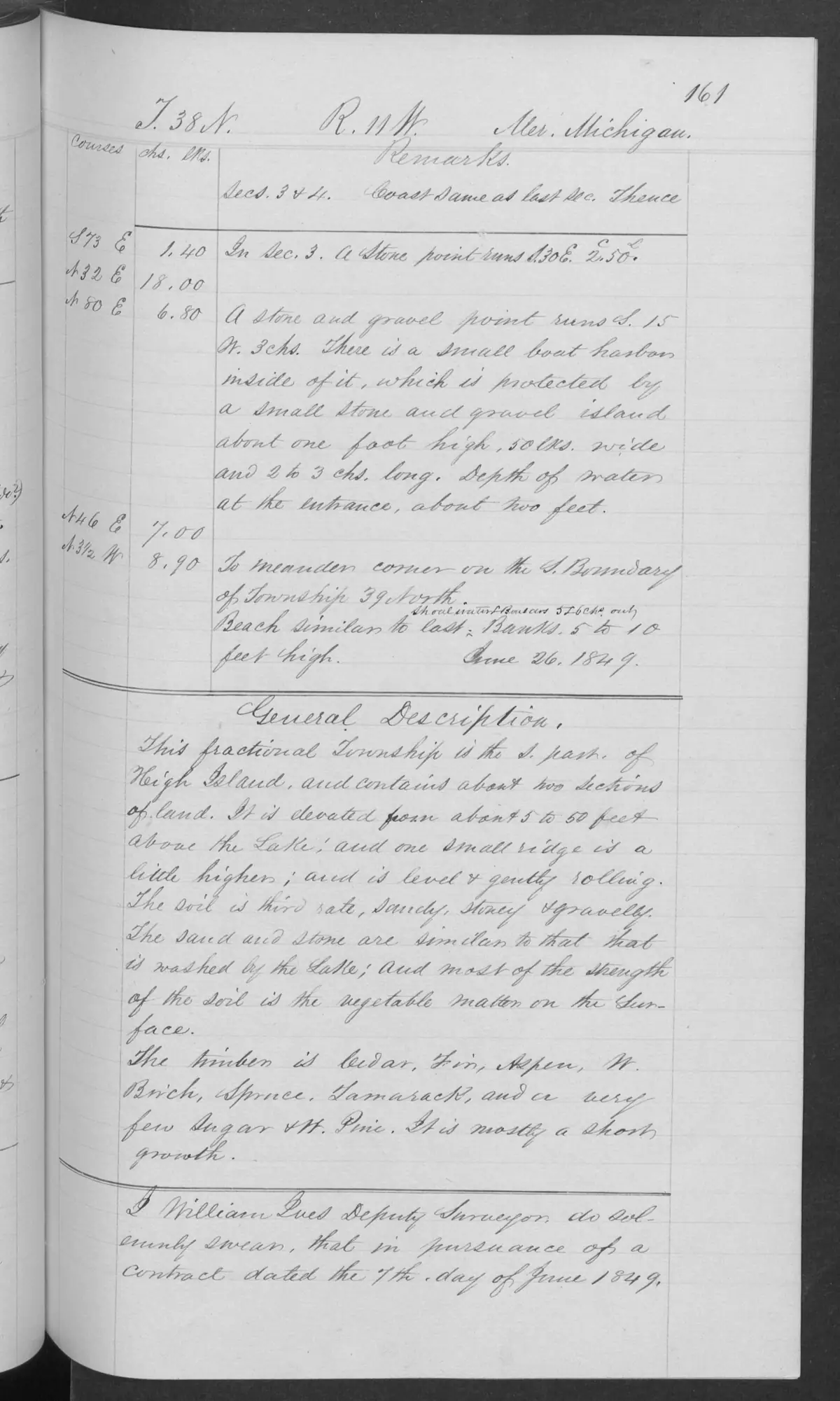
This checked page from BLM Field Note Volume 168138 records the 1849 general description of the part of High Island within fractional T38N R11W. It is a distinct source record from the broader volume and from the separately cited survey heading that used the paired historical form “Little Beaver, or High Island.”
Dated observation
The page estimates the described township portion at about two sections and places its elevation at roughly five to fifty feet above Lake Michigan. It calls the surface level to gently rolling and records sandy, stony, gravelly soil and short growth including cedar, fir, aspen, white birch, spruce, tamarack, and a few sugar and white-pine trees.
Evidence and limits
The field note shows what the federal surveyor recorded for this bounded portion of High Island in 1849. It does not establish the conditions of the whole island, current ecology, a title chain, ownership, parcel geometry, access rights, population, or settlement history.
See also
Sources
- Described in this archive: BLM GLO field-note volumes linked to Beaver Island-area surveys.Visual page-image verification. The original handwritten page describes the High Island part of the fractional township as about two sections, elevated about five to fifty feet above Lake Michigan, level to gently rolling, with sandy/stony/gravelly soil and observed tree cover. This is a bounded 1849 surveyor observation, not a complete island inventory, a modern ecological assessment, a parcel boundary, title, ownership, access, or settlement record.federal · glo_field_notes · page_evidence · field-note-volume-168138-page-0161-high-island-general-description
Added 2 August 2026. Recent changes
Cite this article
Beaver Island Archive, “GLO field-note page: southern High Island description, 1849”, https://beaverislandarchive.org/documents/glo-field-note-high-island-description-1849/, accessed [date], citing Bureau of Land Management, General Land Office Records, Field Note Volume 168138, p. 0161, T38N R11W, southern High Island general description, 1849..
Last revised 2026-08-02. Fill in [date] with the date you read it — this page is static and cannot know that.
BibTeX for “GLO field-note page: southern High Island description, 1849”RIS for “GLO field-note page: southern High Island description, 1849”